Typhoon Rosal slightly intensifies off Batanes as it moves away from PH
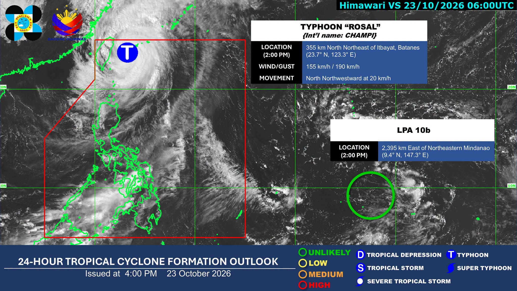
MANILA, Philippines — Typhoon Rosal, with an international name ‘Champi,’ slightly intensified as it continued to move away from the country, the state weather bureau said.
In its 5 p.m. weather advisory, the Philippine Atmospheric, Geophysical and Astronomical Services Administration (Pagasa) said Rosal will generally move northwestward before changing its course northward toward Japan.
Article continues after this advertisement
As of 4 p.m., the typhoon was located 355 kilometers (km) northeast of Itbayat, Batanes inside the Philippine area of responsibility (PAR), while moving at 20 km per hour.
FEATURED STORIES
NEWSINFO
NEWSINFO
NEWSINFO
It carries maximum sustained winds of 155 km per hour near the center and gustiness of up to 190 km per hour.
READ: Rosal further weakens; Signal No. 2 still up in Batanes, Babuyan Islands
The typhoon is forecast to exit the PAR on Saturday morning.
It may continue to weaken into a severe tropical storm by Sunday.
Article continues after this advertisement
“Rosal is expected to [steadily] weaken within the forecast period,” Pagasa reported.
Tropical Cyclone Wind Signal (TCWS) No. 2, which refers to gale-force winds, remained hoisted over Batanes.
Article continues after this advertisement
Under this wind signal, 62 to 88 km per hour wind speed is expected, which may pose minor to moderate threat to life and property.
TCWS No. 1, which means strong winds, was also raised over the northern portion of Cagayan, including Babuyan Islands, the northern portion of Ilocos Norte, and the northern portion of Apayao.
The areas under Wind Signal No. 1 may expect minimal to minor threat to life and property due to its wind speed of 39 to 61 km per hour.
Meanwhile, Pagasa also monitored a low-pressure area 2,395 km east of Northeastern Mindanao on Friday.
Pagasa weather specialist Loriedin De la Cruz-Galicia said that the weather disturbance is unlikely to intensify from now till tomorrow (Saturday).
“It is less likely to develop into a tropical cyclone within the next 24 hours,” she said.
Your subscription could not be saved. Please try again.
Your subscription has been successful.
“Furthermore, we see a low probability that it will cause or have a direct impact on any part of our landmass,” she added. /apl
KioskNews shows a cleaned-up reading view extracted from the publisher’s page — the original always lives on their site, not ours.