LPA trough to bring rains to parts of Visayas, Mindanao on Oct. 30
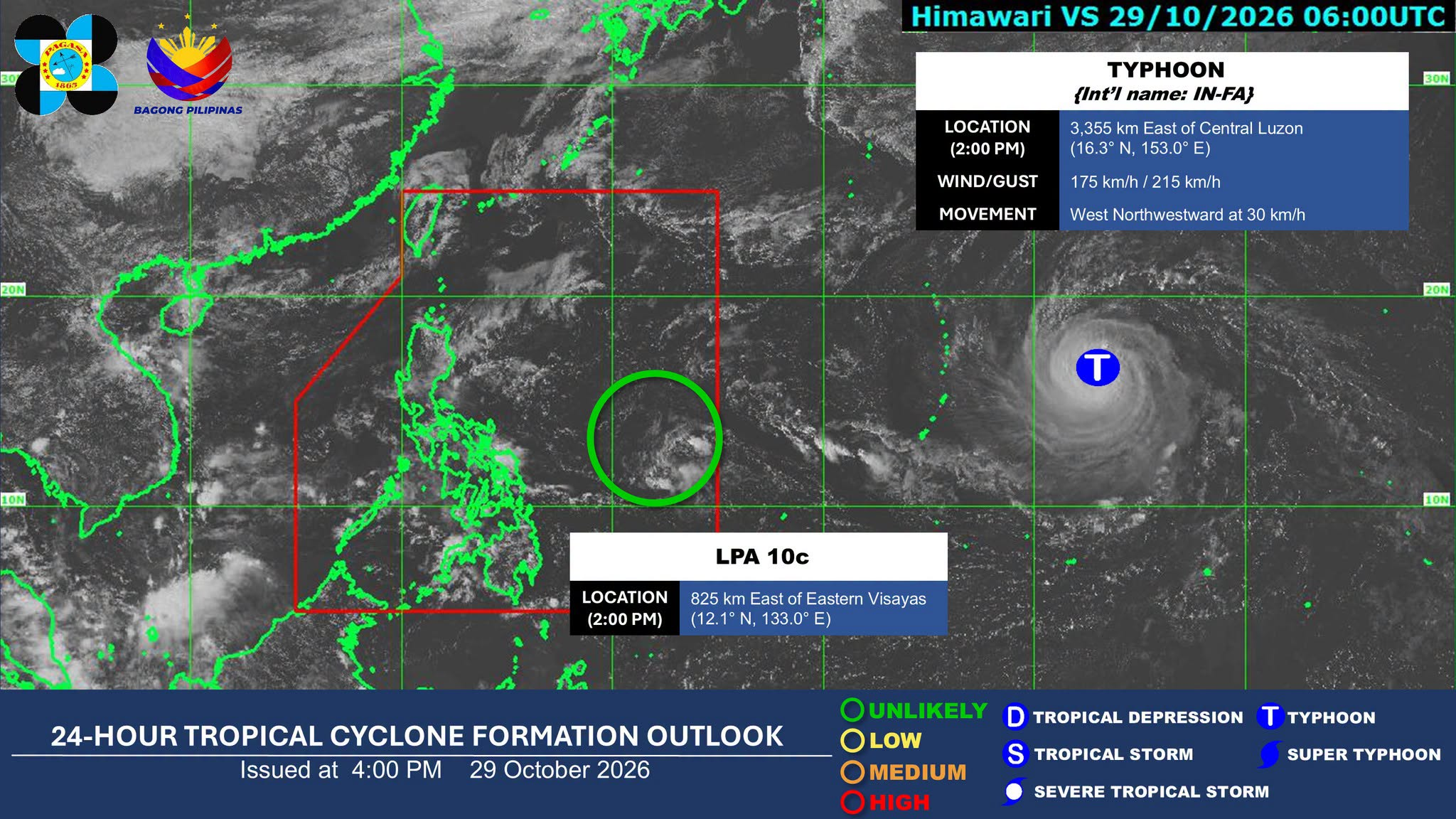

MANILA, Philippines — The trough of a low-pressure area (LPA) inside the Philippine area of responsibility (PAR) is expected to bring scattered rains and thunderstorms to parts of the Visayas and Mindanao on Friday, Oct. 30, the state weather bureau said.
In its 4 p.m. weather advisory on Thursday, the Philippine Atmospheric, Geophysical and Astronomical Services Administration (Pagasa) said the LPA trough may bring cloudy skies with scattered rains and isolated thunderstorms over the Negros Island Region, Central and Eastern Visayas, Zamboanga Peninsula, Northern Mindanao and Caraga.
As of 2 p.m., it was monitored 825 kilometers (km) east of Eastern Visayas. Pagasa said it is unlikely to intensify into a tropical depression within the next 24 hours.
Article continues after this advertisement
READ: Pagasa monitors LPA inside PAR on Thursday morning
FEATURED STORIES
NEWSINFO
NEWSINFO
NEWSINFO
Meanwhile, Typhoon In-Fa”, which is outside PAR, was spotted 3,355 km east of Central Luzon outside the PAR.
It had a maximum sustained winds of 175 km per hour near the center and gustiness of up to 215 km per hour.
The weather bureau reported that the typhoon is moving west northwestward at 30 km per hour.
The shear line is expected to bring cloudy skies and scattered rains over Cagayan, Isabela, Quirino, Nueva Vizcaya, Aurora, Quezon and Camarines Norte.
Article continues after this advertisement
The northeast monsoon, or amihan, may bring partly cloudy to cloudy skies with isolated light rains over the Ilocos Region, Cordillera Administrative Region and Batanes.
Metro Manila and the rest of the country may experience partly cloudy to cloudy skies with localized thunderstorms./dp
KioskNews shows a cleaned-up reading view extracted from the publisher’s page — the original always lives on their site, not ours.