Powerful nor’easter churning up the East Coast

A powerful nor’easter is churning up the East Coast and is on track to bring several days of heavy rain, flooding and strong winds.
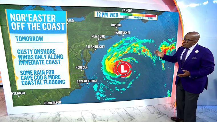
The storm is expected to stay far enough offshore that the heaviest rain will likely affect only the easternmost parts of the country. While the rain will stay mostly offshore, gusty winds and coastal flooding are still possible, especially across the Outer Banks.
Flood advisories are in place from the Jersey Shore to the Outer Banks for 1-2 feet of inundation from onshore winds.
01:13
The storm, still offshore, is intensifying. Coastline cities from New Jersey to Cape Hatteras can expect coastal flooding, beach erosion and gusty winds.
Rain and coastal flooding are expected to impact Cape Cod and Nantucket in the coming days. By Thursday, rough surf and rip currents will hit those areas.
The nor’easter could become a tropical storm but, if it does, it will only intensify as it continues east and away from the coast. It has a 40% chance of formation in two days, and 40% in seven days. If it develops, it will be named Josephine.
Winds will have the biggest impact, with 44 mph winds forecast in Nantucket. Virginia Beach could see 32 mph winds, and Cape Hatteras is expected to have 39 mph winds.
Meanwhile, a storm in the Pacific Ocean is expected to bring heavy rain, flooding and mountain snow. A flash flood risk is in place from Southern California to the Rockies.
A flood threat is in place for California and parts of the Southwest through Thursday, specifically in Southern California from San Luis Obispo to Santa Barbara, and across the Four Corners states.
Six million people across Arizona are also under a flood watch, including Phoenix and Flagstaff.
KioskNews shows a cleaned-up reading view extracted from the publisher’s page — the original always lives on their site, not ours.