Taiwan vows vigilance as Beijing releases detailed satellite imagery of island landmarks
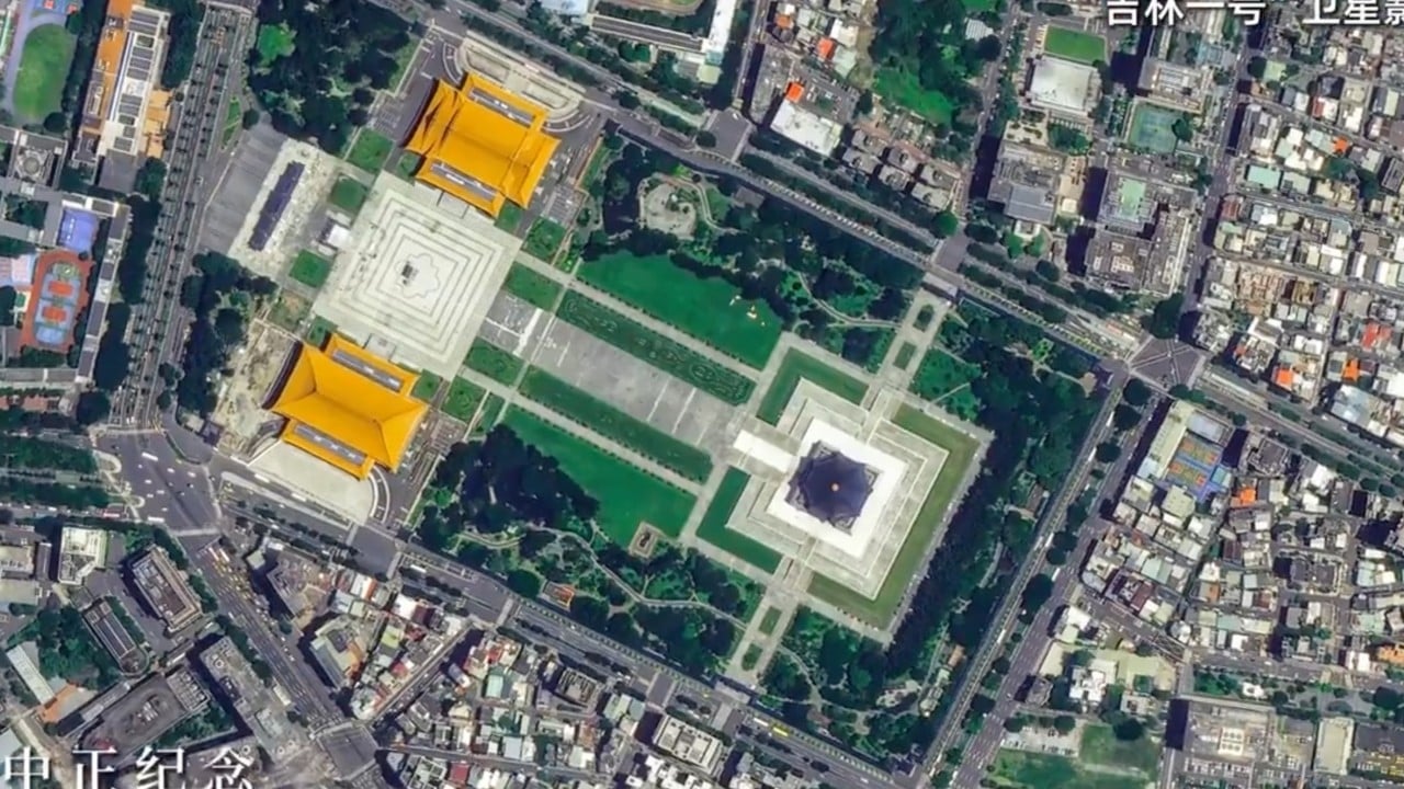
Taiwan’s military has vowed to remain vigilant against mainland Chinese intelligence-gathering activities after Beijing released high-resolution satellite images of the island, raising concerns about its growing surveillance capabilities.
“The defence ministry will not lower its vigilance at any time regarding all such satellite imagery and related intelligence collection directed at Taiwan,” Defence Minister Wellington Koo Li-hsiung told reporters on Tuesday.
“We will also take appropriate early-warning and response measures, including the necessary concealment, mobility and dispersal measures, to ensure the operational security of the armed forces.”
His comments followed mainland Chinese state broadcaster CCTV’s release on Sunday of a 42-second video featuring high-resolution imagery of Taiwan captured by the commercial Jilin-1 remote-sensing satellite constellation.
Labelled “This is China’s Taiwan Province”, the footage moved from views of the entire island to landmarks including Chiang Kai-shek Memorial Hall, the National Palace Museum, Taipei Dome and Taipei Port, as well as Sun Moon Lake and Mount Jade.
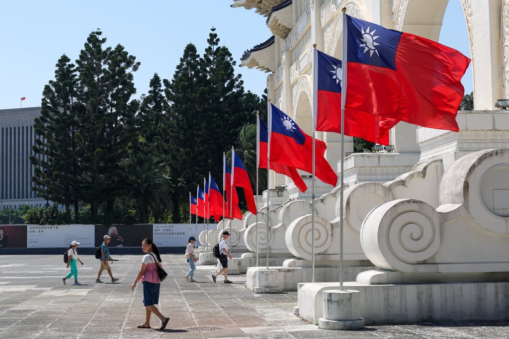
“Every street is clearly visible” from space, it said.
The release marked the second consecutive year that Jilin-1 imagery featured prominently in Beijing’s messaging around October 25, which commemorates the end of Japanese colonial rule over Taiwan in 1945.
Beijing last year formally designated the date “Taiwan Restoration Day”, with Jilin-1 imagery becoming part of a broader campaign linking technological capability with its claim over the island.
Beijing regards Taiwan as part of China to be reunited by force if necessary. Most countries, including the United States, do not recognise Taiwan as an independent state, but Washington is opposed to any attempt to take the self-ruled island by force and is committed to supplying it with weapons.
Last October, high-resolution images showed locations across Taiwan including Sun Moon Lake, Alishan, Taipei Port and Hsinchu Science Park, with streets, buildings and other structures clearly discernible.
The release prompted a public response from mainland China’s defence ministry at the time.
Asked about suggestions that military satellites could produce even clearer images if a commercial constellation could show Taiwan’s streets in such detail, spokesman Zhang Xiaogang said: “It is perfectly normal for Chinese satellites to take a look at the magnificent landscape of China’s Taiwan. There is nothing to be surprised about.”
Mainland reports said the publicly released images were generally at sub-metre resolution, allowing street layouts and other features to be distinguished.
The Jilin-1 constellation then comprised 141 satellites operating about 500km (311 miles) above Earth, according to its operator, Chang Guang Satellite Technology.
At a legislative meeting on Tuesday, ruling Democratic Progressive Party lawmaker Wu Szu-yao said Beijing had “deliberately highlighted prominent Taiwanese landmarks to reinforce its claim” over the island while using the imagery to signal its ability to closely monitor Taiwan.
02:20
US accuses mainland China of targeting Taiwan leader’s family in surveillance case
Premier Cho Jung-tai said in response that Taipei was strengthening its defences through regular and special budgets and responding to external threats through legal and technological measures.
Analysts said the imagery carried both political and military implications.
Joseph Wen, an adjunct research fellow at Taiwan’s government-funded Institute for National Defence and Security Research, said Jilin-1 illustrated Beijing’s “ability to conduct high-resolution observation of virtually any part of Taiwan”.
Whether mainland China could maintain round-the-clock, continuous and real-time surveillance depended on the number and orbital configuration of its satellites, the mix of optical and radar sensors, and the speed at which imagery could be transmitted and processed, he added.
But publicly available information suggested Beijing was probably already capable of near-real-time satellite observation of Taiwan or would be in the foreseeable future, Wen said.
“Persistent observation could reveal militarily useful information from seemingly mundane details, such as changes in the number of vehicles parked at military bases,” he warned.
Analysts also said the releases combined a display of technological prowess with political messaging as part of a broader pressure campaign involving military exercises, legal warfare and public-opinion operations.
“Through the images, Beijing sent the message that under its satellites, Taiwan is effectively transparent and can be observed in considerable detail,” political commentator Chiu Yi said, adding that this was intended to reinforce the impression that the island was within Beijing’s reach.
Retired major general Li Cheng-chieh said the imagery carried more than symbolic significance because satellite intelligence could expose troop movements and other military activities.
“Mainland China’s growing constellation could also make surveillance increasingly persistent,” he said, arguing that the pressure created by showing such capabilities could rival that of People’s Liberation Army exercises around Taiwan.
KioskNews shows a cleaned-up reading view extracted from the publisher’s page — the original always lives on their site, not ours.