Selangor identifies 56 flood hotspots ahead of Northeast Monsoon
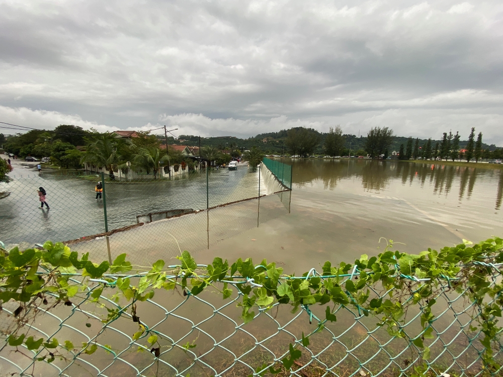

An overflowing rentention pond in sighted in Taman Seri Alam. — Picture by Yusof Isa
First Published: Monday, 16 Nov 2026 8:32 PM MYT
KUALA LUMPUR, Nov 16 — Rainfall exceeding 100 millimetres within just over two hours could trigger flash floods in Kampung Melayu Subang and surrounding areas if rivers and local drainage systems are unable to cope with the volume of water.
Selangor Fire and Rescue Department (JBPM) assistant director (Operations) Ashrul Riezal Ashbar said the two main rivers contributing to overflow in the area were Sungai Damansara and Sungai Buluh.
“In areas currently at risk of flooding, the overflowing water comes from Sungai Damansara and Sungai Buluh. In Kampung Melayu Subang, flooding is also influenced by overflow from the local drainage system,” he told Bernama today.
He said the overflow could also affect several other areas, including Shah Alam, Puncak Alam, Paya Jaras and Kampung Kubu Gajah, before flowing towards Kampung Parit Mahang, Ijok, Cerakah and Kampung Bukit Kuching, eventually reaching Kuala Selangor.
In preparation for the Northeast Monsoon (MTL), Selangor JBPM has identified 56 flood hotspots and 232 flood-prone areas statewide.
Klang has the highest number of flood hotspots, with 13, followed by Petaling (11), Gombak (10), Hulu Langat (nine), Kuala Selangor (six), Sepang (three), and Kuala Langat and Hulu Selangor with two each. No flood hotspots have been recorded in Sabak Bernam.
Hulu Langat has the highest number of flood-prone areas at 37, followed by Klang (33), Sepang (32), Kuala Selangor and Gombak (29 each), Petaling (27), Kuala Langat (22), Hulu Selangor (12) and Sabak Bernam (11).
Ashrul Riezal said the department had 1,603 firefighters and 1,251 volunteer members on standby, supported by 71 rescue boats, 12 operational lorries and 68 four-wheel-drive vehicles to deal with possible flooding during the monsoon.
Kampung Melayu Subang is among the areas in Selangor prone to recurring floods. Heavy rain earlier this month caused several homes there to be inundated.
Following the incident, Prime Minister Datuk Seri Anwar Ibrahim on Nov 3 directed that the implementation of the nearly RM700 million Sungai Buloh and Sungai Damansara Flood Mitigation Projects be expedited. — Bernama
KioskNews shows a cleaned-up reading view extracted from the publisher’s page — the original always lives on their site, not ours.