New tropical depression outside PAR unlikely to affect Philippines
Already have Rappler+?
to listen to groundbreaking journalism.
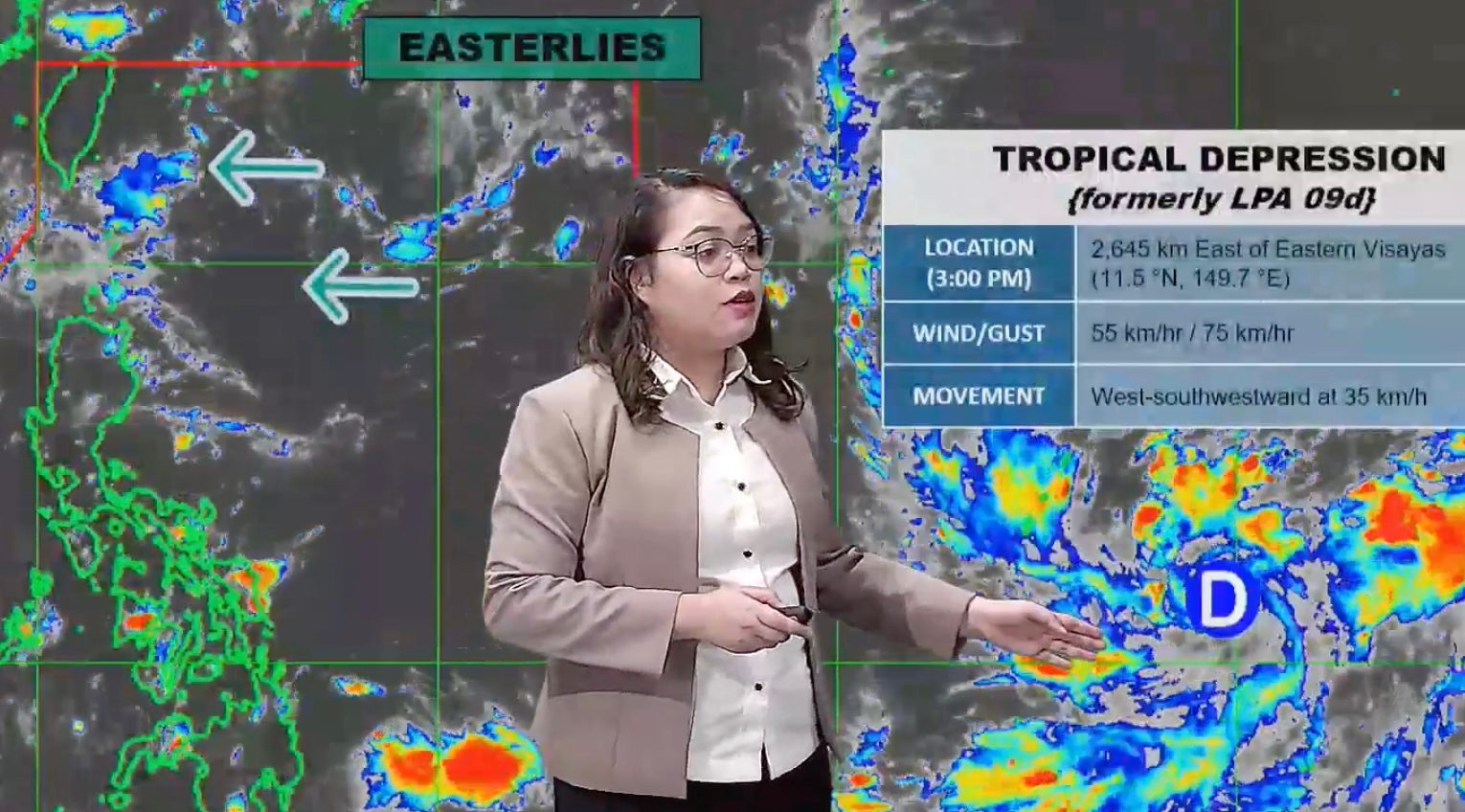
FORECAST. PAGASA Weather Specialist Charmagne Varilla explains the bureau's 4 pm forecast for the tropical depression outside the Philippine Area of Responsibility on September 14, 2026.
PAGASA
The tropical depression might eventually enter the Philippine Area of Responsibility, but it is not expected to have an impact on the country
MANILA, Philippines – A low pressure area outside the Philippine Area of Responsibility (PAR) developed into a tropical depression on Monday afternoon, September 14.
As of 3 pm on Monday, the tropical depression was located 2,645 kilometers east of Eastern Visayas, moving west southwest at a fast 35 kilometers per hour (km/h).
It has maximum sustained winds of 55 km/h and gustiness of up to 70 km/h.
The Philippine Atmospheric, Geophysical, and Astronomical Services Administration (PAGASA) is not ruling out the possibility of the tropical cyclone entering PAR in the coming days. If it enters, it would be given the local name Queenie.
But PAGASA Weather Specialist Charmagne Varilla said the tropical cyclone is not expected to make landfall in the Philippines, and it could have no impact on the country. It might just stay near the PAR northeastern corner.
The weather bureau expects two or three tropical cyclones to develop within or enter PAR in September. The country’s last tropical cyclone had developed in late August — Tropical Storm Pilandok (Krovanh).
In the meantime, the easterlies or warm winds from the Pacific Ocean are affecting extreme Northern Luzon on Monday. Batanes and Babuyan Islands, in particular, are seeing isolated rain showers or thunderstorms due to the easterlies.
The rest of the country will continue to have generally fair weather in the coming hours, although there might be localized thunderstorms.
Varilla also said the southwest monsoon or habagat may return by Wednesday, September 16, and possibly affect portions of the Visayas and Mindanao. – Rappler.com
KioskNews shows a cleaned-up reading view extracted from the publisher’s page — the original always lives on their site, not ours.