Second system intensifying over Bay of Bengal as cyclone ‘Arnab’ loses steam
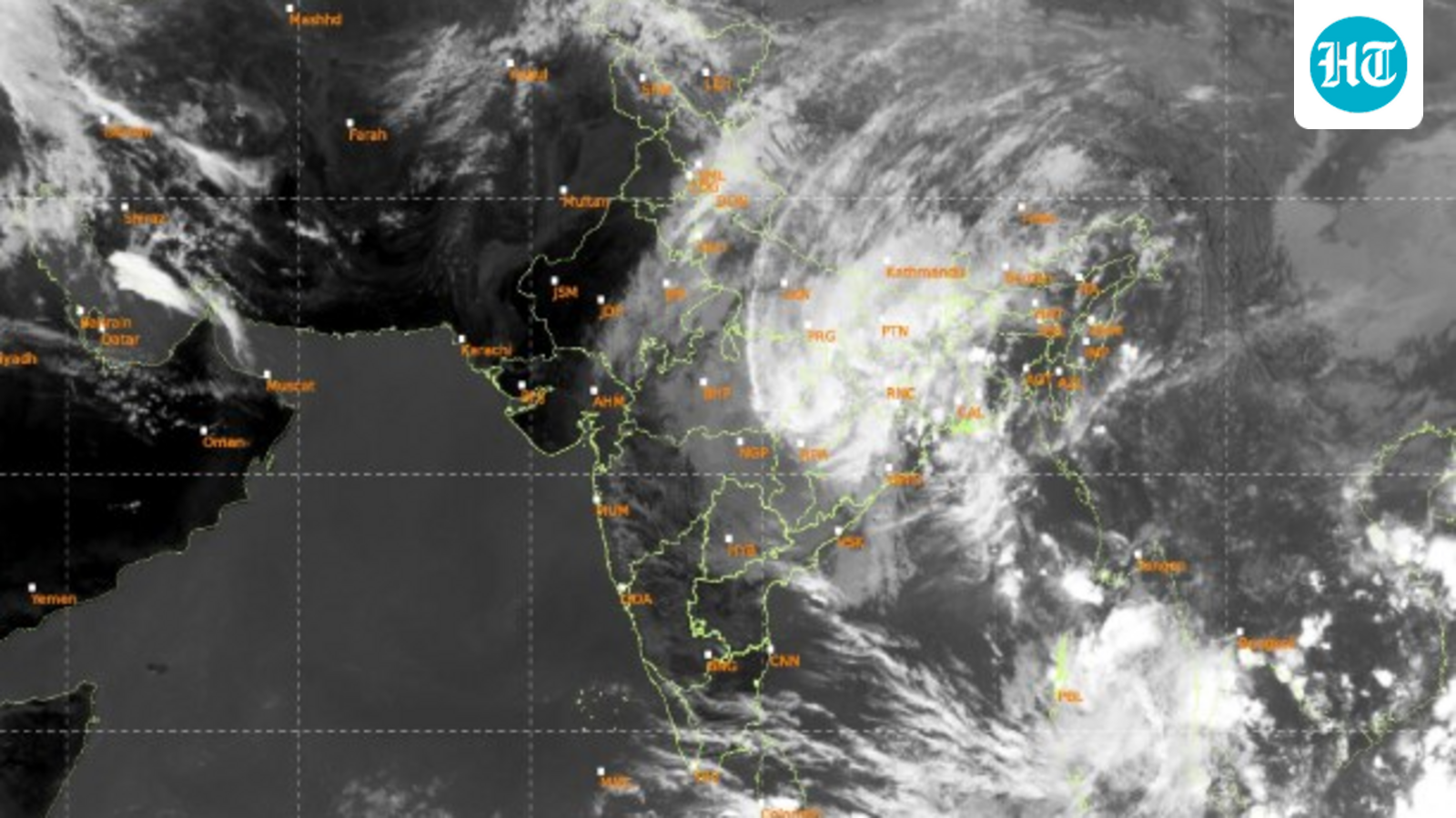
Even as the remnant of very severe cyclone “Arnab” continued to travel deeper inland on Thursday while losing its steam further, a second system has formed over the Bay of Bengal and has already intensified into a low-pressure area, officials of the India Meteorological Department have said.
The second system is present and located over the South Andaman Sea near the Andaman and Nicobar Islands.
“A cyclonic circulation over the South Andaman Sea has intensified into a low-pressure in the early hours of Thursday. It is very likely to move in a west-northwest direction and intensify further into a well-marked low pressure over the Andaman Sea and the area adjoining the Andaman and Nicobar Islands during the next 72 hours,” HR Biswas, a senior scientist of the IMD in Kolkata, said.
Officials are, however, yet to forecast whether the system would intensify into another cyclone, the second after very severe cyclone “Arnab” and its trajectory. The IMD hasn’t issued any cyclone warning yet.
A low pressure has a wind speed of less than 31 kmph, while a depression forms when it ranges from 31 to 49 kmph. A deep depression carries winds from 50 to 61 kmph.
A cyclone is when the wind speeds are between 62 and 88 kmph, while a severe cyclone ranges between 89 and 117 kmph. A very severe cyclone runs with wind speeds of 118 – 166 kmph, and an extremely severe cyclone runs at 167 – 221 kmph. Anything above 222 kmph is a super cyclone.
IMD’s cyclone forecasting
IMD’s cyclone forecasting and warning system is based on numerical weather prediction models, multi-model ensembles, advanced data assimilation techniques, and continuous monitoring using satellites, Doppler Weather Radars, ocean buoys, and coastal observational networks.
The forecast accuracy of cyclone track, intensity, and landfall point increased in 2023 to 2025 by 15-45%, 15-35%, and 10-30%, respectively, compared to 2020-2022, up to a lead period of four days.
“While April and May are known as the pre-monsoon cyclone months, October and November are known as the post-monsoon cyclone months. It is during these months that weather systems such as a low-pressure area and depression often intensify into cyclones,” said an official.
Meanwhile, “Arnab” has weakened into a depression after forcing its way further inland and was last located over south Chhattisgarh and adjoining south Odisha around 8:30 am on Thursday.
“The entire system (remnant of Arnab) moved with a speed of 18 kmph in the last six hours. It is expected to push further north and lose its steam further, eventually weakening into a well-marked low-pressure system by Thursday evening,” said the official.
KioskNews shows a cleaned-up reading view extracted from the publisher’s page — the original always lives on their site, not ours.