What does Philippines seek with new Thitu map in South China Sea?
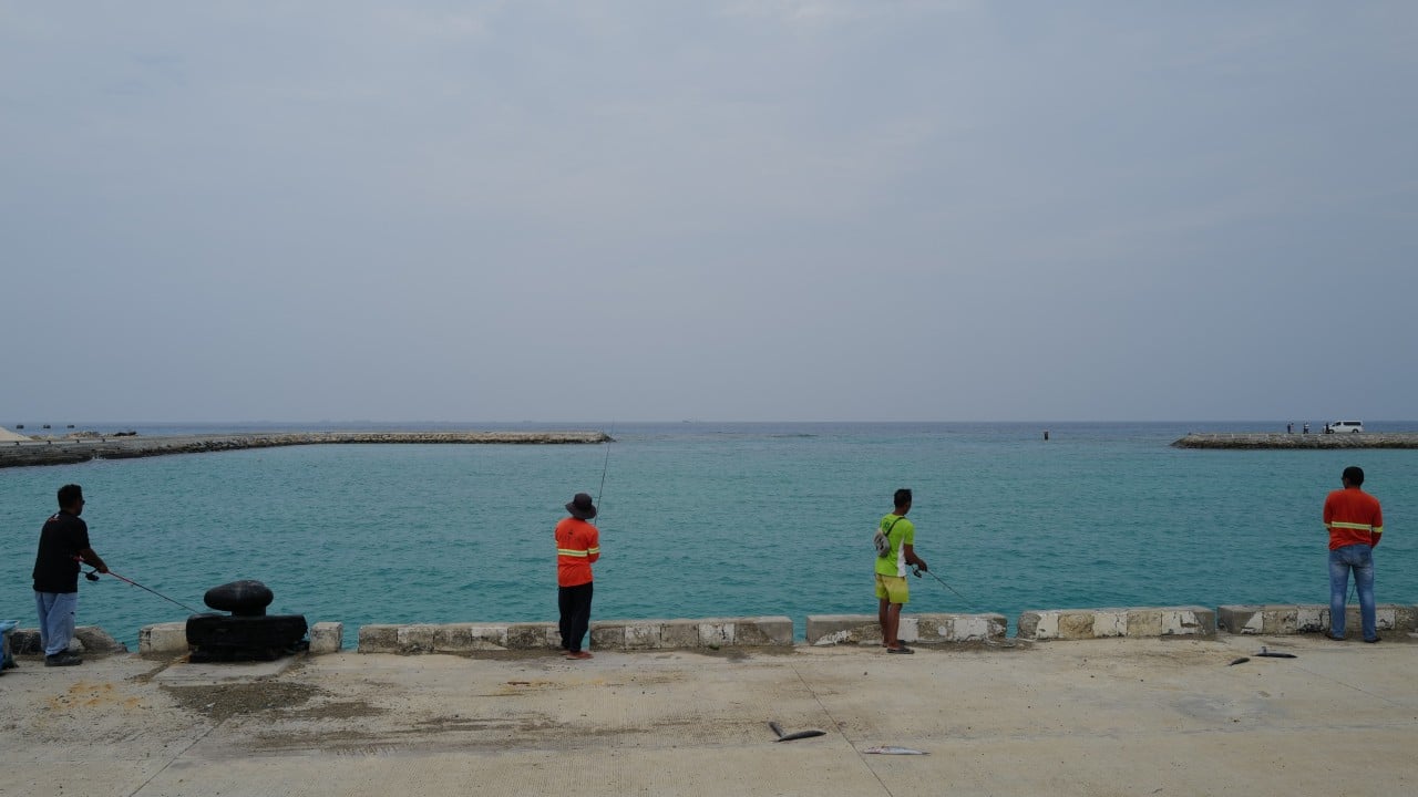
Thitu Island and its residents have come under the spotlight after the Philippines, in a bid to reinforce its claims in the South China Sea, announced plans to file an updated maritime chart with the United Nations.
Observers say the filing would not establish Philippine sovereignty but could help Manila identify and challenge competing claims in more precise legal terms.
More than just a technical document, the updated map is a means for the government to formally document its presence and claim sovereignty over Thitu, known locally as Pagasa, according to Presidential Assistant for Maritime Concerns Andres Centino.
The former military officer said the map charted water depths, island contours and features around Thitu, Lawak and other parts of the Kalayaan island group, including those that remained above water at high tide.
“It is not just a dot on the map,” Centino said last Friday at a ceremonial unveiling of the map on the island, which lies about 480km (300 miles) west of the Philippine province of Palawan.
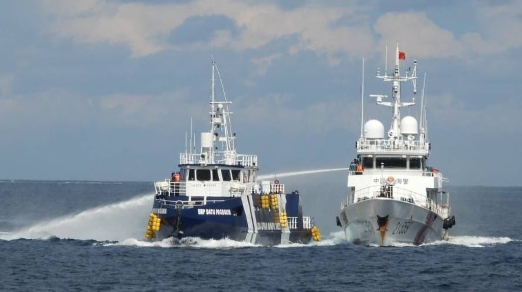
Beijing claims the island, which it calls Zhongye Dao, as part of its Nansha island group, known internationally as the Spratlys. It rejects a 2016 arbitral ruling that found no legal basis for its claims to historic rights within the nine-dash line.
Chinese coastguard ships, maritime militia vessels and research ships have been sighted near Thitu. China has insisted that its actions are lawful and has accused Manila of intruding on its territory.
Manila, meanwhile, is strengthening its physical presence on the island, home to about 100 families. Construction observed during a visit by This Week in Asia included work to extend a runway at Rancudo Airfield by 200 metres (660 feet) to about 1,500 metres. Alongside a newly built hangar, the Philippine Air Force is constructing an observation tower to monitor activity around the island.
Evelyn Grenanda, 35, a mother of four who owns a small grocery store, said the uncertainty could spur some residents to seek opportunities elsewhere. “The island is so isolated that they still need to go to the mainland.”
Another resident, Gemelyn Amlang, 26, preferred to remain on the island as long as the Philippine government provided work and livelihood support.
02:29
‘Stop grandstanding’: Beijing slams Philippine defence chief after minister exposes South China Sea note
But the 26-year-old, who said she had grown accustomed to seeing Chinese ships daily, saw few prospects for herself and her four-year-old daughter. They moved to the island from Palawan three years earlier.
“We are on an island called Hope but it seems there’s no hope. We’re just here, going around in circles. There’s nothing else to do,” she said.
That feeling is shared by fishermen such as Joseph Warina, 32, whose fishing grounds in the contested waters are sometimes “blocked” by Chinese vessels. “I hope what we always fear will not happen,” he said, referring to the prospect of armed clashes.
Such fears persist despite earlier diplomatic assurances. In April 2019, then Philippine ambassador to China Jose Santiago Santa Romana said Beijing had assured Manila it had no intention of occupying or using force against Thitu.
Against this backdrop, Manila is considering diplomatic steps. Centino said the proposed filing to the UN was separate from the Philippines’ recent submission of its official nautical chart of Scarborough Shoal, another contested marine feature.
On record
Experts said depositing the updated map with the UN Secretary General would be primarily an act of legal clarification and international notification under the UN Convention on the Law of the Sea (Unclos), which sets out countries’ rights and responsibilities in the world’s oceans.
“Manila [is placing] on international record a precise description of the maritime entitlements it considers to flow from the features it claims,” said Arnaud Leveau, a geopolitics professor at Paris Dauphine University. “This carries strategic weight, because ambiguity tends to favour the strongest actor at sea. By publishing coordinates, charts and the legal basis of its position, the Philippines narrows that ambiguity,” he added.
Sylwia Monika Gorska, a political analyst at the University of Central Lancashire, said the updated chart gave Manila a more precise record of Thitu and nearby features.
“If Manila deposits baselines or maritime limits under Unclos, those coordinates would enter the formal international record,” she said, adding that they would give Manila a fixed reference point for future diplomatic protests, negotiations and responses to activity at sea.
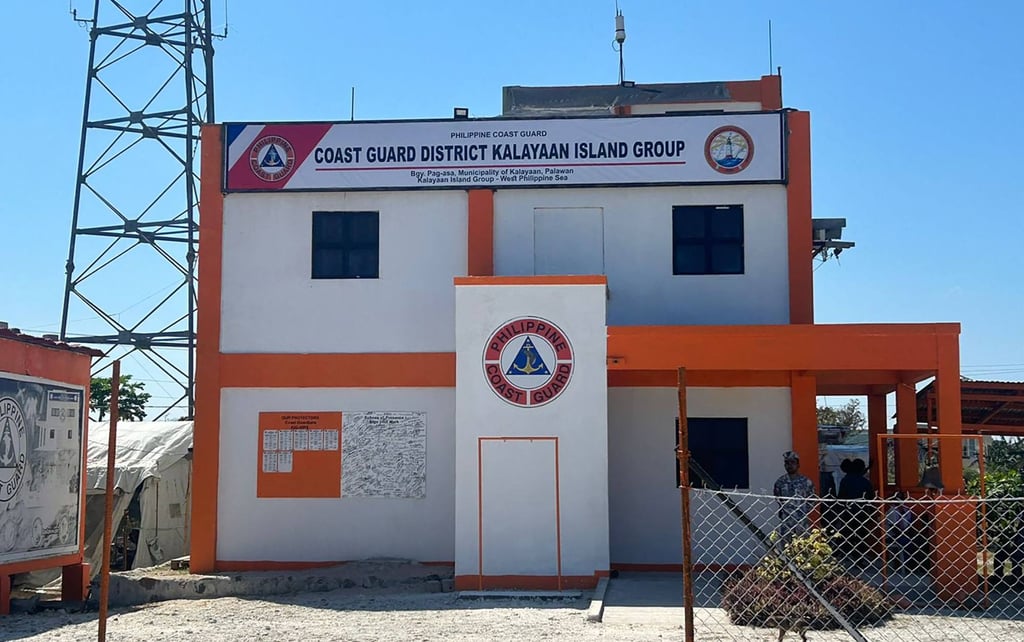
Beyond legal filings, Leveau said maintaining a civilian presence was important because it distinguished the island from being a purely military outpost. “A functioning civilian community strengthens Manila’s position without reducing Pagasa to a purely military confrontation.”
Legal efforts were also more effective when backed by a sustained physical presence, he added. On Thitu, the runway, civilian settlement, public facilities and government administration amounted to a second layer of Manila’s strategy.
Beijing has already challenged the updated chart, with Chinese foreign ministry spokesman Guo Jiakun calling it “illegal, null and void” and a violation of China’s sovereignty.
But the proposed filing would also sit within a wider Southeast Asian pattern of using UN mechanisms to place maritime positions on the international record – a process that can expose differences among other claimants.
In June 2024, for example, the Philippines submitted scientific information to a UN commission to establish the continental shelf’s outer limits beyond 200 nautical miles in the West Palawan region. China, Vietnam and Malaysia challenged the submission on different legal grounds.
The case, Gorska said, showed that opposition to Philippine claims could come from different directions. “The more important lesson is that a Philippine legal move directed largely at strengthening its position against China can still trigger objections from states that otherwise share some of Manila’s concerns about Chinese claims,” she said.
KioskNews shows a cleaned-up reading view extracted from the publisher’s page — the original always lives on their site, not ours.