‘Unseasonably’ warm temperatures expected to hit the UK this week
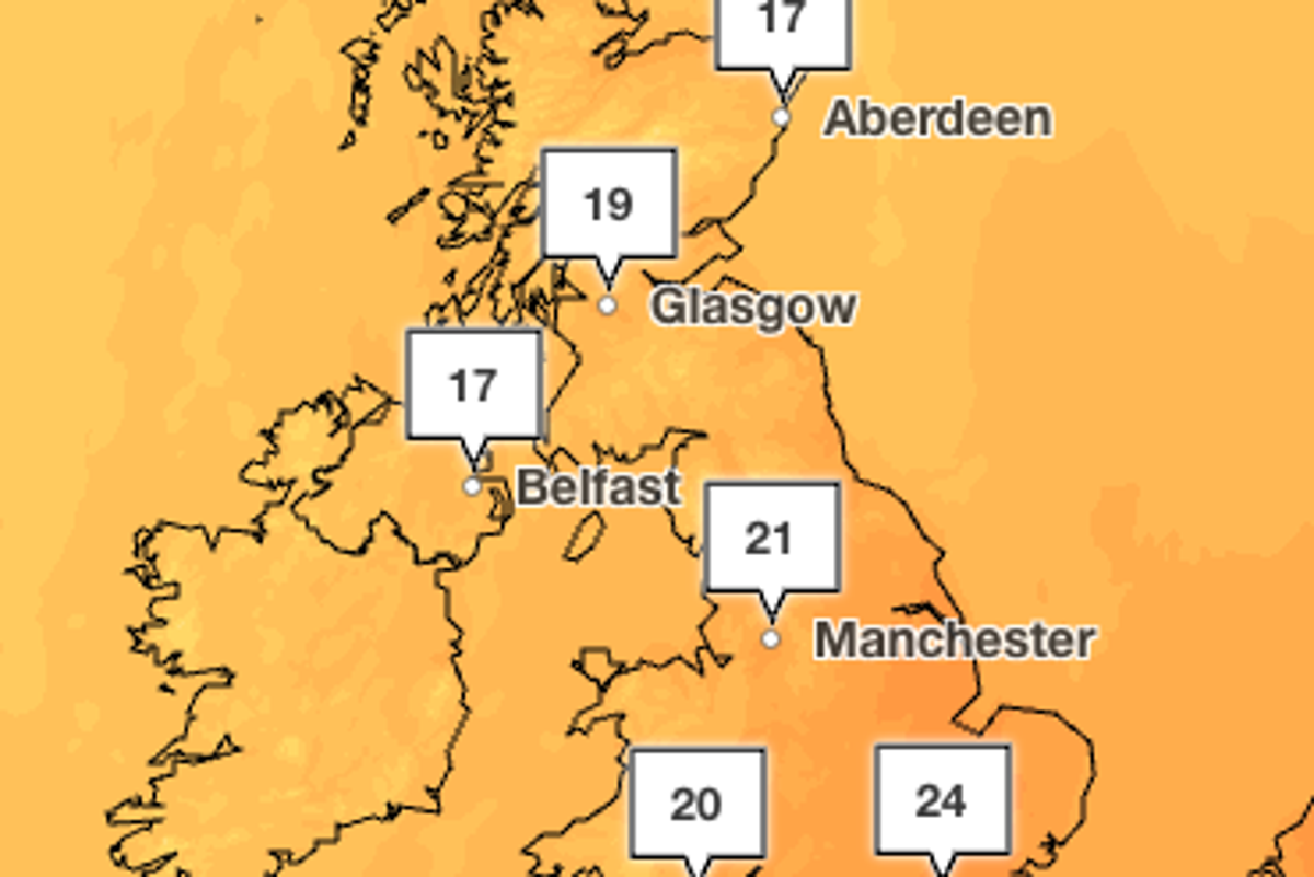
Parts of the UK are experiencing “remarkable temperatures” as areas in the south enjoy a warm 24C in late September.
It’s expected to be the warmest in London this week as temperatures stay in the mid to low 20Cs, as warmer air from Europe brings conditions that will feel “unseasonable”.
Temperatures are also set to hit the mid 20Cs in Cambridge with highs of 24C on Wednesday and in Hull which is expected to see peaks of 23C, according to the Met Office.
Met Office chief forecaster Matthew Lehnert said: “A deep area of low pressure far into the Atlantic is the primary driver behind the UK’s weather over the next few days. Its first influence will help pull some warmer air over much of the country.”
But, the warm weather is not forecast to last, with wet and windy conditions predicted for later in the week.
Scattered showers are forecast from Wednesday night, followed by rainy spells and sunshine on Thursday and Friday.
The Met Office warned many areas of the country will see “wet and blustery” conditions on Wednesday, with up to 10mm of rain expected in some places.
Winds of up to 50mph are also possible, which could cause large waves in western coastal areas.
More settled conditions are expected over the weekend as higher pressure builds.
Here’s a look at the weather forecast for the week ahead:
Today:
Heavy rain clears eastwards by midday, followed by sunny spells with showers. Mainly across western areas, where some may be heavy with isolated hail and thunder. Winds gradually ease but remain gusty, especially in the west. Temperatures above average.
Tonight:
Scattered showers continue near western coasts. Elsewhere remains dry with clear spells. Cooler than recent nights, especially across eastern and southeastern areas, with isolated fog patches developing in sheltered areas.
Thursday:
Showers across parts of England and Wales gradually fade, leaving many areas drier and brighter. Cloud increases in Northern Ireland with rain arriving later. Windy in western and northern areas.
Outlook for Friday to Sunday:
Showers affect northern and western areas at times, staying drier further south. Windy, especially in the north and west. Temperatures near average further north and above average in the south.
KioskNews shows a cleaned-up reading view extracted from the publisher’s page — the original always lives on their site, not ours.