Odisha on alert for third cyclone in three weeks; no hint of landfall area yet, says minister
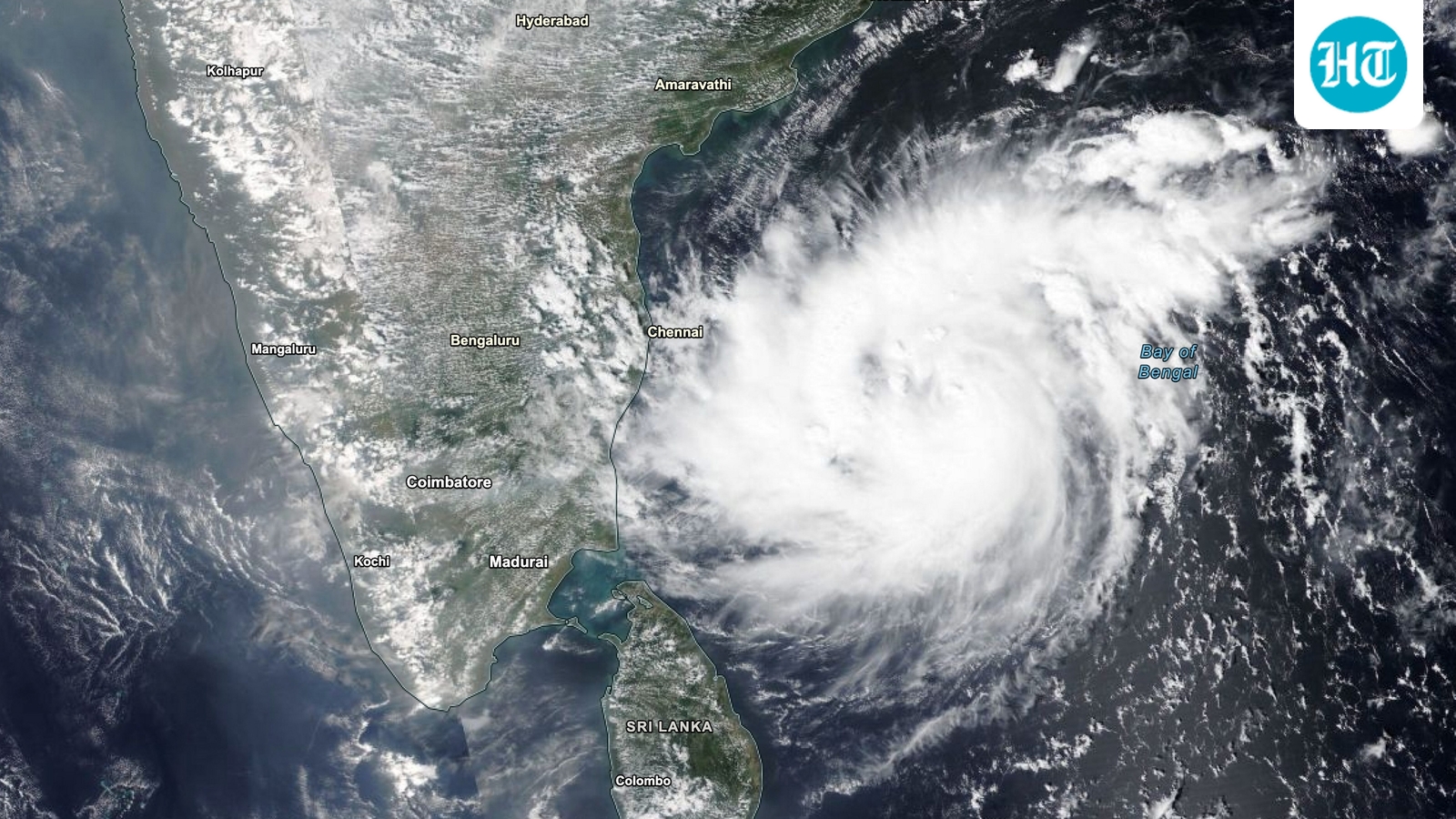
Odisha is bracing for its possible third cyclone in three weeks as a low-pressure area over the Southeast Bay of Bengal is likely to intensify into a cyclonic storm by Monday, according to the India Meteorological Department (IMD).
The IMD said a well-marked low-pressure area over the southeast Bay of Bengal is likely to move northwestwards and intensify into a depression over the same region in 24 hours. Thereafter, it is likely to move north-northwestwards and intensify further into a cyclonic storm over the central parts of the south and adjoining west-central Bay of Bengal on Monday.
The system could further intensify into a severe cyclonic storm by Wednesday, the IMD said in its evening bulletin. The department advised fishermen and coastal communities to return to the coasts by Sunday and follow weather updates and warnings. The weather agency, however, is yet to indicate the likely landfall area and trajectory of the system, Disaster Management Minister Suresh Pujari said.
Odisha braces for third cyclone
Pujari said the state was prepared with its personnel and disaster mitigation machinery for a possible third cyclone in three weeks. He noted that two severe cyclonic storms, Arnab and Murasu, had already affected Odisha, although both made landfall in neighbouring Andhra Pradesh.
"We do not know whether the impending cyclone will hit the Odisha coast. But we need to be prepared, keeping in view the impact of cyclone Arnab. The government has put all collectors on alert, with a focus on districts in the southern, northern and coastal regions," he told news agency PTI.
Also Read | Odisha faces questions over reservoir management weeks after Cyclone Arnab batters Ganjam district
Special Relief Commissioner Rajesh P Patil wrote to district collectors, asking officials placed in the 'orange' and 'yellow' warning categories by the IMD to remain particularly vigilant. Pujari said the state is expected to receive significant rainfall even if the cyclone did not make landfall there. The weather agency is yet to indicate the likely landfall area and trajectory of the system, he said.
The Meteorological Centre in Bhubaneswar has forecast heavy rainfall of 7-11 cm at isolated places on Wednesday, while very heavy rainfall of 12-20 cm is likely in some districts on Thursday and Friday across Andhra Pradesh, Odisha and West Bengal.
The IMD said squally weather, with wind speeds of 45-55 kmph, gusting to 65 kmph, was likely to begin along and off the south Odisha coast from the morning of November 17.
Other states also on alert
Apart from Odisha, the IMD also forecast heavy rainfall in Andhra Pradesh on Wednesday and Thursday, escalating to very heavy rainfall in isolated places on Thursday, along with thundersqualls with wind speed reaching 50-60 kmph. It also forecast heavy rainfall at isolated places over Gangetic West Bengal on Thursday, along with thunderstorms, lightning and gusty winds.
The Met department forecast heavy rainfall over Andaman and Nicobar Islands on Sunday and Monday, accompanied by thunderstorms and lightning. It also advised fishermen not to venture into the Andaman Sea till Monday due to rough sea conditions, or the southeast Bay of Bengal till Tuesday.
Meanwhile, the Indian Coast Guard has placed its ships, aircraft and disaster response teams on high alert along the east coast in Tamil Nadu to brace for the cyclonic storm, according to the PIB defence wing.
Coast Guard ships and aircraft are on standby for immediate deployment, and radar stations are keeping continuous watch on the system. Remote Operating Stations in Chennai and other coastal hubs are broadcasting advisories in regional languages over Very High Frequency (VHF) channels, as per the statement.
KioskNews shows a cleaned-up reading view extracted from the publisher’s page — the original always lives on their site, not ours.