Thursday rains expected in parts of PH due to ITCZ, northeasterly wind
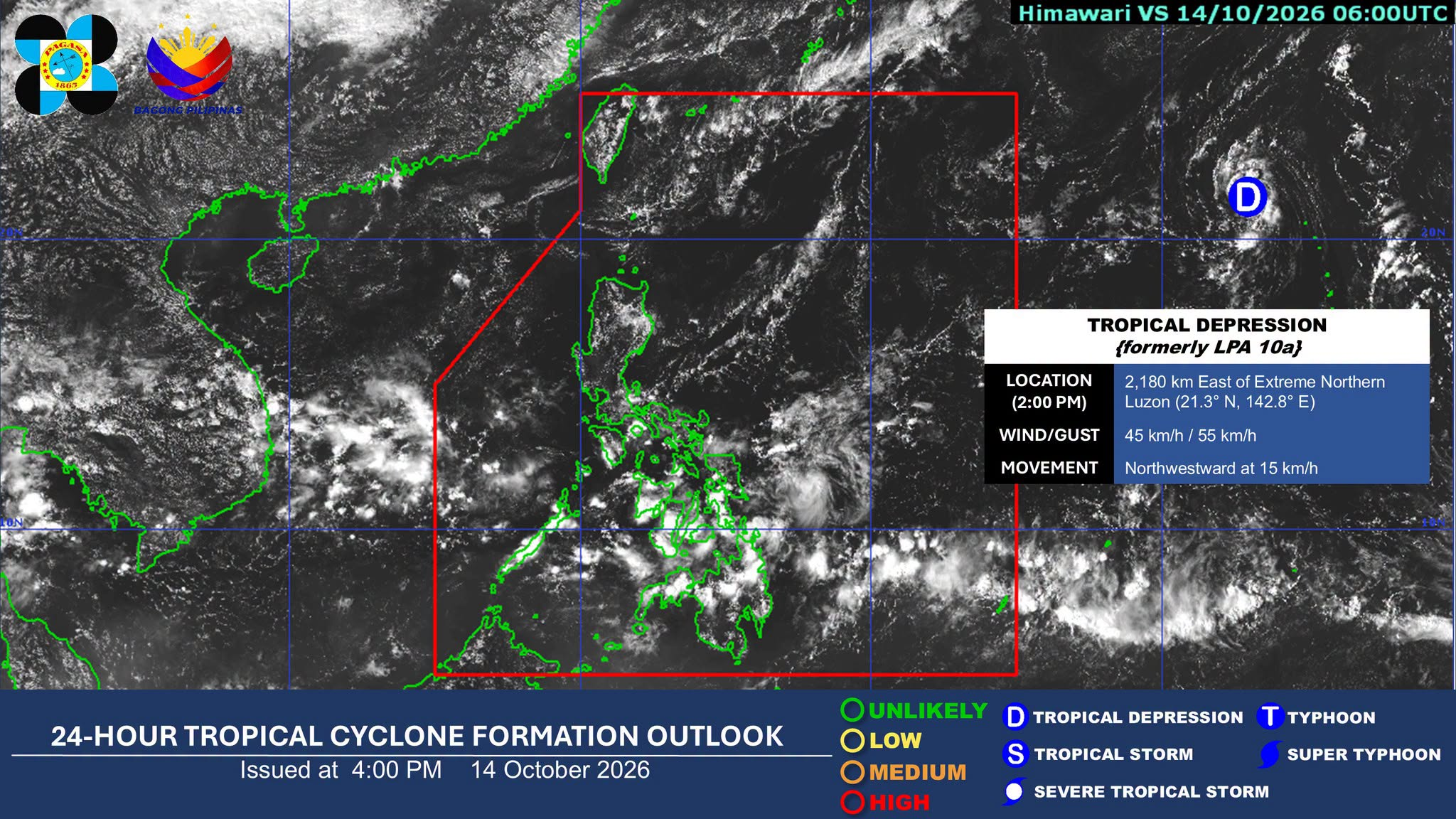
MANILA, Philippines — Occasional rain showers triggered by the northeasterly wind flow and intertropical convergence zone (ITCZ) are expected in several parts of the country on Thursday, according to the state weather bureau.
In its 4 p.m. weather advisory, the Philippine Atmospheric, Geophysical, and Astronomical Services Administration (Pagasa) said that cloudy skies with scattered rains and thunderstorms will persist in the Visayas, Mindanao, Bicol Region, Quezon, and Palawan due to the ITCZ.
Article continues after this advertisement
The weather bureau warned that flash floods or landslides may occur during moderate to at times heavy rains.
FEATURED STORIES
NEWSINFO
NEWSINFO
NEWSINFO
Meanwhile, the northeasterly wind flow may bring partly cloudy to cloudy skies to the Ilocos Region, Cordillera Administrative Region, Cagayan Valley, and Aurora.
Metro Manila and the rest of Luzon will experience partly cloudy to cloudy skies with localized thunderstorms.
READ: ITCZ, northeasterly wind to bring rain to parts of PH on Wednesday
Tropical depression update
Article continues after this advertisement
Pagasa reported that as of 3 p.m. Wednesday, the tropical depression (TD) outside the Philippine area of responsibility was tracked some 2,175 kilometers east of extreme Northern Luzon.
It has maximum sustained winds of 45 kilometers per hour (kph) near the center, with gusts up to 55 kph.
Article continues after this advertisement
The weather disturbance was monitored moving northwest at 15 kph.
Pagasa earlier said in its 5 a.m. weather advisory that the TD is not expected to enter or directly affect the country. /gsg
KioskNews shows a cleaned-up reading view extracted from the publisher’s page — the original always lives on their site, not ours.