Storm Austen mapped: Where high winds and rain will hit UK today before Storm Boelo arrives
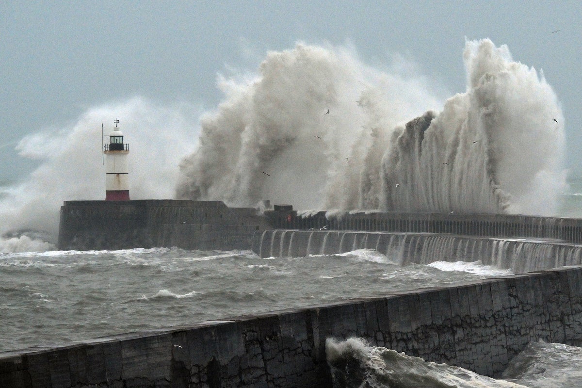
Powerful winds reaching 111mph have been recorded in Cornwall leaving thousands of homes without power as Storm Austen batters the UK.
The Met Office has issued several yellow and amber weather warnings for wind and rain over the next few days as two named storms hit.
Strong winds reaching 70mph are still expected to hit south-west England and Wales today, with a yellow warning in place until 5pm. Another yellow warning for wind has also been issued for south of England and the Midlands until 9pm, with the Met Office warning gusts could reach 55mph.
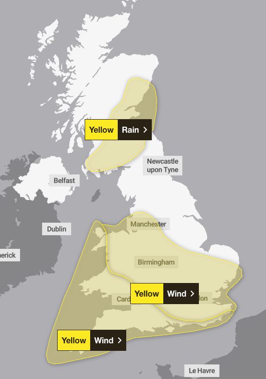
An amber weather warning was in place across Cornwall and parts of Devon between 3am and 10am on Friday alongside a “danger to life” warning along sea fronts and coastal roads due to large waves and thrown beach debris.
More than 9,000 home in Cornwall have no electricity, roads have been closed due to fallen trees and many schools have shut for the day. Schools in Guernsey have closed as a safety measure, while ferries to the Isles of Scilly have been suspended.
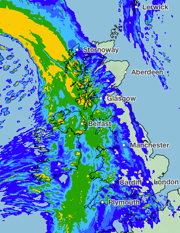
A yellow weather warning for rain has been issued across parts of Scotland between 6am on Friday and 3am on Saturday.
Downpours across the Scottish borders, Glasgow, Edinburgh and Aberdeen could cause flooding, with accumulations of 20 to 40 mm expected widely and up to 80mm possible, bringing flooding and travel disruption in a few places. The rain will turn lighter and clear from the west through the evening and overnight.
The storm has been able to deepen rapidly because of its interaction with a powerful jet stream over the Atlantic, the Met Office explained.
As the storm crosses the jet stream and enters the “left jet exit region,” conditions high in the atmosphere support falling pressure at the surface, helping the low-pressure system strengthen rapidly.
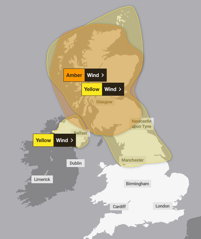
But another storm is on the way this weekend. The Met Office has warned Storm Boelo is set to bring heavy rain and strong winds across the country on Saturday. The strongest winds will be across Northern Ireland, Scotland and northern England.
An amber warning for wind has been issued across Scotland from 9pm on Saturday to 9pm on Sunday. Gusts could reach 80 mph in exposed coastal areas with strongest winds will initially affect western Scotland and far north of Northern Ireland on Saturday evening and then spread eastwards overnight and through Sunday.
A wider yellow warning for wind is also in place across the north of England, east midlands and Scotland from 9pm on Saturday to 9pm on Sunday. Power cuts, damage to buildings, road closures and transport delays are all possible.
Northern Ireland could also see gusts of wind reaching 75mph along with blustery heavy showers. A yellow warning has also been issued in Northern Ireland from 10am on Saturday to midday on Sunday.
UK five day weather forecast
Today:
Severe gales in the south and west, as Storm Austen moves its way eastwards, these easing later. Winds increasing through the day elsewhere, with heavy rain or showers for many but turning drier in the west. Feeling rather cold.
Tonight:
Storm Austen moves off towards the North Sea as winds slowly ease overnight. Much drier for all but rain and showers move into the west by dawn. Staying rather cloudy.
Saturday:
Storm Boelo moves into the northwest, bringing widespread rain for all, heaviest in the west. Winds strengthen through the day with the strongest being in the north and west. Mild.
Outlook for Sunday to Tuesday:
Sunny spells and showers dominate through Sunday, with heavier showers and very strong winds in the north. Rain spreads across the UK on Monday, with milder conditions in the south.
KioskNews shows a cleaned-up reading view extracted from the publisher’s page — the original always lives on their site, not ours.