Storm outside PAR may affect, enter PAR early next week – Pagasa
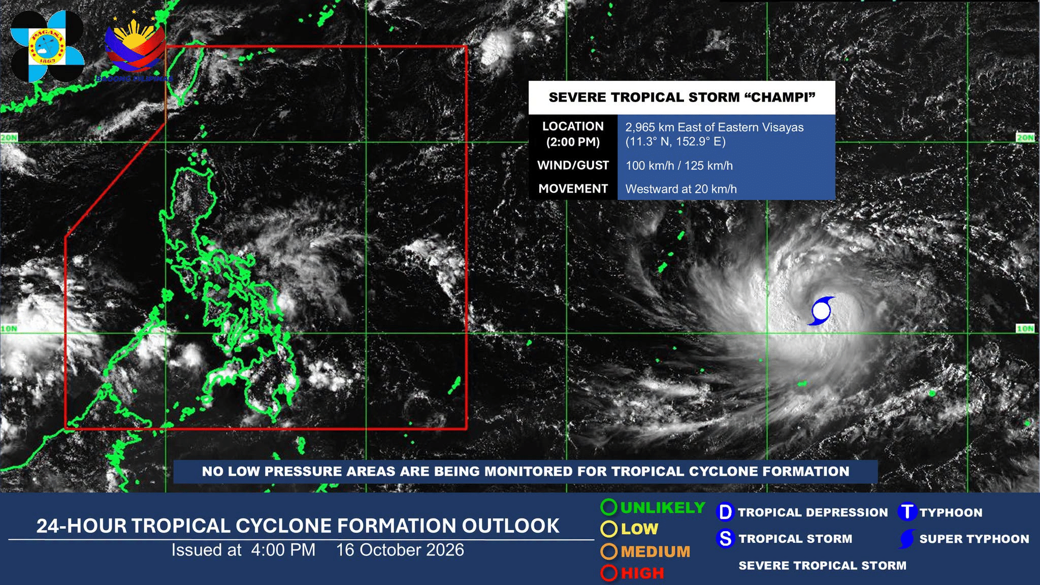
MANILA, Philippines — Severe Tropical Storm Champi, which is still outside the Philippine area of responsibility (PAR) may affect the country as early as Monday, Oct. 19, the state weather bureau said on Friday.
Philippine Atmospheric, Geophysical, and Astronomical Services Administration (Pagasa) weather specialist Daniel James Villamil said in a 5 p.m. weather advisory that the trough or extension, of Champi may trigger rains in parts of the Visayas and Mindanao.
Article continues after this advertisement
The weather disturbance is forecast to enter the PAR on Tuesday, Oct. 20.
FEATURED STORIES
NEWSINFO
NEWSINFO
NEWSINFO
“Posible itong pumasok ng ating Philippine area of responsibility by Tuesday, pero as early as Monday, makakaranas na tayo ng mga kaulapan at pagulan na associated sa trough or extension ng naturang bagyo. Especially dito sa malaking bahagi ng Visayas as well as ilang areas po ng Mindanao,” he said.
(It may enter the Philippine area of responsibility by Tuesday, but as early as Monday, we will already have cloudy skies and rain associated with the trough or extension of this storm, especially across a large part of the Visayas and some areas in Mindanao.)
As of 2 p.m. Saturday, Champi was located some 2,965 kilometers (km) east of Eastern Visayas, moving westw at 20 kilometers per hour (kph) with a maximum sustained wind speed of up to 100 kph near the center and gustiness of up to 125 kph..
READ: 3 weather systems affect PH on Friday, says Pagasa
Article continues after this advertisement
Meanwhile, the intertropical convergence zone will continue to bring cloudy skies with scattered rains and thunderstorms to the Visayas, Mindanao, Bicol Region, Mimaropa, and Quezon.
Pagasa also reported that the easterlies will affect Metro Manila and the rest of Luzon, which may cause gloomy weather with occasional rains.
Article continues after this advertisement
Likewise, it will also bring cloudy skies with scattered thunderstorms over Aurora. /gsg
KioskNews shows a cleaned-up reading view extracted from the publisher’s page — the original always lives on their site, not ours.