Tropical depression’s trough to bring rains in Visayas, Mindanao Thursday
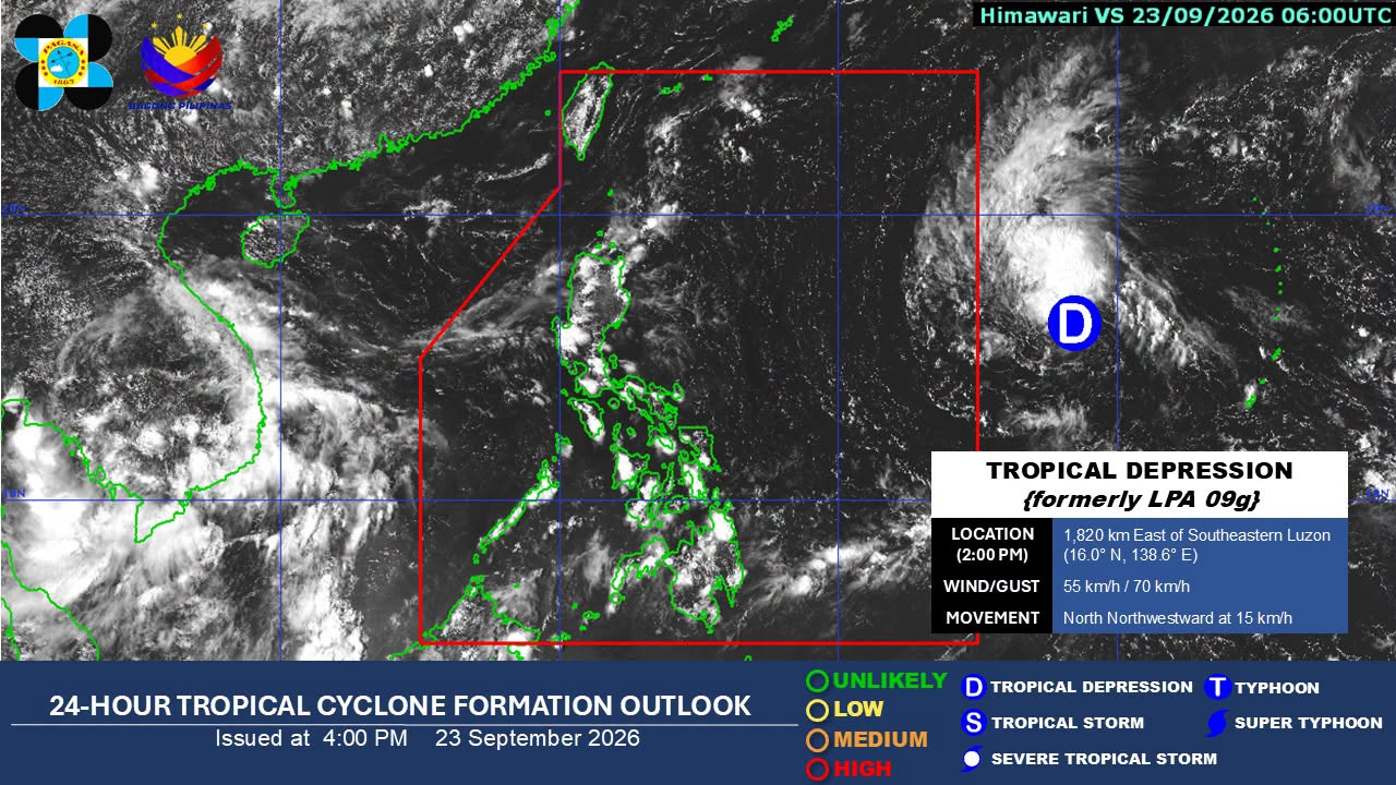
MANILA, Philippines — The trough of a tropical depression will continue to affect Visayas and Mindanao, while localized thunderstorms may prevail over the rest of the country on Thursday, Sept. 24.
This is the forecast from Philippine Atmospheric, Geophysical and Astronomical Services Administration (Pagasa) at 5 p.m. today (Wednesday).
The weather bureau reported that the extension of the tropical depression will still bring gloomy skies tomorrow, with scattered rains and thunderstorms over Eastern Visayas, Caraga, Davao Region and Sarangani.
Article continues after this advertisement
As of 3 p.m., the weather disturbance was located 1,810 kilometers (km) east of the southeastern portion of Luzon while moving generally north northwestward at 15 km per hour.
FEATURED STORIES
NEWSINFO
NEWSINFO
NEWSINFO
READ: Tropical depression to enter PAR Thursday; may enhance habagat
Pagasa warned the public of possible flash floods or landslides that may occur in the affected areas during moderate to, at times, heavy rains.
Meanwhile, Metro Manila and the rest of the country may experience partly cloudy to cloudy skies with isolated thunderstorms on Thursday.
The weather bureau also warned that flash floods or landslides may happen during severe thunderstorms.
Article continues after this advertisement
Pagasa weather specialist Benison Estareja said that aside from Visayas and Mindanao, the trough of the tropical depression may also affect Southern Luzon in the coming days.
“The so-called tail or trough of the typhoon will still have an impact in the coming days, especially over Southern Luzon, Visayas and Mindanao,” he cautioned during his 5 p.m. report. /apl
KioskNews shows a cleaned-up reading view extracted from the publisher’s page — the original always lives on their site, not ours.