‘We need to recover respect for the apparently non-living’: Yameli Guadalupe Aguilar Duarte on geodiversity
Geodiversity might be biodiversity’s lesser-known sibling, but bringing attention to its importance has become a priority for Dr. Yameli Guadalupe Aguilar Duarte. A scientist at the National Institute for Forestry, Agriculture and Livestock Research (Inifap), she is currently working on a project studying karren formations in the Yucatán Peninsula.
Mexico News Daily spoke with Duarte about why geodiversity matters, its biocultural significance for Indigenous communities, why we need to recognize and protect these valuable rock formations, and how to rediscover a sense of wonder for the ground we walk on — and which sustains us.
There is a lot of talk about Mexico’s rich biodiversity, but much less about what sustains it. Why is it so important to pay attention to geodiversity too?
We talk a lot about Mexico’s biodiversity: its extraordinary variety of animals, plants and fungi. But less about that biological diversity that exists because there is also a diversity of physical environments that support it. The two go hand in hand.
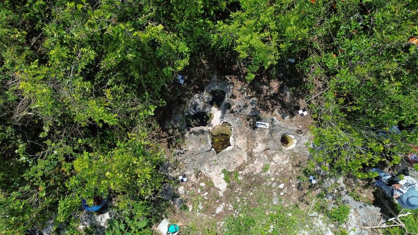
We cannot protect, conserve or properly manage biodiversity without considering the conditions that make it possible. Different types of rocks, soils, bodies of water and landforms create different environments in which life can develop.
That is why we need to bring geodiversity into the conversation.
“Protecting an animal or a plant is not enough if we destroy the soil, contaminate the water or transform the landscape on which it depends.”
Mexico in Numbers: Mexico’s biodiversity and honey production

Another important factor to consider when talking about geodiversity is time. Some of these elements are described as renewable resources, but their recovery may not be possible within a human lifetime. When we lose soils or geological formations, we cannot simply replace them. We need to recognize the consequences of damaging something that took much longer to form than we have to restore it.
While preparing for this interview, I realized that although I consider myself fairly well informed about biodiversity, I knew very little about geodiversity. How would you explain it to someone encountering the subject for the first time?
Geodiversity refers to the variety of components of the physical environment that we generally consider nonliving, or abiotic. These include rocks, minerals, soils, fossils, landforms and different bodies of water.
Think of rivers, lakes, lagoons, aquifers and coastal environments. Or the differences between mountains, depressions and rocky outcrops. These are some of the elements that help create the conditions in which biological diversity develops.
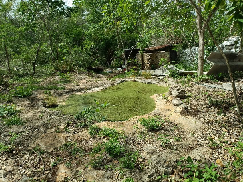
“We tend to pay more attention to what is visibly alive, but these apparently nonliving elements are fundamental. Without them, life as we know it on Earth could not exist.”
When you talk about ‘non-living’ elements, I feel those words deserve quotation marks: a rock may appear motionless or inert, but that does not mean nothing is happening within it. How do you understand that distinction, given your scientific training and your relationship with Indigenous peoples?
My training as a biologist taught me to distinguish between biotic and abiotic components. But my training as a geographer and my experience working with Indigenous peoples changed how I relate to those categories.
Rocks, landforms, soils and bodies of water are not static. They undergo processes of transformation. Rocks can also harbor microorganisms, and soils contain an enormous diversity of life that remains little understood.
For me, that invites a broader way of thinking about the apparently non-living. It is not only a question of scientific classification; it is also about how we understand and relate to our surroundings.
Maya communities in the Yucatán Peninsula have ways of understanding the environment that encourage respect for its different elements. We need to take seriously the scientific, empirical and intergenerational knowledge that contributes to caring for those environments.
In the socioecological crisis we are experiencing, we need to recover respect for water, soils, mountains, cenotes and forests, including what we in modern societies do not ordinarily recognize as alive.
As I listen to you, I think of geodiversity as the home that makes our lives possible, even though we often do not notice it. When do you think we lost that respect for water, soil and rocks?
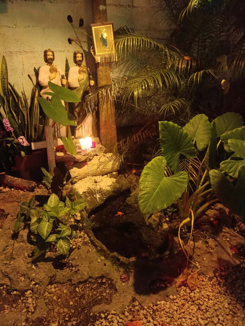
I do not think it happened at a single moment. There have been different turning points throughout history.
One was colonization, which brought the imposition of other beliefs and political systems, alongside the extraction of gold and the appropriation of land. Those processes also displaced knowledge and ways of relating to the environment.
“I am not saying that Indigenous societies had no internal conflicts. But colonization marked an important rupture in how their knowledge, beliefs and relationships with the environment were valued.”
Another factor is how we teach and study nature. From my perspective, biology education in Mexico has placed considerable emphasis on genes, populations and species, while more integrated approaches linking biological processes with those of the physical environment have received less attention.
Today, we also need to question models of development that treat landscapes primarily as sources of materials or spaces to build on or transform. When we discuss extraction or urban expansion, we should ask: development for whom? Who benefits, and who bears the environmental costs?
When I started researching, I saw rocks with very organic shapes, as though water had gradually sculpted them. What exactly are karren formations, and how do they differ from the karst system they belong to?
To understand karren formations, we first need to understand karst. Karst systems develop in rocks that can dissolve and also reform through interaction with various factors, particularly water. That process produces different formations, both underground and at the surface.
Karren are features produced by that dissolution at the rock’s surface. They can include small channels, grooves, pits and various types of hollows, and can even extend across large areas of exposed rock. They are also known as lapiés.
It is important to distinguish these formations from the system as a whole. A karst system is an integrated concept that includes rocks, soils, water, biota, and surface and underground formations through which water flows. Karren, or lapiés, are part of that broader system, but occur at and just below the surface, with some degree of interconnection with the underground environment.
In the Yucatán Peninsula, some karren formations are small hollows that hold water and have their own Maya names, such as haltunes. Other examples are known as xúuches: these are also hollows or natural shafts that channel water into the aquifer.
Although other landforms, such as cenotes and caves, are better known and more widely studied, karren formations such as haltunes and xúuches are also important and deserve to be studied.
I was struck by the fact that these small hollows not only have their own Maya names, but also specific uses and ways of being cared for. How do they relate to agriculture and the knowledge communities have developed about their surroundings?
Their biocultural importance is connected to the knowledge people have developed through observing and using their surroundings.
Some hollows collect water that has been used to support agricultural work or provide drinking water for domestic animals. Others accumulate organic matter. Leaves and small organisms fall into them; moisture encourages decomposition, and a dark, nutrient-rich material forms.
Farmers have collected that material and mixed it into the red soils of their plots. It is a very particular way of understanding the landscape: recognizing that a hollow in a rock can contribute to agricultural production.
One of our research questions is how much of that knowledge remains, how much has changed and how much is being lost.
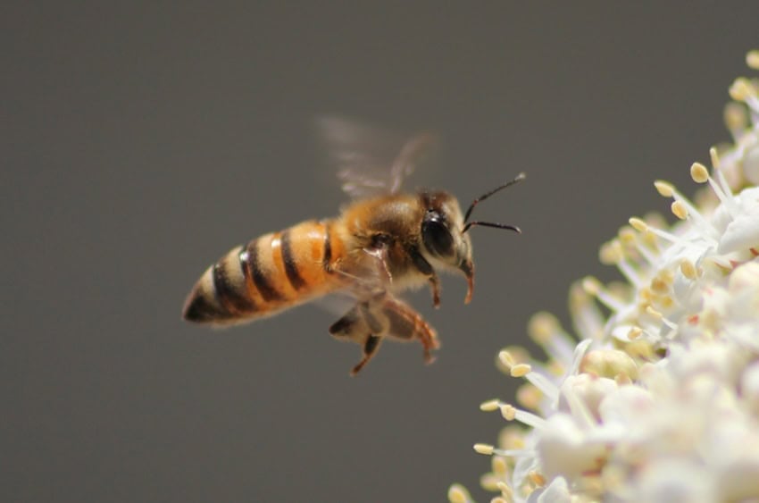
During our first field visits, an older woman from a community near Valladolid took us to several haltunes. At one site, she explained that the water helped them irrigate the milpa. At another, she told us that those hollows were not to be disturbed because bees came there to drink.
That stayed with me: “These haltunes are for the bees.”
“It demonstrates a very nuanced understanding of the environment. She distinguished between sites according to their functions and cared for them accordingly. That is what biocultural knowledge expresses: a relationship between people, their practices and the particular characteristics of the place where they live.”
The story of the woman who reserved certain haltunes for bees made me think about everything we might overlook when we see a simple ‘puddle.’ Beyond their biocultural importance, what functions do they serve for wildlife, water and the environment?
They create small habitats and water sources for wildlife. A formation that may look like an ordinary puddle to someone passing by can be important to the animals that use it.
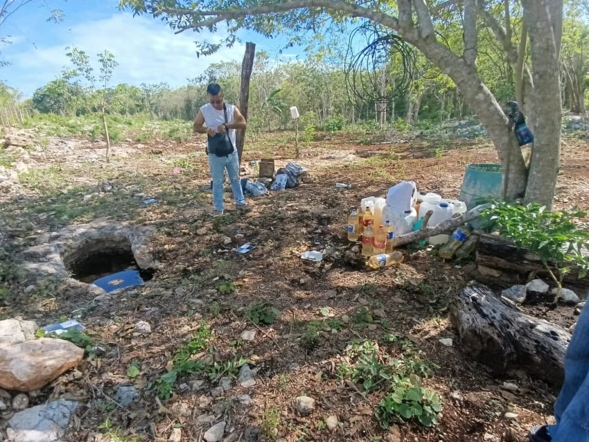
Some are also connected to the subsurface and provide pathways through which rainwater infiltrates the ground. Studying them helps us understand the relationship between the surface and the karst system as a whole.
In cities, we are losing many of those natural functions by covering the ground with streets, buildings and concrete. When people pave their entire yards, they remove spaces through which rainwater could enter the soil and rock.
Spaces that retain vegetation, soils and natural rock formations can also provide wildlife refuges and help moderate urban heat. These are not empty or unused spaces. They perform functions that we easily overlook when we think only about what we can build there.
I imagined these formations in remote places, far from cities, but you have explained their connection to urbanization: they disappear when land is cleared or leveled, or when rock is extracted. What are the main threats to them and to the karst system, including oil and gas extraction?
Two major pressures are urbanization and the extraction of stone for construction.
When land is cleared and leveled for development, vegetation, soils and rock formations can disappear together. The damage begins before the buildings go up. Sometimes even cenotes and karren formations are filled or sealed.
Limestone extraction also removes the formations and transforms the surrounding environment. Large artificial excavations can alter underground water flows and expose groundwater at the surface, making it more vulnerable to contamination and evaporation.
Beyond the direct destruction of karren formations, the karst system faces pressures from activities that demand large quantities of water and generate waste. In the peninsula, these include intensive agriculture, livestock production, mass tourism and urban growth.
The oil and gas industry is another concern. Our project also studies a mountainous karst region in San Luis Potosí, where Indigenous peoples have opposed fracking. The concern is how drilling and extraction can transform these environments and affect the springs and other bodies of water on which communities and their traditional activities depend.
That is why we need to study these formations as parts of an interconnected system, rather than as isolated rocks. Their loss affects more than the visible landscape: it can also affect water, habitats and the communities whose lives and practices depend on them.
We are accustomed to admiring a cenote with blue water, but perhaps not to stopping in front of a rock, a patch of soil or a small hollow. How can we rediscover that sense of wonder?
In my experience, one of the most effective ways is to go into the field.
A photograph, video or documentary can awaken curiosity, but being in a place, observing it and experiencing it directly creates a different connection. Even in a city, we can help people discover the spaces that still retain natural soils and rock formations.
Visiting a geopark and following one of its geological trails is another way to experience that connection. One place I recommend is the Mixteca Alta Geopark in Oaxaca. I have taken two of its routes, and I was fascinated. The trails introduce you to the diversity of soils and landforms, but also to the region’s history, agriculture and the ways people use local materials, such as clay.
What makes those experiences valuable is the connection between the landscape and the communities who participate in its interpretation and management. You are not simply looking at scenery: you begin to understand how the place formed, how people relate to it and why it matters. That direct encounter can awaken a sense of wonder at something you might previously have considered just a rock or a little soil.
We also need other ways of connecting, such as art. I collect rocks and soils, and when I take samples to public talks, people begin to recognize differences in their colors, textures and forms.
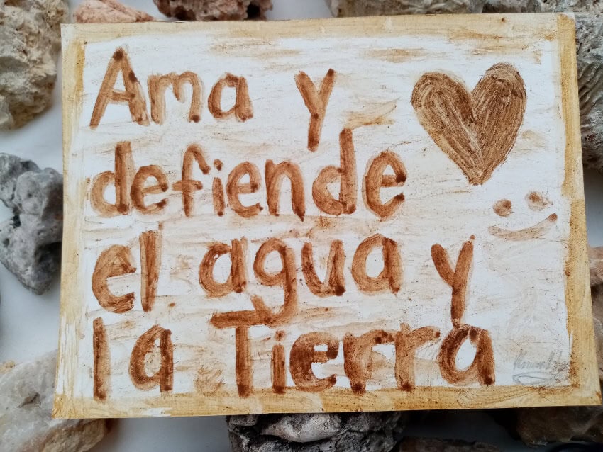
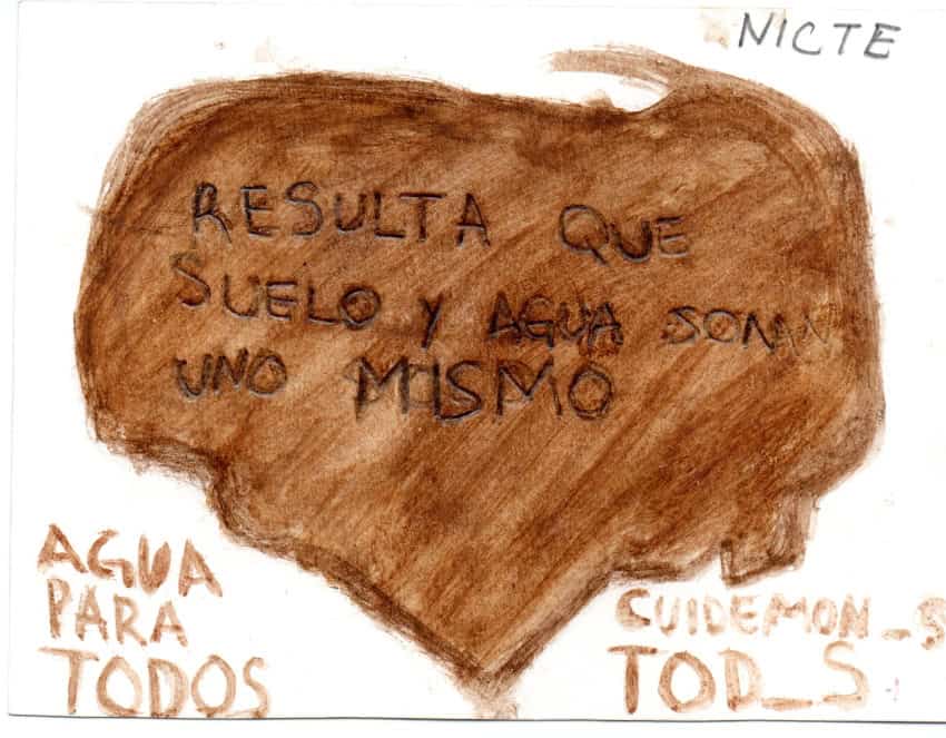
With a colleague, I have also made watercolors using soils. We talk about soil diversity, then invite people to paint a postcard with a message about caring for it. Someone who is not immediately interested in scientific terminology may connect through that creative experience.
The idea is not that everyone must become a specialist. It is to recognize the diversity of the elements we walk over every day — and to understand how they connect to water, vegetation, food production and our own lives.
KioskNews shows a cleaned-up reading view extracted from the publisher’s page — the original always lives on their site, not ours.