Apple updates Maps in India with enhanced 3D imagery, support for 11 languages
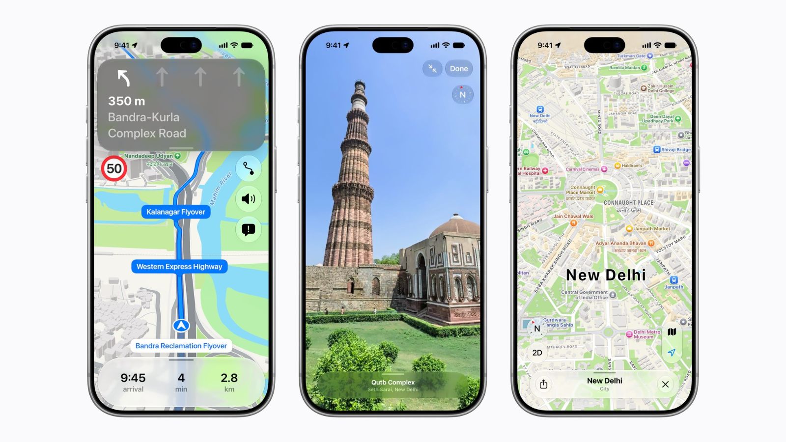
Apple, on Wednesday, November 18, rolled out its all-new map across India. The updated map brings better navigation, 3D landmarks, and features like Look Around, AR Walking, along with improved Natural Language Guidance and dual-language labels designed specifically for India.
“Apple Maps is the best way to explore and navigate the world, and we are excited to bring an enhanced Maps experience to even more users with today’s rollout of the new map in India,” said Max Muller, Apple’s vice president of Apple Maps.
The latest update combines faster and more accurate navigation with detailed imagery of roads, buildings, parks, and shopping centres. The company also claims to include over 300 3D landmarks, making travel easier for users across India. The new features are built specifically for India, with Natural Language Guidance and dual-language labels assisting users in navigating local cities and towns.
The maps now feature 11 Indian languages other than Hindi and English, such as Bengali, Gujarati, Kannada, Malayalam, Marathi, Tamil, Telugu, Punjabi, Odia, and Urdu. The dual-language labels show both English and the regional language on the screen. For instance, if you want to see a city in Andhra Pradesh, the map will show labels in both English and Telugu.
According to Muller, the new map offers some of Apple users’ favourite features like Look Around and AR Walking Directions. “We’ve also designed the map for India’s specific navigation needs, including enhanced Natural Language Guidance and customised dual-language labels, making it easier than ever for users to find the places they love and get to where they’re going.”
The map now includes rich land cover, more accurate roads, 3D buildings, 3D landmark buildings, and over 48 million POIs. It also offers an improved driving experience with landmark-based navigation, lane guidance, and speed limits.
Navigating in India
The new Maps aims to make navigation hassle-free. With Natural Language Guidance, the map sounds more conversational and easier to follow. The company claims that, for India, the feature has been enhanced by adding real-world details such as pillars and other points of interest that may come in handy along the roads.
Story continues below this ad
Another feature, lane guidance, helps users to identify the right turn or entrance to elevated roads. Multi-stop routing allows users to add up to 15 stops in advance, and once they are ready, the routes sync from Mac and iPad to iPhone. Besides, sharing ETA with friends and family is much easier, as it only takes a simple tap. The recipients can also follow the journey, and Maps will keep them updated about the revised ETA.
The company said that users can also report an accident, hazard, or speed check along their route by letting Siri AI know. They can also report when incidents displayed on the map have been cleared. Also, for drivers with certain electric cars, Maps allows them to plan trips along routes that include stops for charging by assessing changes in elevation and other factors along the route.
Meanwhile, transit riders in Ahmedabad, Bengaluru, Chennai, Delhi, Hyderabad, Kolkata, Mumbai, and Pune, as well as on Indian Railways, can use Maps to plan their journeys, find nearby transit stations, and pin their favourite routes. Moreover, riders will also receive notifications when it’s time to get off at their stop. Additional features include AR walking directions, cycling directions, preferred routes, etc.
Dual-language labels and enhanced Natural Language Guidance are available in Apple Maps on iOS 27.2, iPadOS 27.2, watchOS 27.2, and macOS 27.2 or later.
KioskNews shows a cleaned-up reading view extracted from the publisher’s page — the original always lives on their site, not ours.