Weather mapped: Snow set to hit these areas as temperatures plunge to -4C
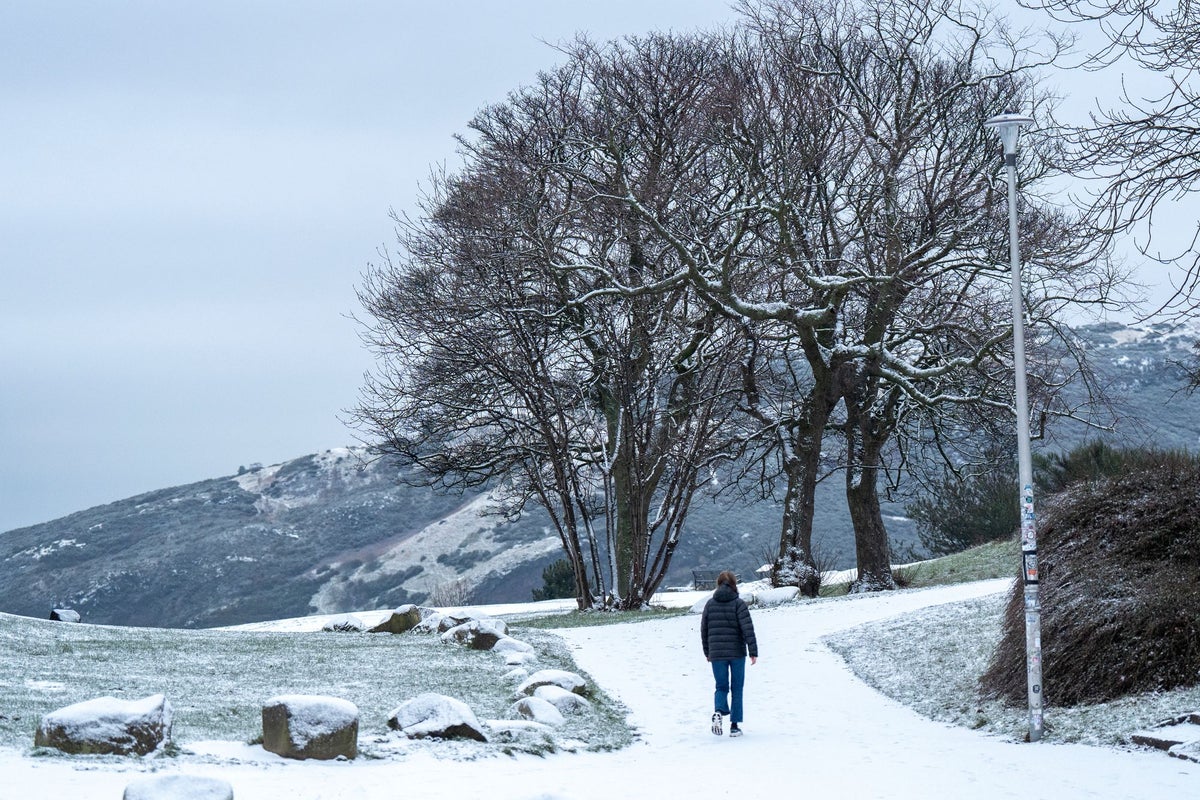
Snow is set to fall in some areas across the UK over the coming days as temperatures drop and yellow cold health alerts come into force.
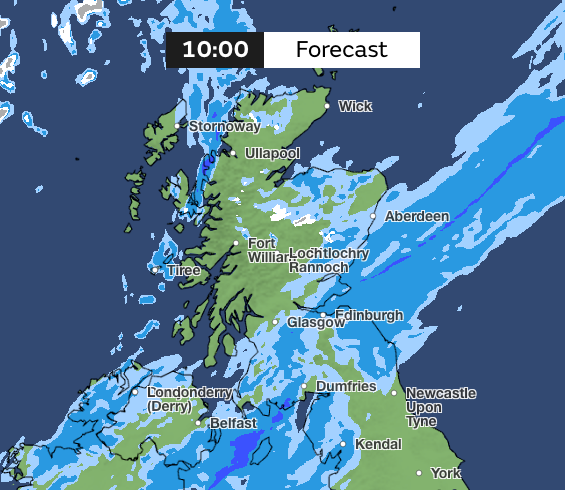
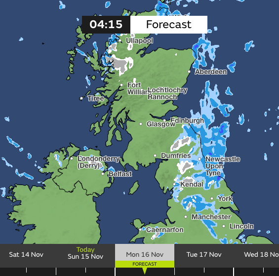
The Met Office’s weather maps show snow is expected in some parts of Scotland this morning, before the temperature drops below zero around Loch Rannoch overnight heading into Monday.
Lows of minus two are also expected overnight in a number of places in Scotland, including Perth, Dalwhinnie and Pitagowan.
Kendal and Penrith will also see lows of minus two early on Monday morning, while Omagh in Northern Ireland and Cumnock in Scotland will hit lows of minus four at 8am.
Armagh, Banbridge, Crumlin, Newry and Ballymena will see lows of minus three.
The Met Office’s map for Monday morning also shows snow in parts of Northern England, North Wales and Scotland.
The cold health alerts were issued by the UK Health Security Agency (UKHSA) for many places in England - the North West, West Midlands and Yorkshire and The Humber. They will be in place from 9pm on Sunday until 9am on Thursday.
These alerts mean weather conditions could result in an increased use of healthcare services and a greater risk to life for vulnerable people, the agency said.
During the day on Sunday, passing showers are forecast to sweep through Wales and southern England, with some possibly thundery in the far southwest, the Met Office said.
Rain will be more persistent for Northern England and Southern Scotland, with strong winds arriving for north-east coasts in the second part of the day.
Those in Northern Scotland and Northern Ireland should experience a brighter and colder day, with showers for some which could be wintry, bringing snow to the hills.
Cold conditions will continue on Monday with long sunny intervals for most, though approaching cloud will dim the sunshine later, the Met Office said.
Meanwhile, those in the north east of Scotland should brace themselves for further wintry showers.
Ethan Douglas, operational meteorologist at the Met Office, said the cold conditions could lead to an ice risk on the roads, causing “potentially hazardous travelling conditions”.
He told the Press Association: “On Sunday night and Monday morning, there is the potential for some disruptive ice (given the preceding rain and cold night) and snow.
“The snow risk will be constrained to Scottish hills, bringing difficult driving conditions there.
“The ice risk may be present more widely across the north of the UK, causing extended journey times and potentially hazardous travelling conditions.”
Met Office five day forecast for the UK
Today:
For Wales and southern England, passing showers, possibly thundery in the southwest. Persistent rain at times for southern Scotland and northern England. Brighter and showery in the north and west. Rather cold in the north, but average in the south.
Tonight:
Much of the rain and showers move off to the east, leaving clear spells, allowing temperatures to fall way, below freezing in the north with a widespread rural frost.
Monday:
A mostly dry and bright day on Monday with sunny spells. Sunshine turns hazy into the afternoon with rain moving into the southwest later. Feeling chilly in the east.
Outlook for Tuesday to Thursday:
Staying unsettled over the next few days with the risk of hill snow for North Wales, northern England and Scotland. Staying cold but temperature returning to average in the south.
KioskNews shows a cleaned-up reading view extracted from the publisher’s page — the original always lives on their site, not ours.