Weather mapped: Where temperatures could hit 27C in final blast of summer sun
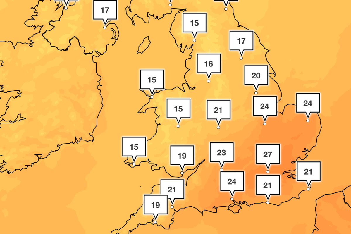
Parts of the UK could see temperatures soar as high as 27C over the next week as a final hit of summer sun shines on the country.
Rain and more autumnal weather have swept across the UK since the start of September. It came after the Met Office confirmed the hottest summer on record, with parts of the country experiencing as many as five heatwaves and remaining in drought as a result.
But forecasters said there could be one more chance for summer sunshine as a “heat dome” moving from North Africa sends temperatures soaring again.
High temperatures are expected on Tuesday, when parts of London and the South East will see late afternoon highs of 25C and bright sunshine will dominate across the South and Midlands.
The Met Office said: “Tuesday will see a cold front gradually move southeastwards across Scotland and Northern Ireland. Many areas will have a mix of cloud and brighter spells, while rain arrives in north-west Scotland and Northern Ireland later in the day.
“The warmest conditions are expected to remain in the southeast, where temperatures could reach 25C, with a potential maximum of 26C.”
Sunshine will continue across the South and South West on Wednesday, with forecasters predicting some cloud cover to move eastwards. But temperatures will remain warm in London and the South East, with highs of around 23C.
But the warmest weather of the week is expected on Friday, with the Met Office forecasting highs of 27C at around 4pm in London.
However, the Met Office also said the warmer weather could be cut short by the expected arrival of a colder front from the West, the timing of which remains uncertain.
After this, conditions are likely to become “changeable”, according to the Met Office’s longer-term forecast, “with spells of rain and showers interspersed with some short-lived spells of more settled weather and temperatures returning to near normal overall”.
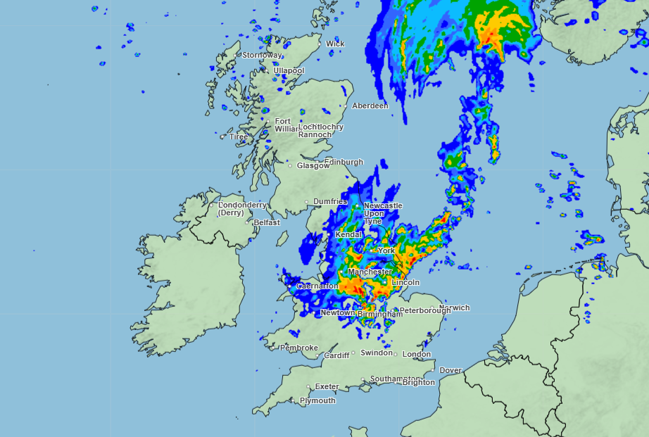
Deputy chief forecaster Tony Wisson said: “There remains some uncertainty over the exact track of a frontal system on Wednesday which could bring a spell of heavy rain, particularly across eastern and south-eastern Scotland, and potentially parts of northern and north-eastern England.
"We're closely monitoring this development and would encourage people to keep up to date with the latest forecasts over the coming days. It’s likely that many southern areas will remain largely dry.”

Met Office five-day forecast
Tuesday
Cloudy in the North and West with rain moving into north-western areas. Largely dry across much of England and Wales with some very warm sunshine in the South East.
Wednesday
Heavy rain moves across Scotland, Wales and England on Wednesday with some heavy bursts at times and perhaps some hail in the East. Warm in the South East, fresher elsewhere.
Thursday to Saturday
Largely dry, bright and settled on Thursday. Outbreaks of rain and strong winds move across the North at times, but staying mostly dry in the South with sunny spells.
KioskNews shows a cleaned-up reading view extracted from the publisher’s page — the original always lives on their site, not ours.