How El Niño fuelled Cyclone Arnab’s rapid intensification
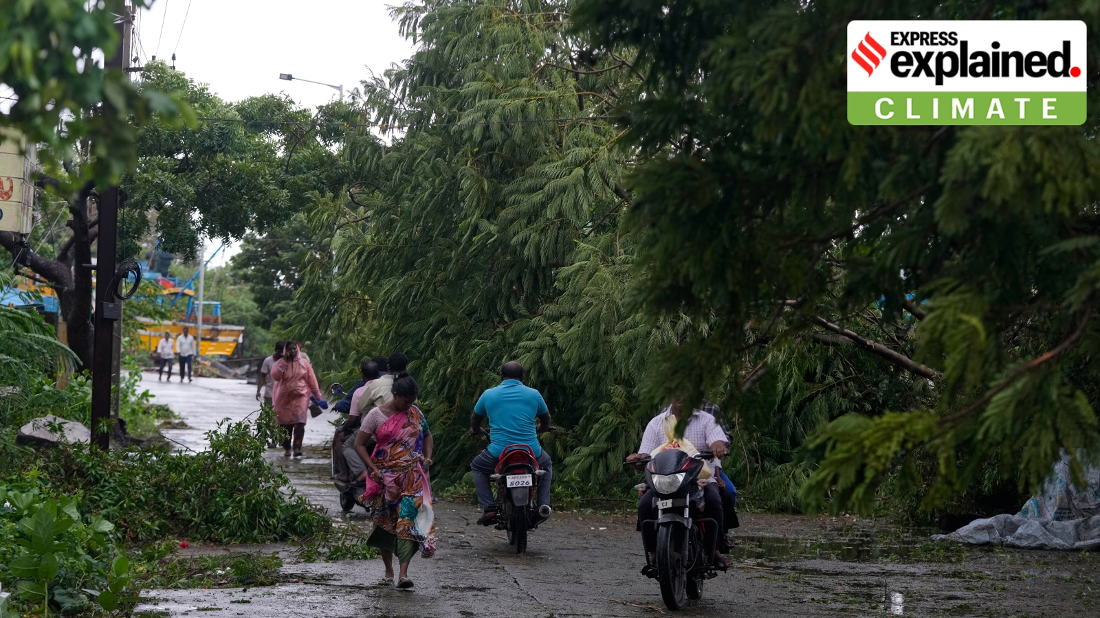
Cyclone Arnab made landfall on India’s east coast on Wednesday morning. The “very severe” cyclonic storm has now weakened into a “severe cyclonic storm” after crossing the Andhra Pradesh and Yanam coasts.
The cyclone left a trail of destruction in its wake, uprooting several trees and power poles, and leading to power outages in several areas. More than 1,80,000 people were evacuated in Andhra Pradesh and Odisha before its arrival.
According to the India Meteorological Department (IMD), the landfall process is complete with the weather system moving entirely over land. Peak wind speeds reached up to 135 kmph, with gusts of up to 150 kmph.
How did Cyclone Arnab form and what role did El Niño — the abnormal warming of the Pacific Ocean’s surface waters — play in its intensification? We explain:
How did Cyclone Arnab form and intensify?
Cyclone Arnab is the first cyclone to form in 2026 in the North Indian Ocean basin, which comprises the Bay of Bengal and the Arabian Sea.
It started as a low-pressure system in the southeast Bay of Bengal on October 23, before intensifying into Cyclone Arnab by October 26.
The weather system then rapidly intensified into a “severe” cyclone and later became a “very severe” category storm — associated wind speeds ranging from 125-135 kmph. Along with rapid intensification, Arnab’s landward movement remained faster than originally forecast by the IMD, which, on Tuesday late night, advanced the landfall from forenoon to the early hours of Wednesday.
Story continues below this ad
Arnab’s landfall commenced around 1 am on Wednesday. It first crossed the coast between Bapatla and Visakhapatnam with wind speeds equivalent to a “very severe” cyclone. At the time of landfall — the process when the cyclone’s eye (or centre) crosses from the sea over to the landmass — it had a wind speed of 125-135 kmph gusting to 140 kmph. The maximum damage is sustained at the time of landfall.
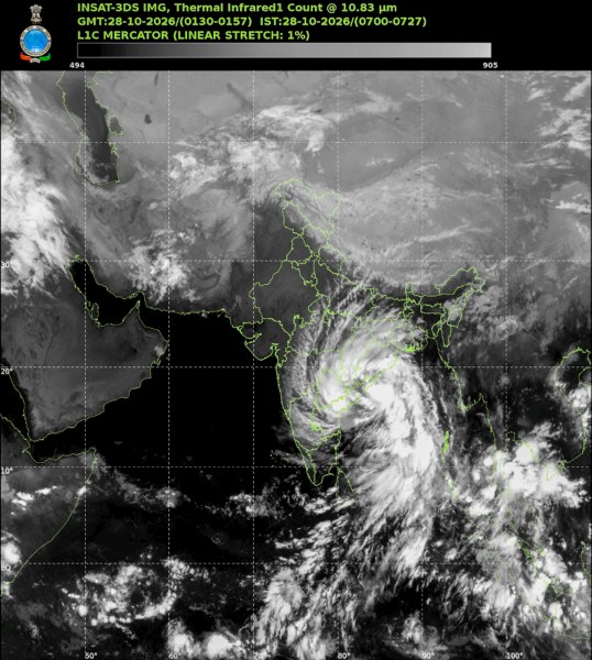 This satellite image taken on October 28 shows the location of Cyclone Arnab during its landfall in Andhra Pradesh. (PTI)
It maintained the same intensity for at least six hours even after landfall. Usually, storms lose steam upon landfall as they run into the landmass and other obstacles. But it has not been the case with Cyclone Arnab.
According to the IMD, Cyclone Arnab remained stationary over regions close to Narsapur (Andhra Pradesh) and Yanam (in Puducherry) since 4 am, thereby slowing down the process of landfall. Normally, cyclone landfall can take up to six hours or more to complete and is dependent on the speed and size of the cyclone.
Heavy rainfall has battered parts of coastal Andhra Pradesh and Odisha since Tuesday. Visakhapatnam recorded 217 mm of rain, Kalingapatam 147 mm, Tuni 123 mm, Kakinada 118 mm, Machilipatanam 115 mm and Gopalpur 94 mm.
Cyclones and El Nino
Story continues below this ad
Along India’s east coast, coastal districts in Odisha and West Bengal are the most prone to cyclones that develop in the Bay of Bengal. In comparison, few cyclones affect the Andhra Pradesh coast and even fewer hit the Tamil Nadu coast simply because of their geographical location.
This is linked to the region of cyclogenesis — starting with the formation of a low pressure system then intensifying multiple times from a depression to a deep depression finally into a cyclone and beyond — and the track the storm traverses.
The year 2026 is witnessing the rapid intensification of El Niño — the abnormal warming of the oceans along the equatorial and central Pacific Ocean. This natural phenomenon is known to alter rainfall, spike temperatures, and disturb wind patterns and ocean temperatures.
In case of an El Niño event, the warming along the equatorial Pacific Ocean further alters the global large-scale atmospheric circulations leading to heating anomalous regions even in the North Indian Ocean region.
Story continues below this ad
After the southwest monsoon ceases, the monsoon trough — a band of low pressure system whose north-southward swinging brings rainfall over India — shifts much to the south. During El Nino years, the already warmer-than-usual oceans also alter the wind / circulation patterns and pressure gradients closer to the equator.
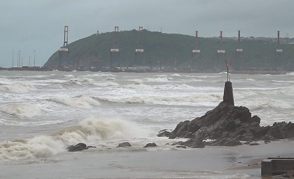 Choppy seas at Visakhapatnam during Cyclone Arnab’s landfall. (PTI)
Tropical cyclones in the North Indian Ocean develop much to the lower latitudes during El Niño years. Due to this, cyclones more often head towards Andhra Pradesh and Tamil Nadu over Odisha or West Bengal, Mrutyunjay Mohapatra had shared earlier.
2014, another El Niño year, saw cyclone Hudhud barrel towards the Andhra Pradesh coast.
Thus, cyclones formed hence not only intensify rapidly but also move faster, as has been the case with cyclone Arnab.
Tropical cyclone’s fuel
Story continues below this ad
The July-September temperature profile along equatorial Pacific Ocean’s Nino 3.4 (the region that is accounted for deciding El Nino’s intensity) ranged 2 – 2.8 degrees Celsius above normal, indicating warm oceans.
Ocean water temperature measuring 26 degrees Celsius or above, prevailing at depths between 50 – 100 metres, makes it conducive for cyclogenesis. Tropical cyclones are fuelled by ocean heat and warm oceans can contribute to the cyclone’s rapid intensification while at sea.
Cyclone Arnab strengthened to its highest intensity as a ‘very severe’ cyclone in just a matter of just a matter of a day.
Cyclone intensification is a highly complex process influenced by a combination of different favorable atmospheric conditions such as the boundary layers, wind shear, convection, upper ocean circulation and air-sea interaction.
Arnab’s track and impact
Story continues below this ad
Heavy rainfall (64 – 115mm in 24 hours) will continue to batter northern districts of Andhra Pradesh and south Odisha districts coasts till Thursday. Odisha and Andhra Pradesh remain on ‘red’ alert while Chhattisgarh is on ‘orange’ alert on Wednesday.
As cyclone Arnab will recurve northwards, it will bring very heavy rainfall (115 – 204mm in 24-hours) over parts of Telangana, Chhattisgarh, Jharkhand, Bihar, Gangetic West Bengal, eastern Madhya Pradesh and eastern Uttar Pradesh where the weakened remnants of cyclone Arnab is expected to cross during the next two days.
KioskNews shows a cleaned-up reading view extracted from the publisher’s page — the original always lives on their site, not ours.