Typhoon Samuel exits PAR; amihan to bring strong winds, rough seas
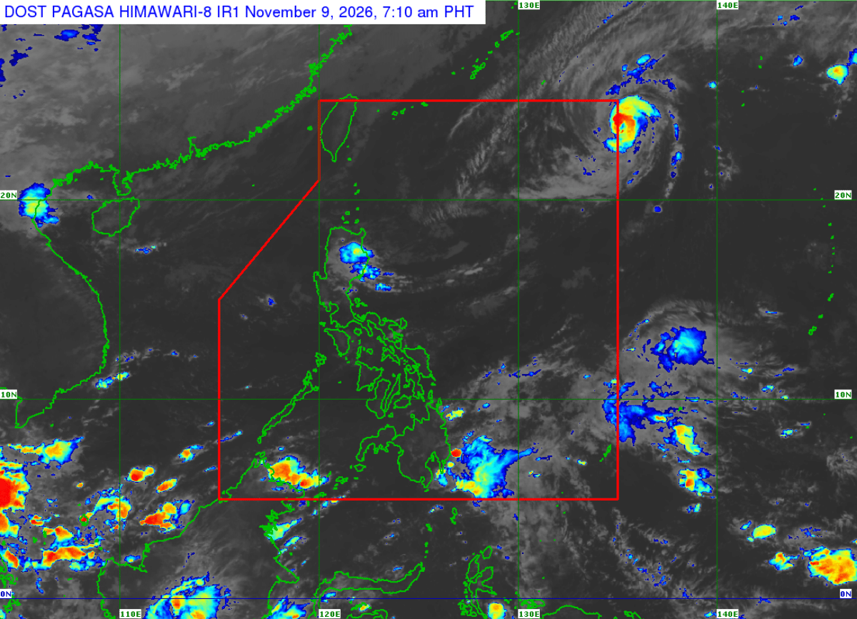

MANILA, Philippines — Typhoon Samuel has exited the Philippine Area of Responsibility (PAR), but the Northeast Monsoon or amihan is expected to bring strong to gale-force wind gusts.
The Philippine Atmospheric, Geophysical and Astronomical Services Administration (Pagasa) said Samuel was unlikely to directly affect the country’s weather throughout the forecast period. No tropical cyclone wind signal was raised over any part of the country.
READ: Typhoon Cempaka enters PAR, named Samuel locally
Article continues after this advertisement
As of 4 p.m., the center of Samuel was estimated at 1,415 kilometers east-northeast of Extreme Northern Luzon, already outside the PAR. It had maximum sustained winds of 130 kilometers per hour (kph), gusts of up to 160 kph and a central pressure of 975 hectopascals (hPa).
FEATURED STORIES
NEWSINFO
NEWSINFO
NEWSINFO
Maximum sustained winds refer to the strongest winds near the typhoon’s center, while gusts are brief increases in wind speed that can be stronger than the sustained winds.
Samuel was moving east-northeastward at 10 kph and was forecast to move faster as it traveled over the Pacific Ocean.
Pagasa said the typhoon could continue to intensify, reaching its peak strength on Monday night or early Tuesday before weakening due to unfavorable weather conditions.
Its maximum sustained winds are forecast to reach 140 kph by 2 a.m. Tuesday and remain at that strength until Tuesday afternoon. The typhoon is then expected to weaken to 130 kph by early Wednesday and 110 kph by Wednesday afternoon, when it may be downgraded to a severe tropical storm.
Article continues after this advertisement
Pagasa forecast Samuel’s center to move farther east-northeast, reaching 1,530 kilometers east-northeast of Extreme Northern Luzon by early Tuesday and 2,720 kilometers away by Wednesday afternoon.
Amihan to bring strong winds
Meanwhile, the Northeast Monsoon will bring strong to gale-force wind gusts on Monday over most of Luzon and Visayas, as well as Dinagat Islands, Surigao del Norte, Misamis Oriental, Camiguin, Lanao del Norte, Misamis Occidental, Zamboanga del Norte, Davao Oriental, Davao Occidental and Sarangani.
Article continues after this advertisement
The same conditions are expected from Tuesday until Wednesday over most of Luzon and Visayas, Dinagat Islands, Surigao del Norte, Misamis Oriental, Camiguin, Misamis Occidental, Zamboanga del Norte, Davao Oriental, Davao Occidental and Sarangani. Coastal and upland communities exposed to the wind are particularly vulnerable to these gusts.
‘Very rough seas’ in Northern Luzon
Pagasa also issued a gale warning over the northern and western seaboards of Northern Luzon.
In its 24-hour sea condition outlook, the agency warned that waves could reach 5.5 meters along the northern coast of Batanes, 5 meters along the Babuyan Islands, the remaining coasts of Batanes, northeastern mainland Cagayan and northern Ilocos Norte, and 4.5 meters along northern Ilocos Sur and the remaining coasts of Ilocos Norte and mainland Cagayan.
These areas are expected to experience very rough seas, making travel dangerous for all types and sizes of vessels. Pagasa advised all mariners to remain in port or seek shelter in a safe harbor if already at sea until the winds and waves subside.
Rough seas are also expected along other coastal areas, with waves reaching up to 4 meters along the coasts of Isabela and northern Aurora, the northern and eastern coasts of the Polillo Islands, and the northern coast of Camarines Norte.
Waves may reach 3.5 meters along northern Quezon, northwestern Pangasinan, the northern coasts of the Kalayaan Islands and Camarines Sur, and the remaining coasts of Ilocos Sur and Aurora.
Seas of up to 3 meters are forecast along La Union, the northern and eastern coasts of Catanduanes, the northeastern coasts of Northern and Eastern Samar, and the eastern coasts of Albay and Sorsogon.
Under these conditions, Pagasa advised operators of small seacraft, including motorized bancas, not to venture out to sea, particularly those who are inexperienced or operating ill-equipped vessels.
Your subscription could not be saved. Please try again.
Your subscription has been successful.
The weather bureau also reminded the public that heavy rainfall and strong winds may still affect areas outside a tropical cyclone’s landfall point and forecast confidence cone, or the projected area within which its center may move. Its forecast track may also still shift within this area. /ms
KioskNews shows a cleaned-up reading view extracted from the publisher’s page — the original always lives on their site, not ours.