Southwest monsoon affecting Luzon, Western Visayas; LPA inside PAR may strengthen
Already have Rappler+?
to listen to groundbreaking journalism.
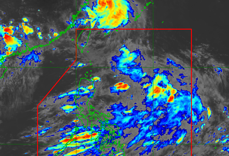
WEATHER. A low pressure area and the southwest monsoon affecting Luzon as of August 27, 2026, 5 pm.
PAGASA
PAGASA says the low pressure area has a 'medium' chance of developing into a tropical depression, but it is still the southwest monsoon or 'habagat' that is mainly affecting Luzon and Western Visayas
AT A GLANCE
- A new low pressure area (LPA) has entered the Philippine Area of Responsibility and has a medium chance of developing into a tropical depression, which would be named Pilandok.
- The LPA is currently located 850 kilometers east of extreme Northern Luzon and is not yet significantly influencing the weather, with the southwest monsoon being the main weather factor affecting the region.
This is AI-generated. Read the article for full context. Report any errors.
MANILA, Philippines – A new low pressure area (LPA), which entered the Philippine Area of Responsibility on Thursday morning, August 27, has a “medium” chance of developing into a tropical depression.
The Philippine Atmospheric, Geophysical, and Astronomical Services Administration (PAGASA) said this LPA — the ninth LPA in August alone — was last located at 850 kilometers east of extreme Northern Luzon.
Once it develops into a tropical depression, it will be called the local name Pilandok.
“Hindi pa ganoong kalaki ang impluwensya [ng LPA] dahil hindi pa pronounced ‘yung paghila niya sa habagat. Ang main na nakakaapekto pa rin po sa atin ay itong hanging habagat,” PAGASA Weather Specialist John Manalo said during their 5 pm forecast on Thursday.
(The LPA does not have much influence yet because its pull on the southwest monsoon is not yet as pronounced. What’s mainly affecting us is still the southwest monsoon.)
The southwest monsoon or habagat is bringing occasional rain to Benguet, La Union, Pangasinan, Zambales, Bataan, and Occidental Mindoro, and scattered rain and thunderstorms to Metro Manila, the rest of Luzon, Western Visayas, and Negros Island Region.
Below is PAGASA’s latest heavy rainfall outlook for the next three days due to the southwest monsoon:
Thursday afternoon, August 27, to Friday afternoon, August 28
- Moderate to heavy rain (50-100 millimeters): Benguet, La Union, Pangasinan, Zambales, Bataan, and Occidental Mindoro
Friday afternoon, August 28, to Saturday afternoon, August 29
- Heavy to intense rain (100-200 mm): Benguet, Zambales, and Occidental Mindoro
- Moderate to heavy rain (50-100 mm): Ilocos Norte, Ilocos Sur, Abra, La Union, Pangasinan, Bataan, Pampanga, Tarlac, Nueva Ecija, Bulacan, Metro Manila, Rizal, Cavite, Batangas, and Antique
Saturday afternoon, August 29, to Sunday afternoon, August 30
- Heavy to intense rain (100-200 mm): La Union, Benguet, Zambales, Bataan, and Occidental Mindoro
- Moderate to heavy rain (50-100 mm): Ilocos Norte, Ilocos Sur, Pangasinan, Abra, Tarlac, Nueva Ecija, Pampanga, Bulacan, Metro Manila, Rizal, Cavite, and Batangas
These areas should watch out for floods and landslides.
In Mindanao, meanwhile, PAGASA has issued heat index warnings, particularly in the regions of Zamboanga Peninsula and Caraga, where temperatures are hitting danger levels (42ºC-51ºC) in some areas. Manalo said the current El Niño “partly” has a role in these warmer conditions. – Rappler.com
KioskNews shows a cleaned-up reading view extracted from the publisher’s page — the original always lives on their site, not ours.