LPA outside PAR may develop into tropical depression within 24 hours
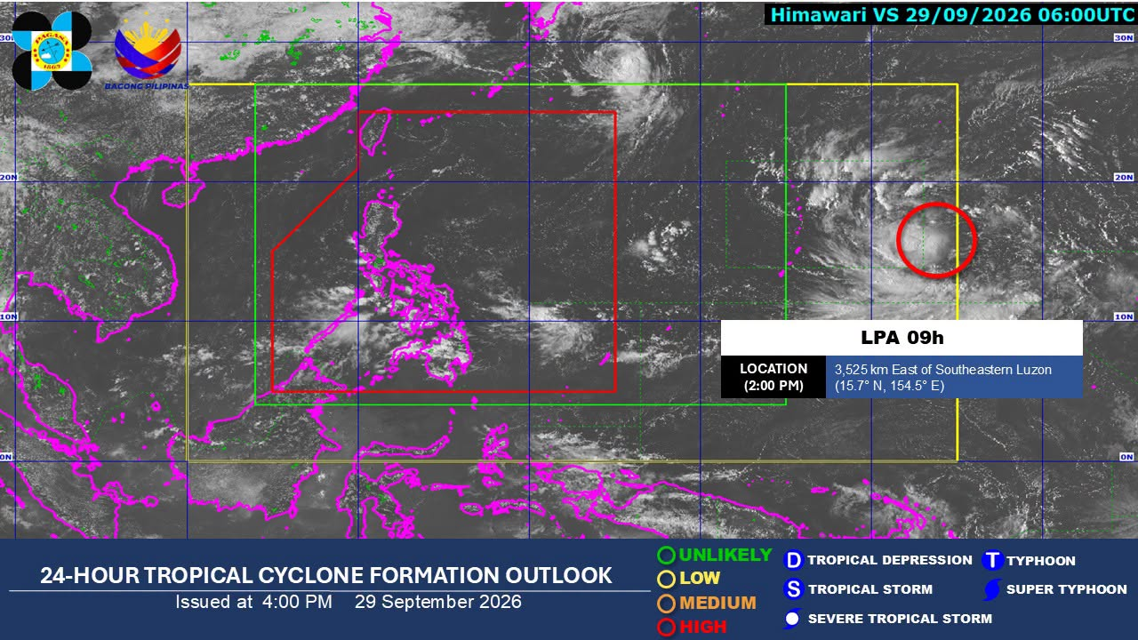

MANILA, Philippines — A low-pressure area (LPA) being monitored outside the Philippine area of responsibility has a “high” chance of developing into a tropical depression, the state weather bureau said Tuesday.
Philippine Atmospheric, Geophysical and Astronomical Services Administration (Pagasa) weather specialist Benison Estareja said “the LPA was last spotted more than 3,500 kilometers east of Southeastern Luzon, and based on analysis, there is a high probability that it will develop into a tropical depression, or a weak storm, within the next 24 hours.”
Its track is expected to move generally west-northwest over the next five days, he added.
Article continues after this advertisement
He also said the LPA may not enter the PAR as it heads north on Monday, Oct. 5.
FEATURED STORIES
NEWSINFO
NEWSINFO
NEWSINFO
READ: ITCZ to bring rains over Palawan, parts of Visayas, Mindanao Tuesday
Major parts of Luzon may continue to have generally fair weather, with chances of localized thunderstorms on Wednesday, he said.
Meanwhile, the intertropical convergence zone, or the convergence of winds from the northern and southern hemispheres, will continue to bring isolated rains over Palawan, the Visayas, and Mindanao. /mcm
KioskNews shows a cleaned-up reading view extracted from the publisher’s page — the original always lives on their site, not ours.