UK weather forecast: Temperatures set to plunge as autumn chill arrives this week
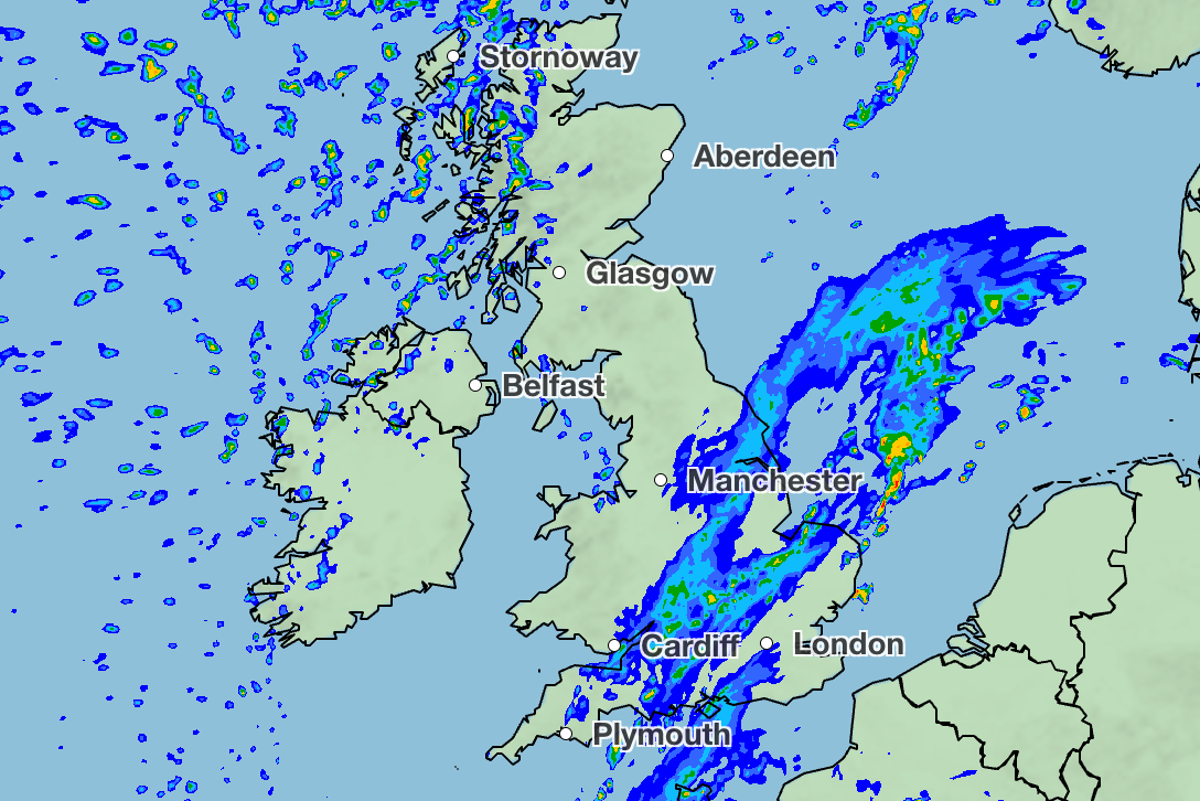
Temperatures across the UK are set to drop in the coming week with cooler air and outbreaks of rain, after one of the warmest Septembers on record.
Temperatures hit a maximum of 28C on 29 September, while the average temperature for the month was 14.6C, making it the joint-fourth warmest since records began in 1884, according to provisional figures by the Met Office.
The warmer start to Autumn also followed the hottest British summer on record. But that is now set to change as milder weather comes in this week.
Sunday will see cloudy weather across much of Scotland and Northern Ireland with outbreaks of rain turning “heavy and persistent” across western Scotland, according to the Met Office’s forecast.
Heavy rain in western Scotland is expected to be accompanied by gusts of wind of up to 40mph far in northwestern areas of the country.
The rest of the UK will be dry and warm with sunshine across southern England once lingering fog clears between mid-to late morning on Sunday.
Early mist and fog will affect south Wales, the Midlands and East Anglia where it is expected to persist for longer.
As the day progresses the rain and brisk winds seen across Scotland and Northern Ireland will sink southwards reaching the north of England and Wales.
Clouds will develop in northern regions of Wales and England, with a chance of rain in some areas.
There are expected to be clear spells elsewhere with more fog forming by dawn on Sunday.
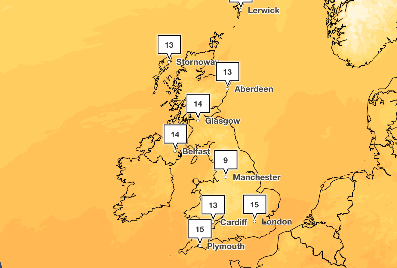
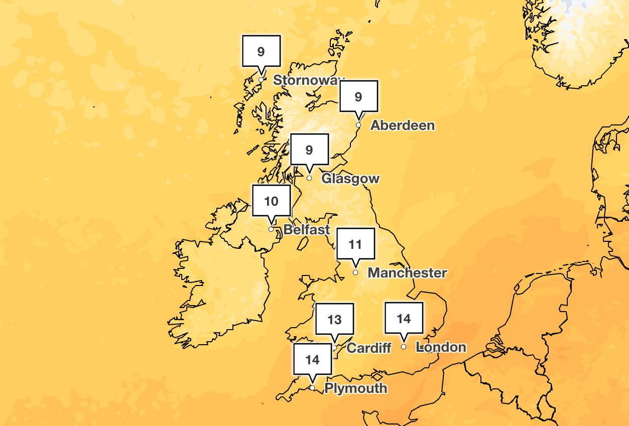
Temperatures are still expected to be higher than usual for the season, possibly reaching 23C in southern England. But if temperatures don’t reach 20C across the UK, it will be the first time since 11 June.
A weather front is then expected to move “erratically” southwards between Monday and Wednesday, according to the BBC, bringing outbreaks of rain and the possibility of thunder and lightning in southern England on Tuesday and Wednesday night. Chilly nights and some frost could be experienced in the most affected locations.
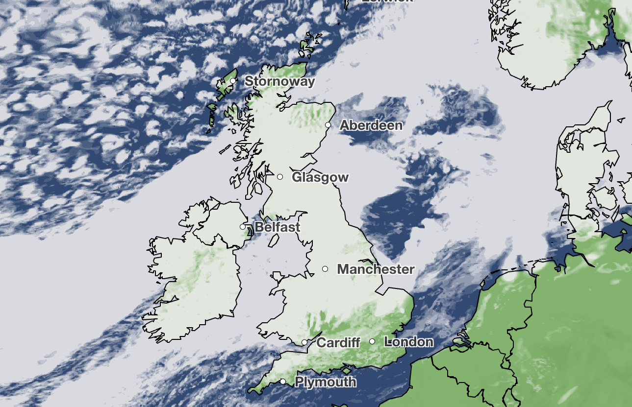
There will be more sunny spells and dry weather in the south and east once the ongoing foggy weather clears on Monday.
Elsewhere, it is expected to be cloudy with patchy rain, which is heaviest and most persistent on the northwestern upslopes.
The rain will move southeastwards between Tuesday and Wednesday with potentially heavy downpours in the southeast.
On Thursday, the weather is expected to be dry and bright for most areas, with it feeling initially warm and then turning colder for all areas.
Forecast for the next five days
Today
Cloudy weather and outbreaks of rain across much of Scotland and Northern Island, turning “heavy and persistent” across western Scotland, according to the Met Office.
Elsewhere, the weather will be dry with sunshine and warmth across the south once fog clears between mid to late morning.
Tonight
Brisk winds, outbreaks of rain and cloud affecting Scotland and Northern Ireland will sink southwards into northern England and Wales. Clear spells will be seen elsewhere with fog forming by dawn.
Monday
Areas of the south and east will see dry weather with sunny spells once fog clears, while elsewhere there will be cloudy weather and patchy rain. Rain will be heaviest and most persistent on northwestern upslopes.
Outlook for Tuesday to Thursday
The southeast of England will face potentially heavy rain through Tuesday and Wednesday as rain moves in that direction. Most areas will be dry and bright on Thursday with it feeling warmer initially before dropping to cooler temperatures.
KioskNews shows a cleaned-up reading view extracted from the publisher’s page — the original always lives on their site, not ours.