Building trust is key in warnings on melting glaciers
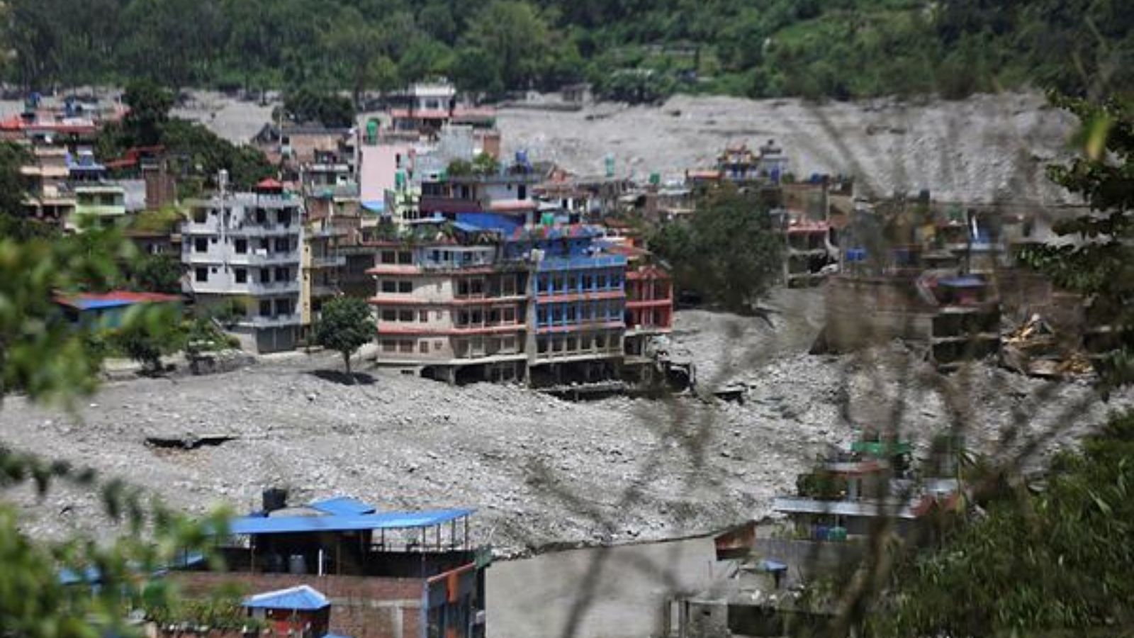
A view of damaged structure following the flash flood in Bhote Koshi and Trishuli rivers in Nepal on September 1, 2026. (Express Photo by Tashi Tobgyal)
Written by: Stuart Dunning
4 min readSep 23, 2026 06:18 AM IST First published on: Sep 23, 2026 at 06:18 AM IST
The disaster that unfolded in Nepal and Tibet started with a rock-ice avalanche that transformed into a devastating debris flow, the kind that was responsible for the Dharali disaster in 2025. A rock-ice avalanche from Ronti Peak in 2021 also became a debris flow, causing the Chamoli disaster. None of these disasters is “natural”. There are many rock avalanches each year and thousands of debris flows; it is only when they adversely impact our lives and surroundings that they become disasters.
The first reports from Nepal suggested an earthquake and, potentially, a glacial lake outburst flood (GLOF). GLOFs are indeed a source of risk to Himalayan communities. Several years ago, we calculated that 15 million people globally faced GLOF danger, over 9 million of them in High Mountain Asia, nearly 3 million in India alone. But in fact, the “earthquake” in Nepal was from the force of the rock-ice avalanche hitting the valley floor, and it became clear there was no glacial lake in the valley.
The Rasuwa disaster, therefore, was not a GLOF, and is more difficult to plan for, in the same way Chamoli was difficult to plan for. There was no large lake to model floods from, to drain if considered dangerous, or to add real-time monitoring to. Rock-ice avalanches could originate from many hundreds of thousands of steep, rapidly deglaciating slopes with thawing permafrost in the Himalaya. I’m sure, as the science progresses, we will find signs that the slopes were already moving before the disaster, but, as with many slopes, how do we decide which ones are the most dangerous and which ones need us to look at big decisions downstream on where we can and can’t live? These are the kind of questions scientists, politicians and communities have to ask, as well as the benefits and risks of hydropower development in these environments. In both Chamoli and Rasuwa, a significant number of people missing or dead were workers in hydropower infrastructure that was in the path of these devastating flows.
For GLOFs, we know where the water will come from: The glacial lake. For the Rasuwa/Chamoli “hazard cascades”, is it practical to have river gauges or monitoring in every single high mountain valley able to provide “enough” warning? I’m not sure it is. What is possible and existing now, and did exist in the Rasuwa event, provides enough warning for those further downstream, but not enough for those upstream. It is not just the detection of the event, it is also the communication of the news, how fast people respond, and what they do.
So, what is the future? Detecting moving slopes across the Himalaya is perhaps possible, working out which ones might catastrophically fail is perhaps not reliably so yet, and the consequences of getting it wrong are high. What is possible is a denser seismic station network. We know we can detect and locate the landslide-generated earthquake, and the extreme flood events themselves generate continuous seismic “noise” as they rumble down valleys, as with GLOFs. So, this is possible, but it has not been done. Why? It would need cross-border co-operation across the Himalaya and tens of millions of dollars. That is a societal and science challenge. We can do the science, but it must be embedded in communities who trust the warnings, and know what to do. We may save lives that way, but we do not save the places. And so, there are big questions to ask about sustainable development into the future and the pressures on new and old uses of land.
The writer is professor of applied geomorphology at Newcastle University, UK
KioskNews shows a cleaned-up reading view extracted from the publisher’s page — the original always lives on their site, not ours.