וואלההטמפרטורות עולות: הכבדה בעומסי החום | תחזיתESPN DeportesBajan revoluciones de la Final de Leagues Cup tras gol de Alexis VegaThe Jerusalem PostBen-Gvir tells police commissioner he will not approve officer appointments until after electionESPNWMU prez: B1G's replay process could improveSouth China Morning PostPhilanthropic giving in Asia forecast to hit US$1.5 trillion over next decadeCBS NewsArmed man arrested after charging at Democratic Ohio governor candidateRTL BoulevardDoden en gewonden bij crash van Amazon Prime-vliegtuig op luchthaven MiamiABC News (Australia)Children hired by underworld target of NSW gang violence crackdownLa NaciónCuarto, cocina y baño en 1,9 m²: así es la “casa propia” a la que pueden acceder los jóvenes en SueciaDaily MailThe Celebrity Traitors release date is LEAKED by Joe Marler and Richard Osman as they break strict embargo during live showVarietyRob Reiner Wins Posthumous Emmy for ‘The Bear’中国新闻网“秋老虎”肆虐 重庆轨道交通车站成市民纳凉好去处
The Daily Newsstand · Free, Always
Monday, September 7, 2026

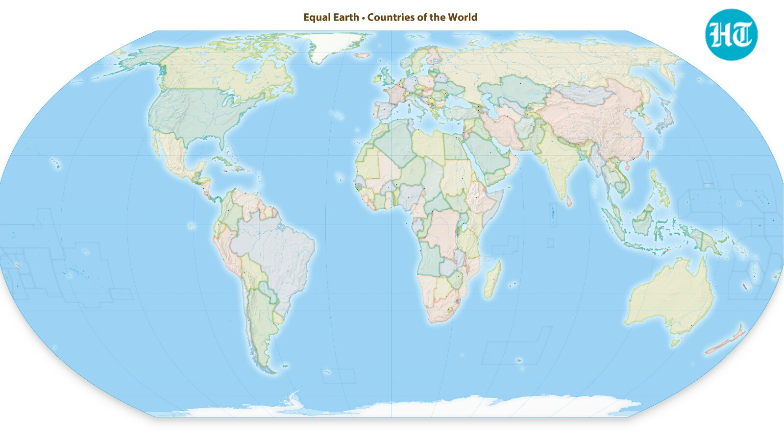
India backs ‘Equal Earth’ map at UN, but warns against inaccurate depiction of Jammu and Kashmir, Ladakh
Translate

The Ministry of External Affairs issued a clarification on Sunday regarding the union territories of Jammu and Kashmir and Ladakh after backing the African Union's resolution to “rebalance” the world map.

The new map -- known as the Equal Earth cartographic projection -- "is a relevant option for improving the accuracy of the cartographic representation of the world," the resolution said. (AFP)

In a statement, MEA spokesperson Randhir Jaiswal stated that India voted in favour of the map, while explaining that the vote stressed on “the underlying principle of promoting equal - area cartographic representation.”

“We also highlighted that the resolution does not constitute endorsement of any specific map, projection or depiction of national boundaries,” the MEA added further.

The United Nations General Assembly voted on Friday to back a resolution spearheaded by several African countries to adopt a map that makes their continent bigger while shrinking North America and Europe.

The resolution aimed at "a more accurate representation" of continental landmasses. The resolution was supported by 164 countries, while the United States voted against it, and six other states abstained.

View the original on Hindustan Times

KioskNews shows a cleaned-up reading view extracted from the publisher’s page — the original always lives on their site, not ours.