EXPLAINER: Why are there storms during El Niño
Make this your preferred source to get more updates from this publisher on Google.
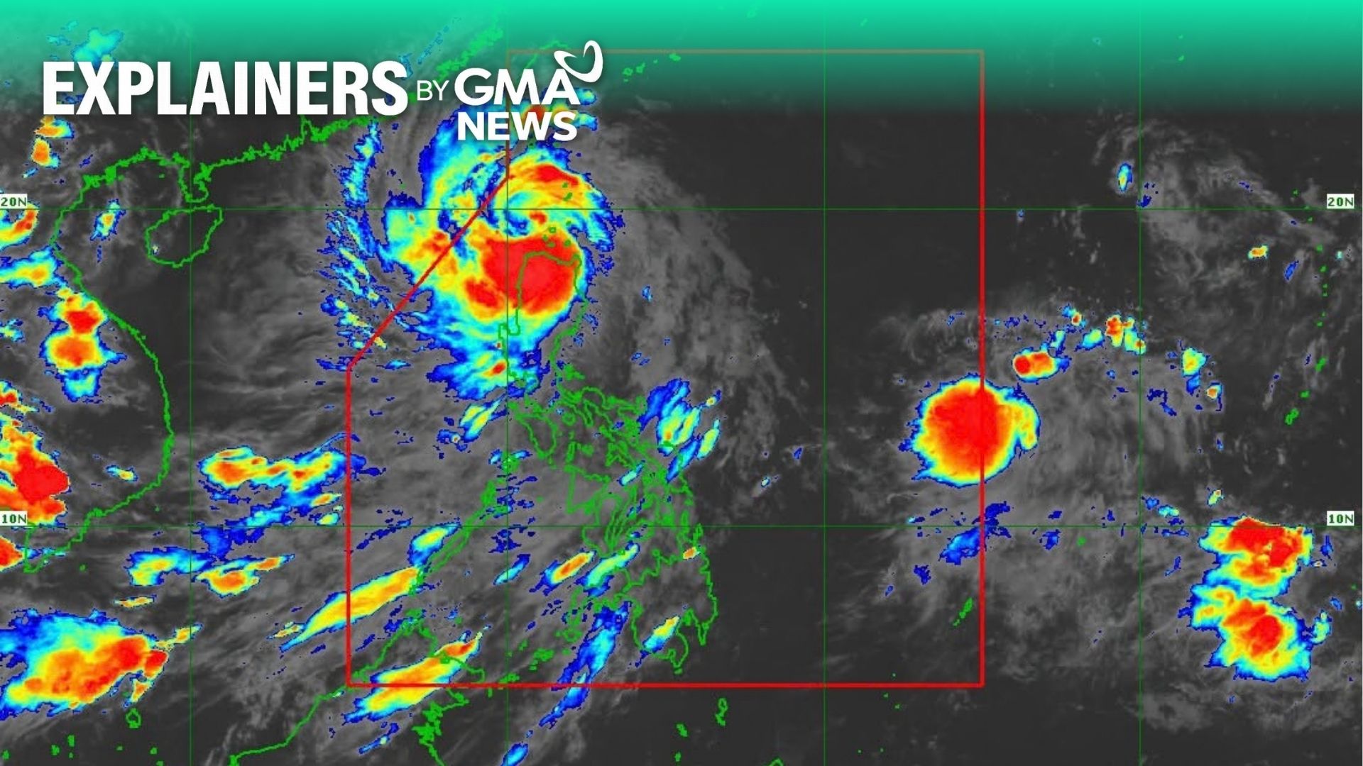
Several areas in northern Luzon are under Signal No. 1 after Super Typhoon Champi entered the Philippine Area of Responsibility (PAR) on Tuesday morning and was given a local name Rosal.
State weather bureau PAGASA said Central Luzon and Metro Manila may experience rains in the coming days, as it nears the country's landmass.
PAGASA Deputy Administrator for Research and Development Marcelino Villafuerte earlier said that the Philippines is already experiencing a strong El Niño, with the phenomenon likely intensifying even further before the year ends.
PAGASA said the average temperature across the Philippines is set to rise by 1 to 2 degrees Celsius during the El Niño phenomenon.
So, why are there storms entering or forming inside PAR despite the El Niño phenomenon?
In a Tuesday press briefing, PAGASA Climate Monitoring and Prediction Section Chief Ana Liza Solis said, based on historical records, there are more storms under typhoon and super typhoon category during the El Niño whether it is weak, moderate, strong, or very strong.
"Usually, mas marami pa yung land falling and crossing na bagyo of typhoon and super typhoon category kapag may El Niño during the months of October," Solis said.
(IUsually, there is more land falling and crossing of typhoon and super typhoon category storms when there is El Niño during the months of October.)
"It so happens na very unusual itong track ng bagyo dahil at this time of the year, supposedly land falling and crossing ng bagyo pero ngayon nakikita may recurving ng bagyo," she added.
(So it happens that this storm track is very unusual because at this time of the year, storms usually landfall and cross a landmass, but now, we see that it is recurving.)
Solis explained that one of the characteristics of a storm during El Niño is that its tracks could change.
Based on PAGASA's cyclone bulletin, Rosal will generally move west northwestward until Wednesday, October 21, before moving generally northwestward until Friday morning, October 23, PAGASA said.
But on Friday, Rosal will begin to turn north northwestward to northward until it exits PAR that evening or early morning of Saturday, October 24.
Solis said PAGASA will release regular heat index forecast in the coming days to inform the public of the temperature across the country.
Several government agencies have also launched initiatives, plans, and technology that they plan to use to mitigate the effects of the extreme heat and dry conditions.
Meanwhile, the public has been advised to start storing and conserving water due to possible supply shortages once the drought worsens. —VAL, GMA News
KioskNews shows a cleaned-up reading view extracted from the publisher’s page — the original always lives on their site, not ours.