Andhra Pradesh, Odisha on alert as IMD warns of possible cyclone over Bay of Bengal by October 26
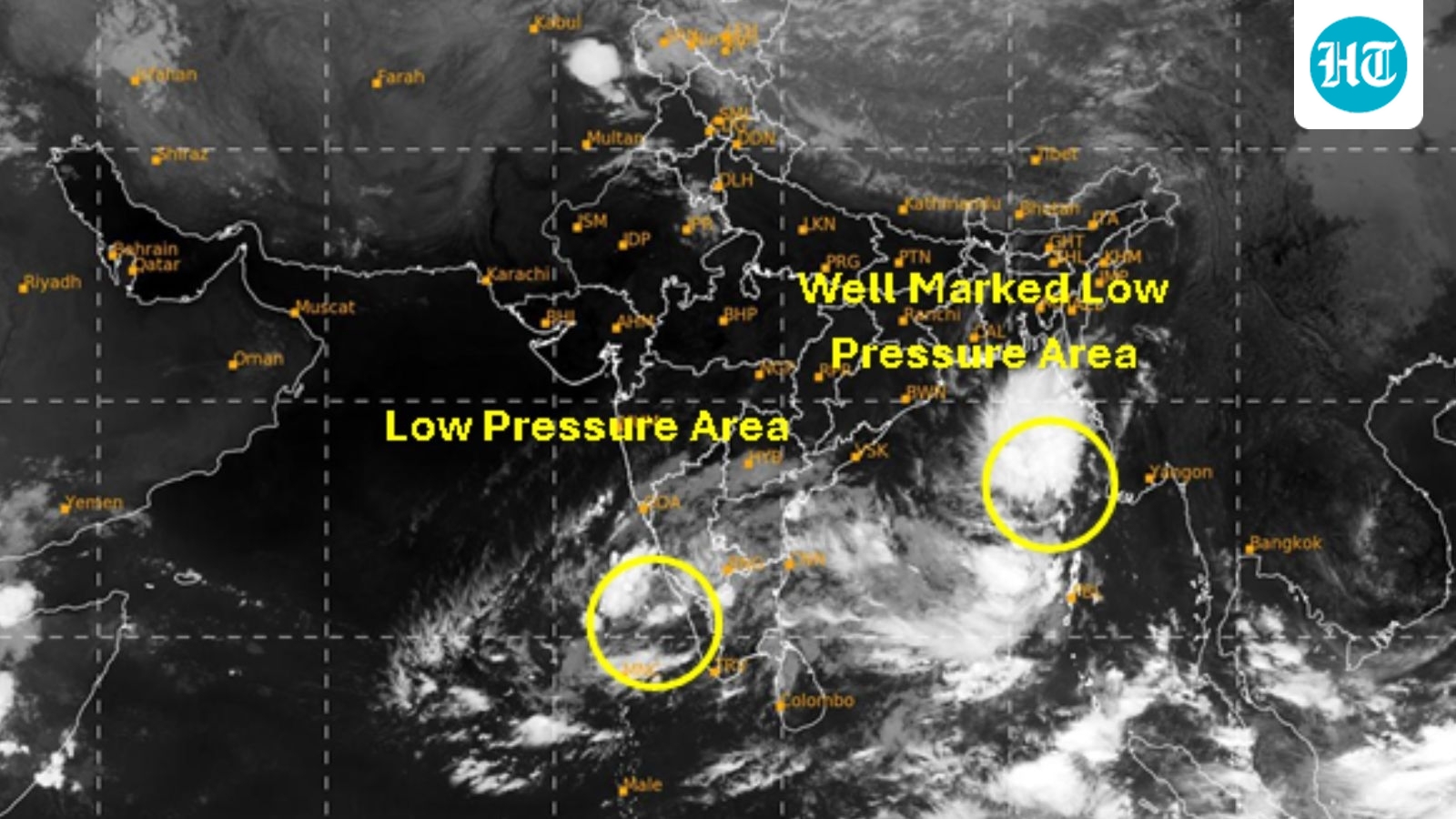
The India Meteorological Department (IMD) has warned about a well marked low-pressure area over the Bay of Bengal region that will likely develop into a cyclonic storm by October 26 morning.
As per IMD’s latest bulletin, this low-pressure area is expected to persist over the same region and intensify into a depression on Saturday. Thereafter, it is very likely to move and intensify further into a deep depression on October 25 and into a cyclonic storm over the Westcentral Bay of Bengal by October 26 morning.
It would continue to intensify further and reach over Westcentral Bay of Bengal near Andhra Pradesh coast around morning of October 28, the weather department added.
IMD has issued a pre-cyclone watch for Andhra Pradesh and adjoining South Odisha coasts in this regard.
ALSO READ: IMD forecasts heavy rain in Keralam till Oct 25
Extremely heavy to heavy rain to hit Andhra, Odisha between October 27-29
The IMD has forecast extremely heavy to heavy rainfall for coastal Andhra Pradesh and Odisha between October 27 and 29.
According to the roster that lists names of cyclonic storms, the next cyclone that forms in the North Indian Ocean will be named Arnab.
The name Arnab (which means "ocean" in Bengali) was contributed by Bangladesh to the regional tropical cyclone naming list maintained by the World Meteorological Organization (WMO) and the IMD.
A weather system last month also triggered cyclone watch but ended up not intensifying into a cyclonic storm. It, however, crossed Andhra Pradesh-Odisha coast as a deep depression and brought heavy rain. The system had intensified into a deep depression over westcentral and adjoining northwest Bay of Bengal on September 23.
Classification for depressions, cyclones
According to IMD website, the weather department classifies low-pressure systems based on their intensity, using pressure patterns over land and maximum sustained wind speed over the sea. A system is classified as a low-pressure area when it has one closed isobar, while a depression has two and a deep depression has three. A system with four or more closed isobars is classified as a cyclonic storm.
Based on wind speed, a system with maximum sustained three-minute surface winds of 17-27 knots (31-50 kmph) is called a depression, while 28-33 knots (52-61 kmph) is classified as a deep depression. Once maximum sustained winds reach 34 knots (63 kmph) or more, the system is classified as a cyclonic storm. Thus, a low-pressure area does not automatically mean a cyclone; it must intensify and cross the prescribed thresholds to be classified as one.
KioskNews shows a cleaned-up reading view extracted from the publisher’s page — the original always lives on their site, not ours.