Pilandok exits PAR early Thursday morning
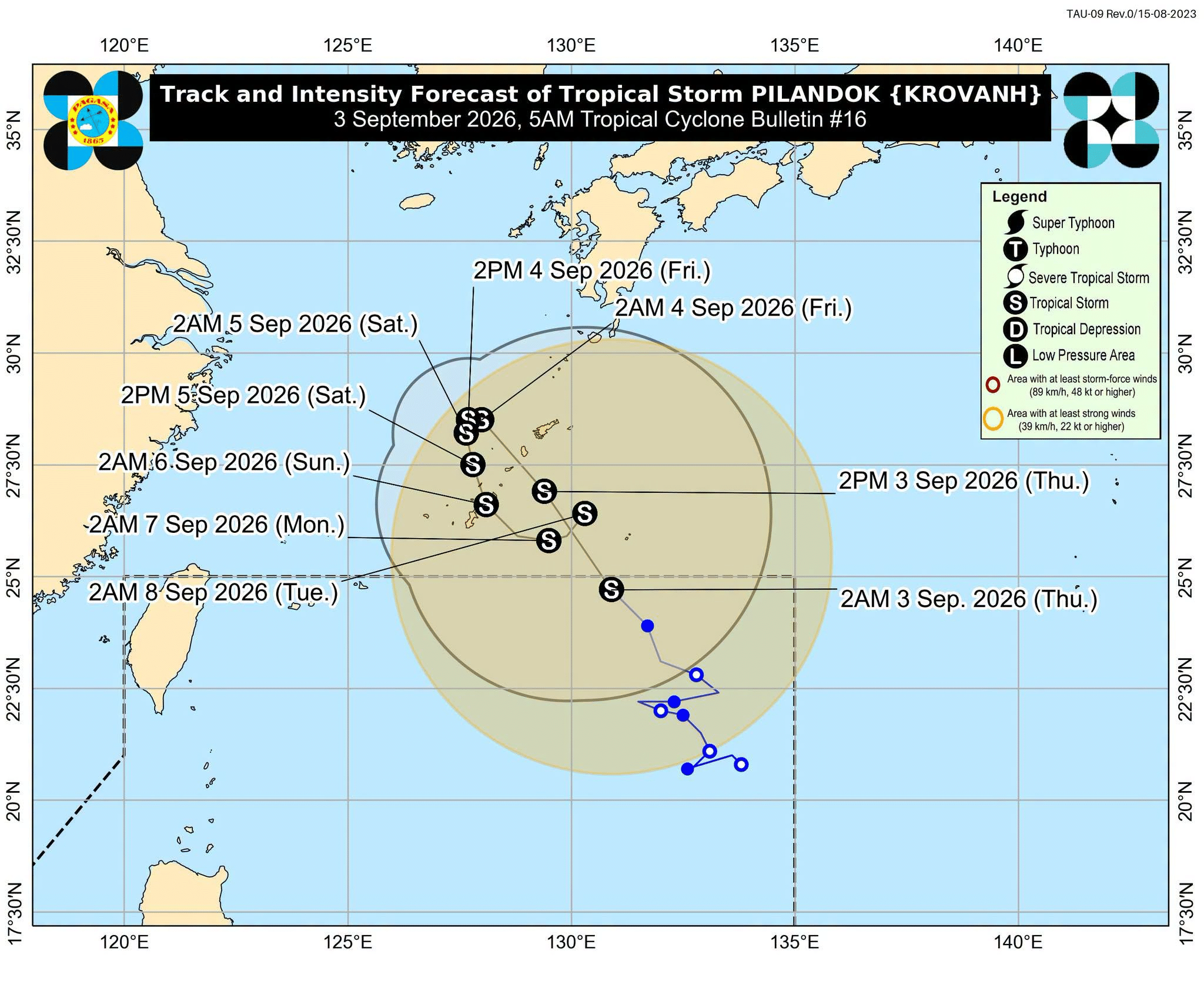

MANILA, Philippines — Tropical Storm Pilandok (international name: Krovanh) exited the Philippine area of responsibility (PAR) early Thursday morning and is not expected to directly affect the country, according to the state weather bureau.
In the 5 a.m. weather forecast of the Philippine Atmospheric, Geophysical, and Astronomical Services Administration (Pagasa), weather specialist Leanne Loreto said that Pilandok exited the PAR as of 4:30 a.m.
READ: Wet, windy Thursday parts of Luzon, Visayas on Thursday – Pagasa
Article continues after this advertisement
It was last estimated 1,030 kilometers east-northeast of Extreme Northern Luzon as of 4 a.m. It maintained its strength as it was still carrying a maximum wind speed of 75 kilometers per hour (kph) and gustiness of up to 90 kph.
FEATURED STORIES
NEWSINFO
NEWSINFO
NEWSINFO
“Less likely na papasok ito sa PAR ulit at hindi na rin makakaapekto sa panahon,” Loreto said.
(It is less likely to re-enter the PAR and this will not affect the weather conditions.)
Meanwhile, Loreto said that the southwest monsoon or habagat will continue to prevail in parts of Luzon on Thursday.
READ: Walang Pasok: Class suspensions on Thursday, Sept. 3
Article continues after this advertisement
She noted that habagat will bring significant rainfall (50 to 100 millimeters) over Ilocos Norte, Ilocos Sur, La Union, Pangasinan, Abra, Benguet, Zambales, Bataan, and Occidental Mindoro on Thursday.
She added that Metro Manila, Cagayan Valley, the rest of Cordillera Administrative Region, the rest of Central Luzon, Cavite, Batangas, Rizal, Laguna, and Oriental Mindoro will experience scattered rainshowers and thunderstorms due to habagat.
Article continues after this advertisement
On the other hand, Visayas and Mindanao will see hot and humid weather conditions with low chances of rainshowers.
Gale warning was also raised in Batanes and Western Babuyan Islands. /jpv
KioskNews shows a cleaned-up reading view extracted from the publisher’s page — the original always lives on their site, not ours.