Military to enlist civilians to map coast
DUAL-USE ASSETS: The surveys would help identify sites for defensive mines and obstacles, while sensitive military planning would remain classified, an official said
By Lo Tien-pin and Fion Khan / Staff reporter, with staff writer


The navy plans to use civilian ships and aircraft to map beaches China is likely to use in an invasion, in a first-of-its-kind initiative, a senior military official said yesterday.
The Ministry of National Defense’s Defense Innovation Division plans to employ civilian fishing boats and aircraft to conduct high-precision hydrographic surveys and beach terrain mapping at potential Chinese invasion landing sites, known as “red beaches,” across Taiwan, the official said on condition of anonymity.
“Red beaches” are locations where the Chinese People’s Liberation Army (PLA) is most likely to attempt amphibious assaults in the event of a conflict across the Taiwan Strait.
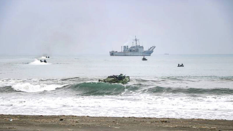
A Chung Ho-class tank landing vessel and an AAV7 vehicle participate in a drill in waters off Taoyuan on March 23, 2023.
Photo: CNA
Four to 20 potential landing sites have been identified by the ministry, US think tanks and the Institute for National Defense and Security Research, including Zhuwei (竹圍) in Taoyuan, Wazihwei (挖子尾) in New Taipei City’s Bali District (八里) and Sishu (喜樹) in Tainan.
In the past few years, the concept has expanded to include “composite red beaches,” which combine port facilities with environments suitable for airborne operations.
In the past, crucial hydrological data were gathered independently by the navy’s 192nd and 151st fleets during training exercises.
However, given the dynamic near-shore topography shaped by dramatic seasonal and typhoon-driven changes, the capabilities and flexibility of traditional naval survey vessels have proven inadequate.
The military is adopting mature commercial off-the-shelf technologies with civilian and military applications.
Under the plan, the military would contract private survey companies to deploy vessels such as civilian fishing boats as asymmetric maritime sensors.
Equipped with advanced multibeam echo sounders, the boats would survey coastal waters up to 3m deep, where larger vessels cannot operate and smaller boats would otherwise take too long to map, generating high-density bathymetric data.
The military would also charter civilian aircraft to conduct large-scale aerial surveys of beach environments using light detection and ranging (LiDAR) technology.
By directing laser pulses through the water’s surface, the aircraft can rapidly produce integrated 3D models of terrain above and below the waterline.
The data could help plan for PLA amphibious landings and provide a basis for defensive mine-laying operations, the official said.
They could identify deep channels in which to lay mines and reefs where obstacles could be placed, concealing mines to make them difficult to detect and blocking landing routes used by Chinese vessels and amphibious vehicles including hovercraft, they added.
Addressing concerns over national security risks associated with outsourcing sensitive military data to the private sector, including potential information leaks to China, the official said that security measures have been built into the mechanism.
Civilian fishing boats and aircraft would only collect raw physical data at the initial stage, the official said, comparing the information to meaningless fragments of a code.
Processing, including noise reduction, data integration and the most sensitive tasks — linking the information to military tactics and planning coordinates for counter-landing operations — would happen behind closed doors at military units, including the Naval Meteorological and Oceanographic Office, they said.
This decentralized approach would harness the efficiency of civilian technology while protecting national security, they added.
Faced with a possible cross-strait conflict, the navy has discarded a decades-old policy of relying solely on warships for military hydrological surveys by embracing private-sector partnerships and asymmetric warfare thinking to defend Taiwan’s coasts, they said.
The military would be able to gather critical intelligence on coastal operating environments dozens of times faster than before, the official said, calling it a major milestone.
The initiative demonstrates Taiwan’s determination to follow the US military’s Defense Innovation Unit’s example in developing asymmetric capabilities, they added.
KioskNews shows a cleaned-up reading view extracted from the publisher’s page — the original always lives on their site, not ours.