UK weather: Temperatures to soar to 26C this week as Britain basks in late summer sun
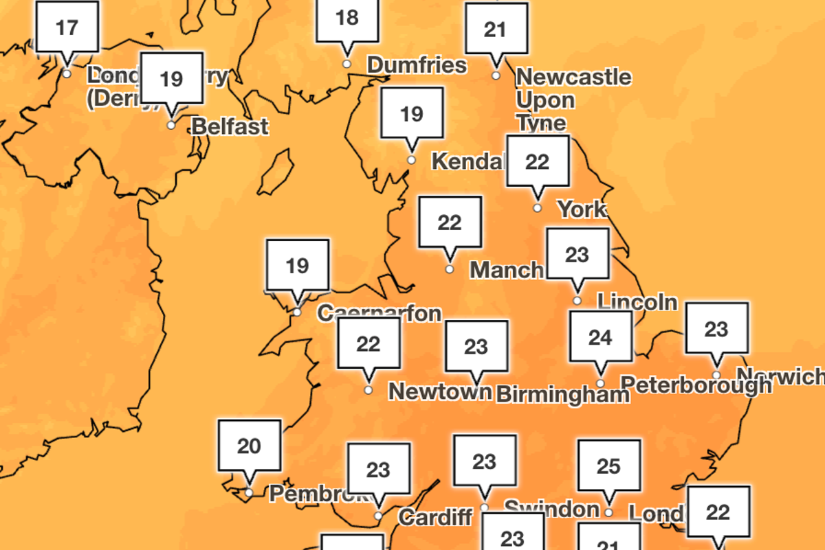
Parts of the UK will be hotter than Athens next week as temperatures soar to 26C as late-summer warmth returns.
Greece’s capital city will struggle to see temperatures above 24C at the start of next week, while large swathes of England are forecast to bask in the mid-20s.
The south will get the best of the sun, but most areas will see warmer-than-usual temperatures for late September.
Met Office forecasts show Tuesday will be the hottest day of the week, with the mercury soaring to 26C across the south-east of England.
Monday and Wednesday will also see temperatures above 20C across most of England, with the mercury only taking a slight dip towards the end of the week.
A build up of high pressure across the UK is responsible for the temperatures creeping up compared to the milder weekend.
The Met Office said: “The change begins with developments over the Atlantic. A deep area of low pressure is expected to form well to the west of the UK. Although this system is not forecast to move directly across the country, it is likely to drag warmer air up from the continent and subtropical Atlantic.
“High pressure will then build across the UK alongside this warmer air during the latter part of the weekend and into next week. This would mean a transition to predominantly dry and bright conditions, with sunny spells becoming more widespread.”
However, the Met Office also said the warmer weather could also be cut short by the expected arrival of a colder front from the west, the timing of which remains uncertain.
After this, conditions are likely to become “changeable”, according to the Met Office’s longer-term forecast, “with spells of rain and showers interspersed with some short-lived spells of more settled weather and temperatures returning to near normal overall”.
It comes after an unbearably hot summer this year, marking the UK’s hottest on record.
The consecutive heatwaves had a devastating impact on the country, resulting in droughts and wildfires, and despite recent rainfall and fresher conditions, the nation is still paying the price.
Met Office five day forecast
Today:
Rain clears to the south by morning, leaving a drier and brighter day with lighter winds. A few showers continue in Scotland. Feeling pleasant in the sunshine.
Outlook for Monday to Wednesday:
Sunny spells on Monday and Tuesday, and turning warmer. A brief spell of rain moves into the north on Wednesday, but staying dry for many.
KioskNews shows a cleaned-up reading view extracted from the publisher’s page — the original always lives on their site, not ours.