Bureau warns of severe thunderstorms, hail, destructive winds
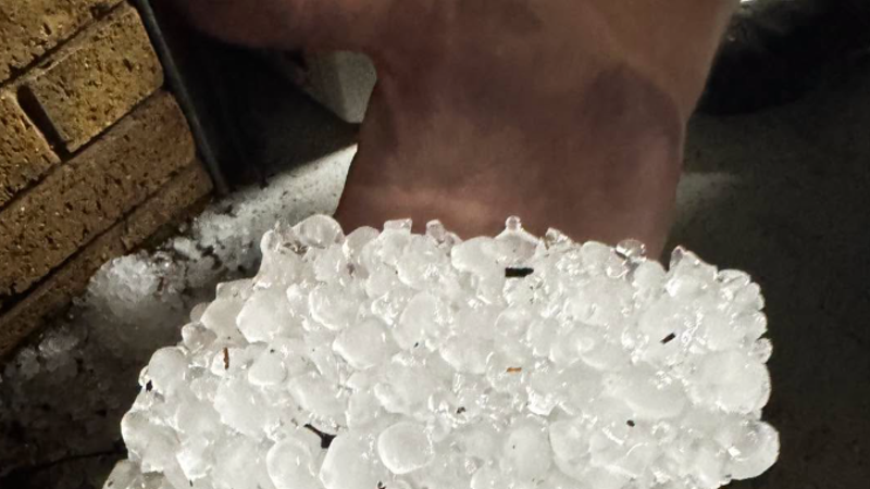
South-east Queensland is on alert for another round of severe thunderstorms, with the weather bureau warning of giant hail and destructive winds.
Broad parts of eastern Australia could be impacted by the system, the Bureau of Meteorology said, but regions most likely to cop intense conditions were the south-east coast, Darling Downs, Granite Belt, Wide Bay-Burnett and southern parts of the Central Highlands.
“These storms may produce damaging to destructive winds, large to giant hail and heavy rainfall that could lead to flash flooding,” meteorologist Christie Johnson said.
“Basically, any storms that develop from now do have the potential to become severe.
“Peak times for severe storms will be as we get more heat coming in through the day, so particularly into the late morning and through the afternoon.”
The warning arrived less than 24 hours after storms battered parts of Queensland including the Wide Bay-Burnett region, Maryborough and Gympie on Monday.
Hail stones up to 10 centimetres were reported at Glenwood near the Fraser Coast, up to four centimetres in Yarraman near Toowoomba, and through parts of the Northern Rivers in NSW.
“We also saw more than 50 millimetres of rainfall recorded at Cooroy on the Sunshine Coast in just 30 minutes yesterday afternoon,” Johnson said.
While some severe thunderstorm warnings had been cancelled by the bureau on Tuesday morning, Johnson said troughs were already moving over parts of Queensland, with two systems set to converge by the afternoon.
“That combination is why we’re looking at having a very significant storm, particularly over south-eastern Queensland today,” she said.
Destructive winds of 120km/h were possible, with the strength to bring down trees and powerlines.
Johnson said tornado-like conditions weren’t out of the question, but said it would be in the context of “really busy weather”.
“Any supercell thunderstorm does, by definition … have the risk that it could produce tornadoes,” she said.
“[But they are] quite rare. It’s much more likely that we’ll just get damage from the destructive winds out of the supercell itself.”
The bureau encouraged anyone in affected areas across to check weather updates, as storm warnings could change throughout the day.
Start the day with a summary of the day’s most important and interesting stories, analysis and insights. Sign up for our Morning Edition newsletter.
KioskNews shows a cleaned-up reading view extracted from the publisher’s page — the original always lives on their site, not ours.