Flood warning as first severe storm of the season looms, second front develops
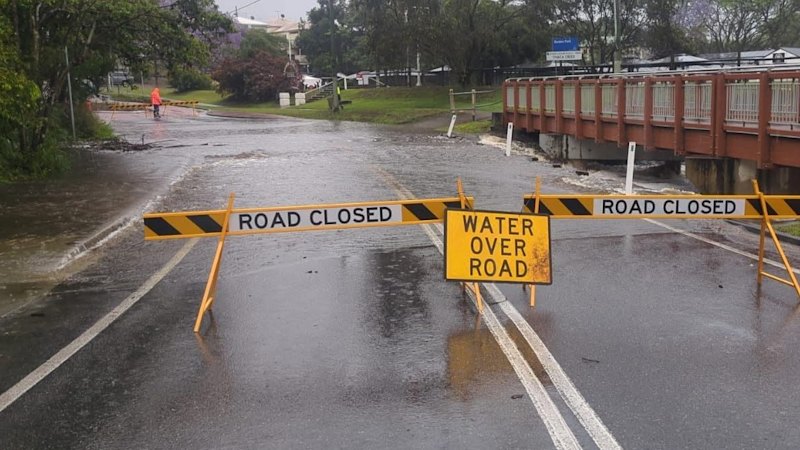
A severe thunderstorm is forecast for Brisbane, with the weather bureau warning residents in north-western suburbs as the system stalled just north of the city on Thursday morning.
The Bureau of Meteorology issued a warning for flash flooding between the Sunshine Coast and the state border – including Brisbane, Caboolture, and Ipswich across Thursday.
Senior meteorologist Angus Hines said the region has experienced a few smaller storms, but said the storm season generally had been less intense than in previous years.
“This [storm] will be the first big one and certainly the one that’s bringing the most intense rainfall,” he said.
The south-moving storm dumped up to 170 millimetres of rain on Caboolture and Morayfield over three hours from 4.30am.
Between 4.45am and 7.45am, Burpengary recorded 141 millimetres. Further north, parts of Elimbah recorded up to 163 millimetres over three hours by about 8am.
While the weather bureau initially predicted the storm would move over Brisbane between 7am and 8am, the system slowed across the morning.
“This thunderstorm is slow-moving,” the bureau said in updated warnings across the morning.
By 9am, the storm remained over Caboolture, with the weather bureau reducing the area expecting widespread falls to a stretch from the Sunshine Coast to Ipswich.
While the storm was still predicted to hit Brisbane, suburbs to the city’s north and western regions were most prominently in the firing line.
Police reported almost 40 SES call-outs over 24 hours from 6.30am on Wednesday for sandbagging and setting up tarps across Moreton Bay Brisbane, the Gold Coast, and Logan.
Swift-water rescue crews also responded to multiple stranded vehicles, including one at an intersection in central Caboolture.
Residents were advised to move vehicles away from trees or park them undercover, secure pets and close windows.
The weather bureau also strongly discouraged driving as the storm passed overhead.
Hines said the storms were inside a larger rain system that had been sitting over much of the state since Monday.
“Even without the stormy weather, we’ve got this broad rain band, so pretty much everyone across the south-east will get a decent drop of rain today,” he said.
“Then wherever those thunderstorms pop up, embedded in this overall rain band, those rainfall numbers will climb much more sharply [and] much more rapidly.”
Hines said areas outside the storm’s path could still receive up to 30 millimetres of rain on Thursday.
Energex recorded four outages across the south-east at 9.15am, affecting more than 1700 homes in Eumundi, Eagleby, Loganholme, and Wacol.
While the system was not expected to bring intense winds, Hines said gusting could cause isolated instances of swirling wind that could “kick through in any direction”.
The senior meteorologist predicted wet conditions would last until Monday afternoon.
“Temperatures will climb a little bit [over the weekend] because the thick cloud cover and the rain band will break apart a bit,” he said.
“Even though we’ve still got showers in the forecast, we’re much more likely to get some good spells of sunshine.”
But Hines said temperatures would remain between 3 and 6 degrees below the October average – 28 degrees – until the larger rain band lifted.
Start the day with a summary of the day’s most important and interesting stories, analysis and insights. Sign up for our Morning Edition newsletter.
KioskNews shows a cleaned-up reading view extracted from the publisher’s page — the original always lives on their site, not ours.