As seas rise, Singapore is reshaping its coastline to protect its future
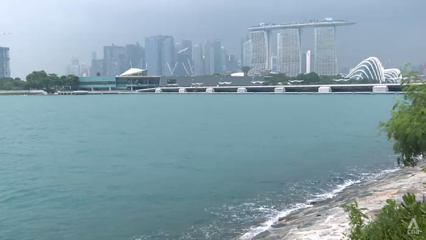
From an offshore reservoir along the East Coast to land reclaimed below sea level, Singapore is reshaping its coastline. In the second of a three-part series on coastal cities adapting to climate change, CNA examines how ambitious engineering projects are helping the island-state protect its shores.
New: You can now listen to articles.

This audio is generated by an AI tool.

22 Nov 2026 03:10PM
SINGAPORE: For decades, Singapore has built upwards and pushed its coastline outwards, reclaiming land from the sea to make room for a growing population and expanding economy.
Now, that same strategy is taking on a new purpose: protecting the island-state from rising sea levels.
By 2100, mean sea levels around Singapore could rise by as much as 1.15m. Combined with high tides and storm surges, water levels could reach up to 5m above today's average sea level.
With about a third of Singapore's land lying less than 5m above mean sea level, the consequences could be far-reaching.
The risks extend well beyond beaches and coastal parks. Residential areas, shipping ports, the financial district and other critical infrastructure could also be vulnerable to flooding.
For a country that has spent generations overcoming its geographical constraints, rising seas present another formidable challenge – one that demands action today to guard against a future threat decades away.
ENGINEERING AROUND WATER
Singapore has long relied on large-scale engineering to manage its water resources.
One of its most prominent examples is Marina Barrage, which opened in 2008 and transformed the mouth of the Marina Channel into a freshwater reservoir in the heart of the city.
The barrage serves multiple purposes: fresh water supply, flood control and recreational space.
During heavy rainfall, its gates can be opened at low tide to release excess water into the sea. At high tide, the gates remain closed and powerful pumps are used to discharge rainwater instead.
"Marina Barrage is an example of (a) holistic approach," said Khoo Teng Chye, a professor from the National University of Singapore’s College of Design and Engineering.
Cleaning up the surrounding water catchments made it possible to build a tidal barrier and create a freshwater reservoir, turning what was once a water management challenge into an asset for the city, he added.
Off Singapore's northeastern coast, a different approach has taken shape on Pulau Tekong.
There, about 800ha of land have been reclaimed using the polder method, in which low-lying land is enclosed by a protective dike.
Stretching 10km and reaching 6m above mean sea level at its highest point, the dike keeps seawater out. It can also be raised further in the future as sea levels rise, allowing the coastal defence to be strengthened over time.
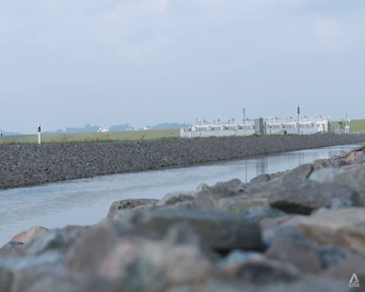
Within the polder, a network of drains and pumps keeps the reclaimed land – which lies about 1.2m below sea level – dry.
Since the polder method creates usable land at a lower elevation, the project used nearly 50 per cent less sand than traditional reclamation would have required.
NEW LINE OF DEFENCE ALONG EAST COAST
Singapore is now preparing for an even more ambitious transformation along its eastern shoreline.
The Long Island project would create new land offshore from East Coast Park to form a new island, alongside a freshwater reservoir and potentially 20km of new waterfront parks.
But why build an entirely new coastline instead of simply erecting a seawall?
According to PUB, Singapore's national water agency, a seawall along the East Coast waterfront would present significant trade-offs.
“We looked at the option of keeping seawater out by building a seawall 3m high. But doing so will limit park users' access between the park space and the waterfront for sports and water recreation,” said Thoo Jung Chee, senior deputy director of PUB's flood resilience planning department.
“Not only that, the seawall (would also have) to be supplemented by tide gates and pump stations. These will occupy space that is now greenery and recreation facilities."
The Long Island is intended to address these challenges through a more integrated approach.
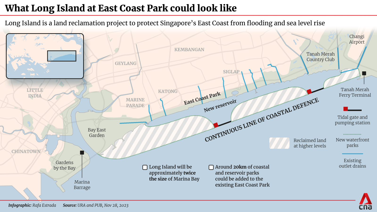
Under the project, the 12 existing drains along the East Coast would feed into a new reservoir created between the current shoreline and the reclaimed land.
Two barrages and pumping stations would regulate water flows, allowing excess rainwater to be discharged into the sea even during periods of heavy rainfall.
The reservoir could also become an additional source of freshwater for Singapore.
In effect, Long Island would combine coastal protection, flood management, water supply and recreation within a single mega-development.
But turning the vision into reality will be a major engineering undertaking, said Tan Yeow Chong, director of land reclamation at Singapore’s Housing and Development Board (HDB).
“Converting sea space into usable land is a complex process. Before we can create the land, we first must understand and prepare the ground beneath it ... to make sure the reclaimed land can support buildings and infrastructure,” he said.
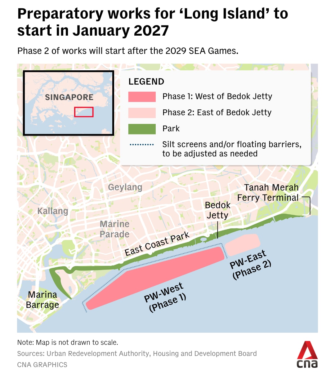
Preparatory works are slated to begin in January 2027, marking the first steps in a project expected to take several decades to complete.
PLANNING FOR THE FUTURE
Even as Singapore invests in new coastal defences, a fundamental challenge remains: what if sea levels rise faster than scientists predict?
“Climate change and sea-level rise is uncertain. However, our design criteria is already based on the best scientific knowledge to date,” said Adrian Law, executive director of the National University of Singapore’s Coastal Protection and Flood Resilience Institute.
“Our Coastal Protection Code of Practice, newly issued by PUB in June this year, includes an adaptive approach that can be adjusted when the sea level rise progresses.”
Such an approach is intended to help Singapore respond to changing conditions without having to build all its coastal defences at once.
It also means future generations will have the option of strengthening or modifying infrastructure as new information becomes available. Experts say achieving that balance will require continued research, monitoring and substantial investment.
Singapore has estimated that coastal protection could cost around S$100 billion (US$80 billion) over the next century.
It is an enormous financial commitment to address a threat which full impact has yet to materialise. Yet, for a densely populated island-state whose homes, economy and critical infrastructure are closely tied to its coastline, the cost of inaction could be far greater.
KioskNews shows a cleaned-up reading view extracted from the publisher’s page — the original always lives on their site, not ours.