Way Kambas develops AI center to track elephants, monitor forest fires
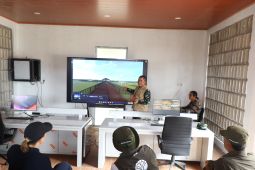
Bandarlampung, Lampung (ANTARA) - A joint committee overseeing Sumatran elephant conservation at Way Kambas National Park is developing an artificial intelligence-based command center to map elephant migration routes and strengthen wildlife monitoring.
“This advanced digital facility will strengthen wildlife surveillance, map elephant corridors, and detect forest and land fires as well as forestry crimes in real time,” Brig. Gen. Sriyanto, the committee’s chairman, said.
The system is expected to identify individual elephants precisely by integrating visual data with GPS-based location information, he said in a press statement issued here on Wednesday.
“The command center is designed for multiple functions, from identifying wildlife biological data and preventing poaching and theft to analyzing animal data to map elephant ranges as seasons change,” he added.
To support the machine-learning database, the committee has deployed a Terra Drone team operating an M1 unmanned aerial vehicle.
Related news: Tame Sumatran elephant dies at Riau training center
The team is collecting visual samples intensively each morning and afternoon from elephant populations at the Elephant Response Unit and Elephant Training Center. Each elephant is photographed 30 times and recorded in 360-degree video.
“The collection of elephant visual data for AI training is targeted for completion within the next one to three days,” he said.
Beyond wildlife monitoring, Sriyanto said the command center would play a key role in preventing forest and land fires. Four fire-prone areas are monitored centrally through a dashboard.
The system also includes an early-warning simulation tool capable of detecting indications of forestry crimes and assessing the severity of forest and land fires.
“For direct mitigation along the park boundary, the committee has also demonstrated integrated speakers and long-range warning microphones to deter encroachment and prevent wildlife herds from approaching settlements in buffer villages,” Sriyanto said.
Related news: BNPB conducts weather modification to protect Way Kambas elephants
Translator: Agus WS, Rahmad Nasution
Editor: Bayu Prasetyo
Copyright © ANTARA 2026
KioskNews shows a cleaned-up reading view extracted from the publisher’s page — the original always lives on their site, not ours.