Pagasa monitors LPA inside PAR on Thursday morning
MANILA, Philippines – A low pressure area (LPA) was being monitored inside the country on Thursday morning, according to the state weather bureau.
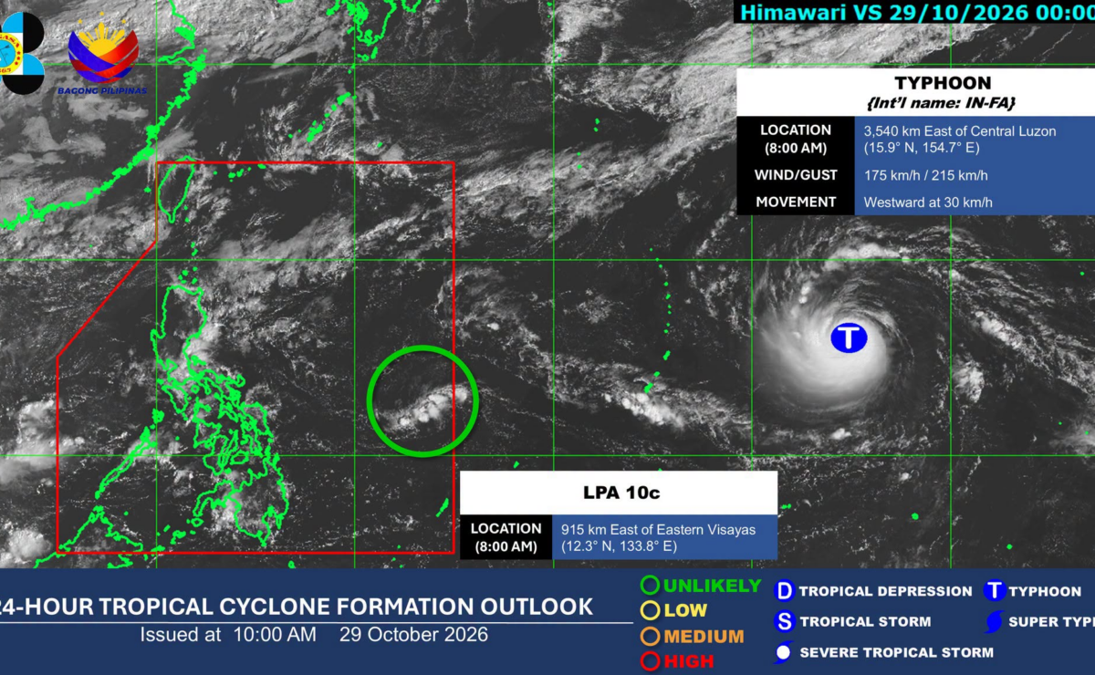
in its tropical cyclone formation outlook issued at 10 a.m., the Philippine Atmospheric, Geophysical, and Astronomical Services Administration (Pagasa) said that the LPA was last estimated 915 kilometers (km) east of Eastern Visayas as of 8 a.m.
READ: Amihan, shear line to bring rain to parts of Luzon Thursday
Article continues after this advertisement
Meanwhile, Typhoon In-fa was being monitored outside of the country. It was last seen 3,540 km east of Central Luzon as of 8 a.m. It was carrying a maximum wind speed of 175 kilometers per hour (kph) and gustiness of up to 215 kph.
FEATURED STORIES
NEWSINFO
NEWSINFO
NEWSINFO
READ: Cooler days seen as Pagasa declares onset of ‘amihan’ season
In its separate 5 a.m. weather forecast, Pagasa said that the shear line will bring cloudy skies and rains over Metro Manila, Calabarzon (Cavite, Laguna, Batangas, RIzal, and Quezon), Aurora, Bicol Region, Camarines Norte, Camarines Sur, Marinduque, and Oriental Mindoro on Thursday.
On the other hand, the northeast monsoon or amihan will affect Cagayan Valley, Cordillera, and Nueva Ecija. /jpv
KioskNews shows a cleaned-up reading view extracted from the publisher’s page — the original always lives on their site, not ours.