Habagat to persist over parts of Luzon, Visayas Tuesday

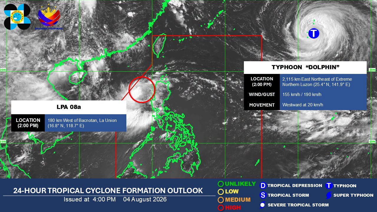
Satellite image captured at 6:40 a.m. on August 18, 2026. (Photo by Pagasa)
MANILA, Philippines — The southwest monsoon will continue to prevail over parts of Luzon and Visayas, bringing monsoon and occasional rains on Tuesday, according to the state weather bureau.
In the 5 a.m. weather forecast of the Philippine Atmospheric, Geophysical, and Astronomical Services Administration (Pagasa), weather specialist Veronica Torres said that the southwest monsoon is mainly affecting the western portions of Luzon and Visayas.
Article continues after this advertisement
READ: Walang pasok: Class, work suspensions on Aug. 18 due to monsoon rain
FEATURED STORIES
NEWSINFO
NEWSINFO
NEWSINFO
Monsoon rains are expected over Benguet, La Union, Pangasinan, Zambales, Bataan, Cavite, and Occidental Mindoro while occasional rains will affect Abra, Ilocos Sur, Tarlac, Pampanga, Bulacan, Nueva Ecija, Laguna, Rizal, Oriental Mindoro, and Metro Manila.
The rest of Luzon, Negros Island Region, and the rest of Western Visayas will see cloudy skies and scattered rainshowers and thunderstorms while the rest of Visayas and Mindanao will experience partly cloudy to cloudy skies with chances of localized thunderstorms. Torres also said that hot and humid weather may also be possible over these areas.
READ: 27 killed as ‘habagat’ on 3rd week
No gale warning is raised in any seaboards of the country.
Article continues after this advertisement
Temperature forecast in the following areas:
- Metro Manila: 24°C to 28°C
- Laoag: 24°C to 30°C
- Baguio: 16°C to 19°C
- Tagaytay: 23°C to 26°C
- Tuguegarao: 25°C to 33°C
- Legazpi: 26°C to 30°C
- Kalayaan Islands: 26°C to 33°C
- Puerto Princesa: 25°C to 33°C
- Cebu: 27°C to 34°C
- Iloilo: 26°C to 32°C
- Tacloban: 27°C to 34°C
- Cagayan de Oro: 25°C to 34°C
- Davao: 25°C to 33°C
- Zamboanga: 25°C to 34°C
LPAs inside and outside the country
Article continues after this advertisement
Torres also shared that the low pressure area (LPA) monitored inside the Philippine area of responsibility (PAR) was last estimated 1,115 kilometers (km) east of Northern Luzon as of 3 a.m.
It has a high chance of developing into a tropical depression in the next 24 hours and will be named as “Neneng.”
Meanwhile, the LPA outside PAR was last located 295 km west-northwest of Laoag City, Ilocos Norte. She added that it has a medium chance of being a tropical depression in the next 24 hours.
Your subscription could not be saved. Please try again.
Your subscription has been successful.
However, she said that this LPA is not expected to enter the country for now and is moving far from our landmass. /dp
KioskNews shows a cleaned-up reading view extracted from the publisher’s page — the original always lives on their site, not ours.