DENR chief orders closer watch on flood threats after Nepal disaster
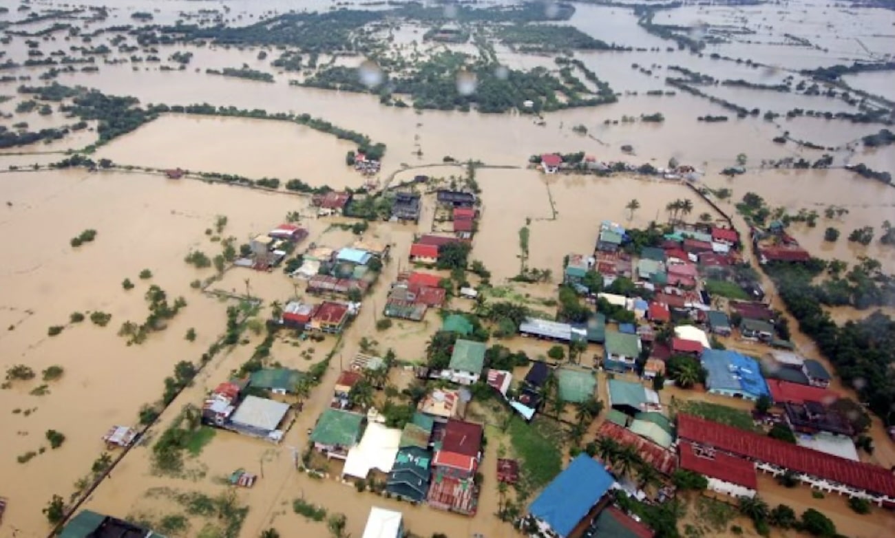

MANILA, Philippines — Environment Secretary Juan Miguel “Mitch” Cuna has ordered closer monitoring and risk assessment of flood threats and intensified law enforcement and use of science and technology in forest and watershed protection, using drones, satellite imagery, and near-real-time forest disturbance alert systems to detect threats early and reduce risks to downstream communities.
“Protecting our forests and watersheds requires timely information and decisive action,” Cuna said.
“Drones, satellite imagery, and near-real-time monitoring tools allow us to identify risks earlier, deploy personnel effectively, and strengthen enforcement in hard-to-reach areas.”
Article continues after this advertisement
Cuna made the order in the wake of the Nepal mudslide disaster that killed at least 1,000, noting that, though that country’s mountain hazards differ from those in the Philippines, debris flow and flash floods caused by natural landslide damming could also happen here.
FEATURED STORIES
NEWSINFO
NEWSINFO
NEWSINFO
READ: Nepal PM warns of risks as scientists flag more glacial disasters
The DENR statement pointed out one instance: In 2012, Typhoon Pablo triggered a massive debris flow in New Bataan, Compostela Valley (now Davao de Oro).
The DENR noted this lesson from the experience: “Upstream risks rapidly threaten downstream populations when vulnerable landscapes, altered conditions, and extreme weather converge.”
“What happens in the headwaters does not stay in the headwaters,” Cuna explained. “Flood resilience begins upstream by protecting forests, understanding landscape hazards, and making sound land-use decisions.”
Article continues after this advertisement
The DENR stressed the importance of watershed protection — which has been established in the Philippines starting with the revised Forestry Code of 1975 — in mitigating flooding, erosion, sedimentation, and landslides.
So the country now has watershed protection policies on integrated planning, reforestation, climate adaptation, and Watershed Management Councils.
Article continues after this advertisement
Science-based geohazard info, land-use planning
Cuna stressed that preparedness relies on reliable environmental and geohazard mapping to help local government units (LGUs) in settlement planning, infrastructure development, and disaster readiness.
The DENR’s Mines and Geosciences Bureau (MGB) provides geohazard maps for landslide and flood risks to guide local evacuation and land-use decisions.
Similarly, the National Mapping and Resource Information Authority (NAMRIA) supplies authoritative base maps and topographic data to integrate hazard awareness into development planning and emergency response.
Complementing these spatial tools, the Forest Management Bureau (FMB) relies on the Satellite Land Monitoring System (SLMS), which uses satellite imagery, GIS, and cloud platforms to make biannual land use and forest cover change maps, ensuring local planning and climate reporting are grounded in precise, up-to-date forest resource data.
Strong environmental law enforcement
“We will continue to use every lawful tool to protect critical ecosystems and hold violators accountable,” Cuna affirmed.
This involves monitoring technologies matched with firm regulatory action against illegal mining, logging, and other activities that threaten ecosystem integrity.
Citing an example, he said that, as of the second quarter of 2026 alone, 93 cease-and-desist orders had been issued to mining companies violating and not complying with requirements, enforcing strict compliance with environmental safeguards.
READ: Threats posed by floods highlight need to protect Sierra Madre – Speaker Dy
Community preparedness and risk reduction
The DENR urges flood- and landslide-prone communities to heed official weather advisories and local authority warnings during severe weather.
The Nepal disaster underscores that risk reduction must begin upstream through ecosystem management, informed land use, and continuous downstream readiness.
Your subscription could not be saved. Please try again.
Your subscription has been successful.
“Our goal is to reduce risks before they become disasters by protecting ecosystems, enforcing laws, and collaborating with local communities,” Cuna. /atm
KioskNews shows a cleaned-up reading view extracted from the publisher’s page — the original always lives on their site, not ours.