Outback kaleidoscope: Australia’s fabled desert lake bursts to life in rare sight
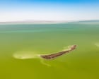
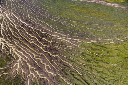
The Australian desert is green. Not just green – depending on where you look from above, it could also be a marbled reddy-pink and blue or yellow-brown with flecks of purple. But green is the most striking colour because the desert is not supposed to look like this.
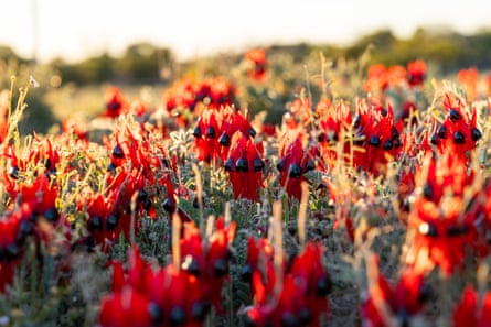
It won’t last. But for now, in late September, the deep outback – a celebrated part of the Australian continent that few people get to see – is blanketed in plant life. There is sandhill wattle, saltbush and lignum, and grasses and desert flowers. The vegetation is thickest along hundreds of twisting rivers and creeks that cut across the landscape.
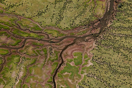
These rivers and creeks carry water from a prodigiously wet monsoon season that brought flooding rains to western Queensland. Rainfall nearly 50% above the long-term average caused havoc, killing livestock and cutting outback tracks, some of which remain underwater. But it also filled up three major river systems – the Georgina, the Diamantina and Cooper Creek.
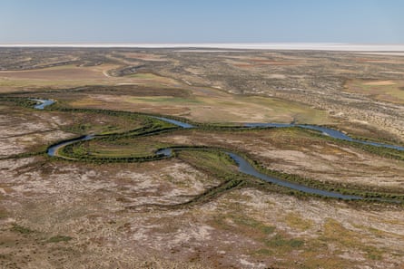
They run to one place: Kati Thanda-Lake Eyre. Local rainfall, which persisted between March and August, added to the flow. The result is that the centre of the continent is being transformed in a way that hasn’t happened since 1974.
Taking off
We are flying north in a six-seater light aircraft from William Creek, a tiny outpost that operates as something like an independent kingdom in the middle of Anna Creek station, the world’s largest cattle property. At nearly 24,000 sq km, Anna Creek is bigger than Wales.
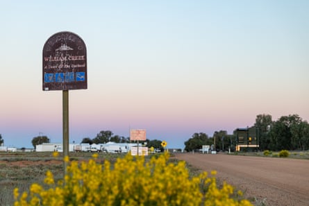
William Creek is much, much smaller. Lying on the traditional lands of the Arabana people, and owned by charter flight operator and unofficial mayor Trevor Wright, it has about a dozen buildings, huddled together in a vain attempt to shelter from the elements, about halfway along the famed Oodnadatta Track.
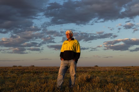
Kati Thanda is about 60km north-east of the town. They are separated by the Tirari Desert, which now looks more like scrubby parts of the coastal east than arid backcountry.
After a few minutes the lake appears on the horizon like an ocean. Soon, mirror-like water is all we can see as the horizon disappears.
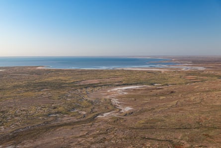
It’s Australia’s largest lake by surface area. Stretching 144km in length and 77km in width, it covers about 9,500 sq km – almost as much as suburban Melbourne. It includes the country’s lowest point, about 15 metres below sea level.
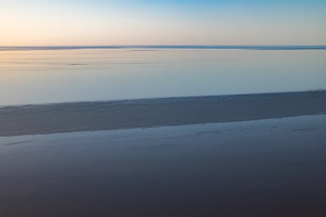
Kati Thanda is endorheic, meaning the water it collects has nowhere to drain. Most of the water from the region’s river systems enters via the Warburton Creek. Once in the lake it becomes the Warburton Groove, a north-south geological channel that paints a dark band as it spreads across the lake for up to 90km.
From lake to salt plain
It empties by evaporation, sometimes at an astonishing rate, losing up to 1cm of depth a day. Given the infrequency of the sort of heavy rains experienced this year, it is empty most of the time. When it is, it turns into a vast salt plain.
Its crust is estimated to be made up of 400m tonnes of salt. The salt flats not underwater, mainly in the north, shimmer with vibrant white. They are stable enough when completely dry for British driver Donald Campbell to have chosen it as the place to set a land speed record of 648 km/h in 1964.
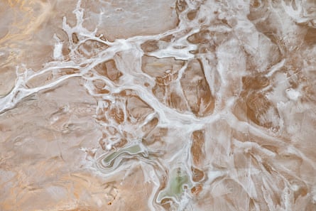
When we visit, the salinity of the lake is roughly equivalent to an ocean. Soon, as evaporation kicks in, it will be as much as seven times saltier than the Coral Sea. That has already happened in small pockets that filled last year in the Madigan Gulf, in the lake’s south-eastern corner. From above, the water appears as an extraordinary burst of pink.
The strawberry sheen is caused by bacteria and algae that relish the salt. The high salt content has other side-effects. In a remarkable act of survival, zooplankton and phytoplankton eggs lie dormant in the salt while the lake is dry and hatch after the next influx, creating a basin thick with life – what some describe as “invertebrate soup”. It kicks off the return of a food chain that results in the return of fish: spangled perch, bony bream and species of hardyhead.
Birdlife arrives
The invertebrates and fish, in turn, bring birds.
Initially we see only a smattering of birds here and there. A few silver gulls hang on the breeze about 700km from the nearest sea. Later, we catch a darting pod of pelicans flying low over the lake’s surface.
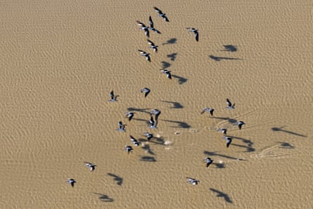
As we sweep over Halligan Bay near the lake’s western shore, it becomes clear where they are headed – to join thousands of other pelicans standing in the shallows and nesting on exposed sand within the lake. A scientific aerial survey of birdlife two weeks later, in early October, finds a smaller flock – about 800 adults and mostly nearly fledged young. Prof Richard Kingsford, the director of the Centre for Ecosystem Science at the University of New South Wales, who has been studying birdlife across the continent for more than 40 years, says they also saw a few hundred dead pelican chicks.
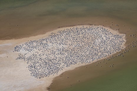
As H5N1 bird flu spreads, there has been concern it may have reached the arid centre. But Kingsford says they saw no pelicans showing the abnormal behaviour associated with sickness. It is more likely the deaths were a result of a more regular event: some breeding pelicans may not have been able to get enough food for their chicks as the lake became more saline.
This theory was supported by signs of pelicans flying to flourishing rivers to the west, in search of fish. “There is nothing there to indicate it isn’t a natural event,” Kingsford says.
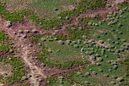
Elsewhere on the lake there are terns: gull-billed, whiskered and the large Caspian. Banded stilts are scattered about. But not as many as you might expect. “This is indicative of an ecosystem which is salty and not productive for high diversity and numbers of waterbirds,” Kingsford says.
Springs and floodplains
As we head north, the lake gives way to the Munga-Thirri-Simpson Desert and its 200km-long lines of parallel sand dunes, currently a patchwork of green tones. Millennia ago this was home to megafauna such as the SUV-sized, wombat-like Diprotodon. Today, it includes the Kalamurina Wildlife Sanctuary, a protected area larger than Tasmania that takes in gibber plains, floodplains and ephemeral lakes.
We cross the Goyder Lagoon, an important bird area that is part of the Diamantina river system. Periodically, we pass over mound springs – unusually vibrantly coloured areas that are a sign of water being released from the world’s deepest underground freshwater reservoir, the Great Artesian Basin.
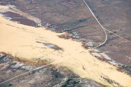
The Diamantina was the greatest contributor to the flooding, and Kati Thanda filling, last year. It had a devastating impact, including killing about 130,000 cattle. It flooded again this year, but not as much. As we approach the south-eastern Queensland outpost of Birdsville, its flow is a distinctive yellow, and the spillover continues to affect daily life, swallowing the show grounds and cutting off the Birdsville Track – an unsealed, 500km lifeline to other communities – all this year.
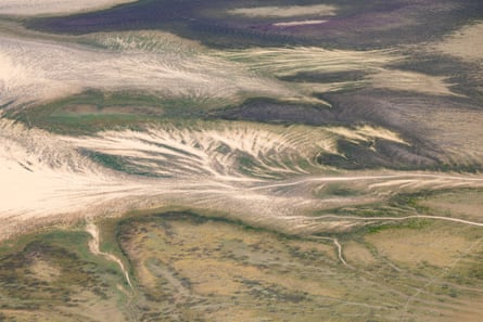
From there, it is time to return. With the plane’s back side door removed to allow better camera access, we trace part of the 1,300km Cooper Creek back towards the lake. There are waterbirds here in larger numbers than in Kati Thanda itself – according to Kingsford there are more than 10,000, including grey teal and pink-eared ducks.
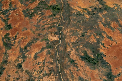
The creek and its tributaries provide a final burst of colour: a turquoise-blue that is in sharp contrast to the swirling, vibrant red of the iron oxide smothering the rocks and sand of the Sturt Stony Desert.
It’s an arresting scene, but it’s also ephemeral. In the hot months ahead, the water here and in the lake will likely retreat as a super El Niño bites and daytime temperatures rise to 45C. More of the dust, salt and red earth beneath will be revealed. But for now, in this century at least, it is a one-of-a kind show.
KioskNews shows a cleaned-up reading view extracted from the publisher’s page — the original always lives on their site, not ours.