Explainer: Why Is Uttar Pradesh Seeing Heavy, Continuous Rainfall
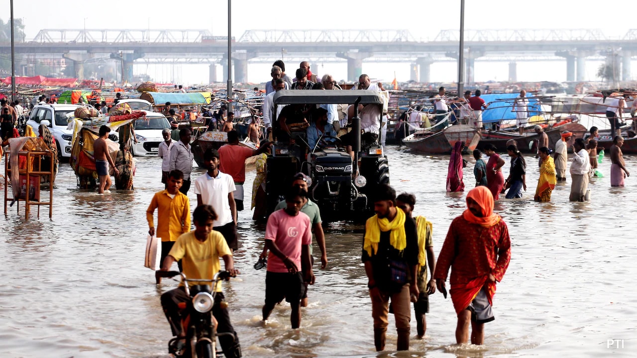
Days of wet spell have created a sea of problems in Uttar Pradesh. As per the state's Office of Relief Commissioner, as many as 56 people lost their lives and 46 were injured in incidents related to the deluge. Heavy rains accompanied by strong surface winds reaching 30-40 km/h threw life out of gear, knocked down trees, uprooted electric poles, and inundated roads, lanes, and villages across Kanpur, Varanasi, Prayagraj, Gorakhpur, Bareilly, and numerous other districts.
Going by official data, Uttar Pradesh, against a normal daily average of just 1.8 mm, recorded 45.1 mm of rainfall in the 24 hours by Sunday morning, with 56 out of the state's 75 districts registering excessive rainfall.
What Is The Cause?
The India Meteorological Department (IMD) attributes this widespread flood-like situation to the rare atmospheric convergence of two distinct weather systems operating simultaneously over Northern India. As per officials, the severe weather activity is the result of a 'Deep Depression' merging its moisture fields with an incoming 'Western Disturbance', right at the time when the southwest monsoon is withdrawing from North-West India.
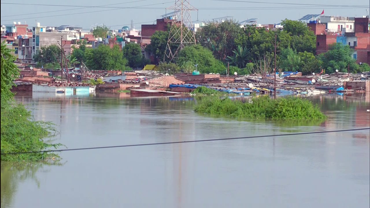
A view of a submerged village as heavy rainfall inundates the residential areas along the Pandu River, in Kanpur. Photo Credit: ANI
Speaking to NDTV about the situation in Uttar Pradesh, IMD Senior Scientist Dr Akhil Srivastava said, "The IMD has issued a warning for thunderstorms and lightning in Western UP today (Monday, September 28). No specific warning has been issued for Eastern UP. Overall, the intensity of rainfall has declined in UP."
Giving an insight into the cause of the deluge, Dr Srivastava added, "Heavy rainfall in UP was recorded under the influence of a well-marked low-pressure area over northern parts of central Uttar Pradesh, which caused isolated heavy to very heavy rainfall in West Uttar Pradesh and isolated heavy rainfall over East Uttar Pradesh."
How Did This Happen?
As per the IMD, the system originated as a deep depression over the Bay of Bengal. It crossed the North Andhra Pradesh-South Odisha coast before pushing inland northwestwards across Northeastern Madhya Pradesh and entering adjoining Southeastern Uttar Pradesh.
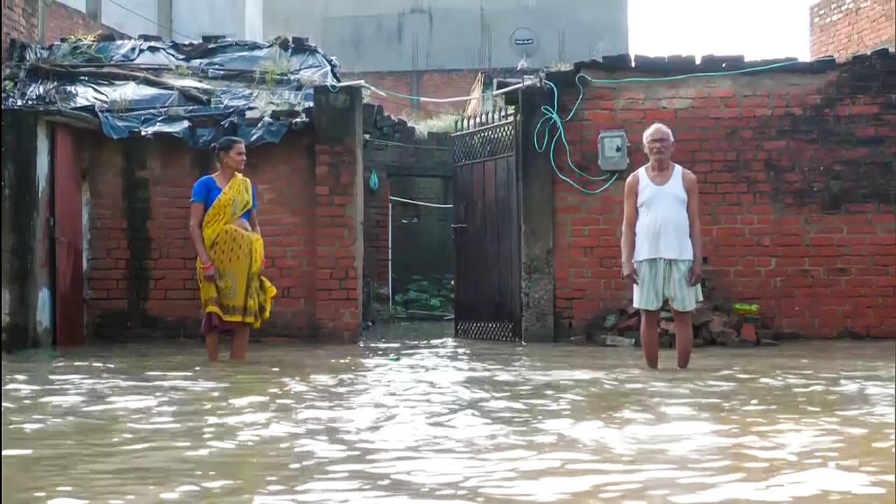
Affected locals stand amid partially submerged houses as heavy rainfall inundates the residential areas along the Pandu River, in Kanpur. Photo Credit: ANI
In simpler terms, a depression is described as an organised low-pressure atmospheric system formed by intense, localised heating. Warm, moist air flows inward toward the low-pressure centre and rises rapidly. As it ascends into cooler altitudes, it condenses into massive rain-bearing clouds.
Contextualising this in the case of Uttar Pradesh-by 5:30 AM on Sunday (September 27), the system moved north-north-westwards across central Uttar Pradesh and degraded into a "Well-Marked Low-Pressure Area", though it retained enough moisture to feed continuous intense precipitation.
Arrival Of A Western Disturbance
Western disturbances are explained as extratropical storms originating over the Mediterranean, Black, and Caspian Seas. High-altitude winds known as the subtropical westerly jet streams transport these systems eastward across Iran and Afghanistan toward Northwest India.
When the cold, upper-tropospheric trough of the Western Disturbance interacted with the tropical monsoon low-pressure system pushing up from Madhya Pradesh, it amplified atmospheric instability. This interaction triggered widespread torrential downpours and localised cloudburst-like events across the Terai belt and plains of Uttar Pradesh.
The Impact And Warnings
The combined impact produced exceptional rainfall totals across both Eastern and Western Uttar Pradesh. Major rivers like the Ghagra and Rapti have crossed critical warning mark thresholds at several monitoring stations, even threatening low-lying rural and agricultural belts.
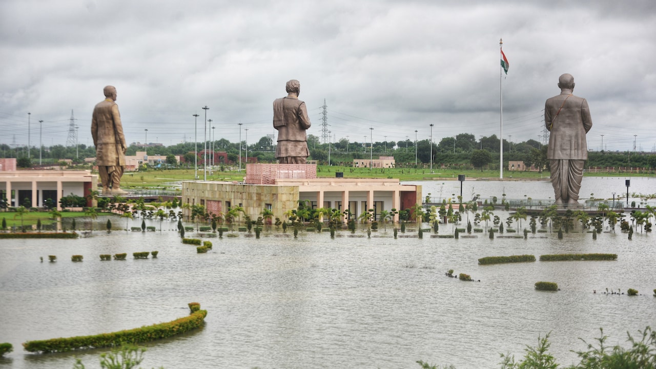
A view of the inundated Rashtra Prerna Sthal, triggered by heavy rainfall, in Lucknow. Photo Credit: ANI
According to IMD forecast projections, the well-marked low-pressure area over central Uttar Pradesh is continuing to move north-northwestward and gradually dissipate into a simple low-pressure system over the next 12 hours. Isolated heavy rainfall remains expected across parts of Uttarakhand and West Uttar Pradesh, with conditions normalising as the system clears out by early October.
In light of this, agricultural authorities have advised farmers to immediately drain standing water from rice, maize, sugarcane, and pulse crops to avoid root rot. Residents are strictly cautioned against taking shelter under isolated trees due to active cloud-to-ground lightning risks accompanying squally winds.
KioskNews shows a cleaned-up reading view extracted from the publisher’s page — the original always lives on their site, not ours.