Experts on what the September heat dome will mean for the UK and Europe
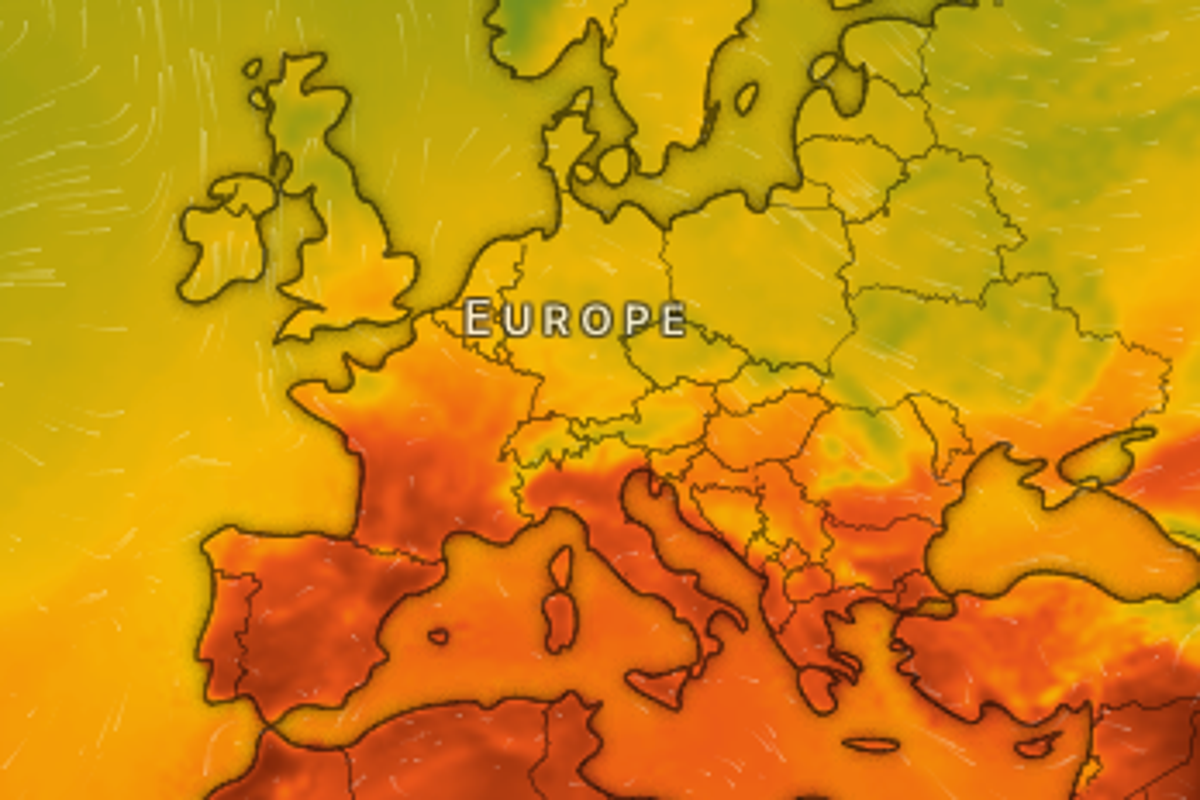
An intense September heatwave has been forecast across Europe, as a heat dome is set to send temperatures soaring.
BBC forecasters say temperatures could hit the high 30C and even 40C in some parts of southern Europe and the Mediterranean in early September.
Warm weather is being pushed up towards France, Spain and Italy from North Africa, with high-pressure creating a heat dome.

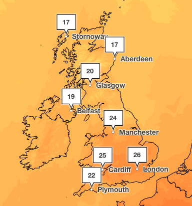
Although the UK will see highs of 26C this weekend, the hot weather might be short-lived as changeable conditions and rain are forecast in the north and west.
Where will the EU heat dome hit?
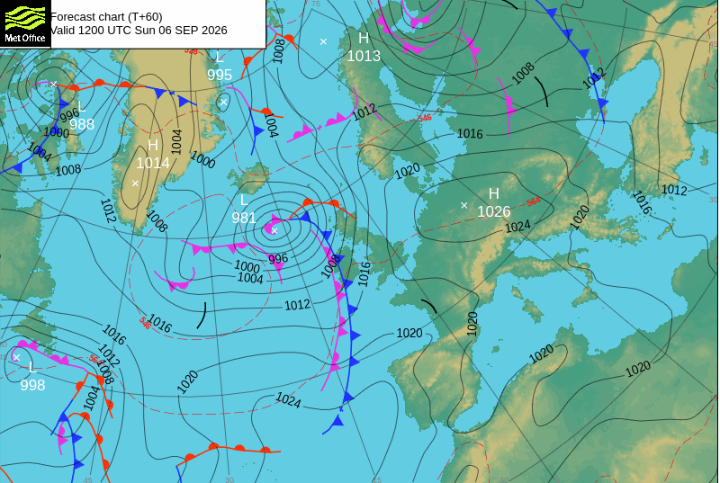
A heat dome develops when a large area of high pressure becomes established over a region and remains there for an extended period, according to the Met Office.
Under high pressure, air sinks through the atmosphere. As it sinks, it becomes compressed and warms. At the same time, cloud formation is suppressed, allowing strong sunshine to reach the ground.
A heat dome has been developing over Europe and is set to bring a hot start to September across France, Spain, Italy and the Balkan region.
In the coming week, Spain and Italy will see temperatures between 38C and 42C in low-lying valleys and coastal areas.
Forecasters suggest the heatwave will be long-lived in southern Europe.
The Spanish and French Weather Services are warning of the increased risk of wildfires as the landscape is still parched from the dry and hot conditions of the summer.
Will the UK see another heatwave?
Hotter and sunnier weather is forecast for the weekend with highs of 26C expected in London on Sunday.
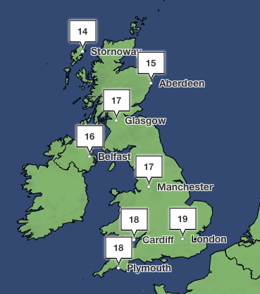
However, unlike the heat dome in southern Europe, it won’t last as temperatures are forecast to cool early next week to below 20C.
From Tuesday, temperatures across Europe are expected to decrease as well. For the UK, changeable weather with rain and showers forecast, as well as some sunshine.
According to the Met Office long-range forecast, the latter half of September will likely be unsettled with longer spells of rain expected.
Rain is likely to be most frequent across northern and western areas, while the south and east are more likely to see longer drier interludes, forecasters said.
UK weekend weather forecast
Saturday (5 September):
Mostly dry with sunny spells. A few showers affect the northwest, with thicker cloud and rain later. Breezy at first in the far north before easing. Temperatures near average.
Outlook for Sunday to Tuesday:
Rain spreads southeast, heaviest in western Scotland. Brighter conditions follow with showers, some heavy and thundery. Windy at times. Very warm on Sunday, then turning cooler for the coming days.
KioskNews shows a cleaned-up reading view extracted from the publisher’s page — the original always lives on their site, not ours.